
PNOI
General Cargo
Current Trip
| Time Travelled | 7 days |
|---|---|
| Remaining Time | 21 h, 52 mins |
| Distance Travelled | 2265.14 nm |
| Remaining Distance | 384.24 nm |
| AVG Speed | 12 Knots |
| MAX Speed | 14.5 Knots |
| AVG Wind | 11.2 knots |
| MAX Wind | 22.6 knots |
| MIN Temp | 17.5°C / 63.5°F |
| MAX Temp | 28.7°C / 83.66°F |
| Draught | 9.2 m |
| Position Received | 6 d ago |
Current Position
| Longitude | -16.55810° |
|---|---|
| Latitude | 27.12589° |
| Status | Under way using engine |
| Speed | 9.5 Knots |
| Course | 113.5° |
| Area | North Atlantic Ocean |
| Station | T-AIS |
| Position Received | 6 d ago |
Info
Information
The current position of PNOI is in North Atlantic Ocean with coordinates 27.12589° / -16.55810° as reported on 2024-05-16 19:51 by AIS to our vessel tracker app. The vessel's current speed is 9.5 Knots and is heading at the port of COTONOU. The estimated time of arrival as calculated by vessel tracking app is 2024-05-24 14:21 LT
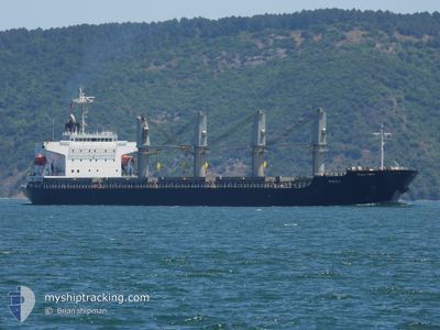
The vessel PNOI (IMO: 9400887, MMSI: 372605000) is a General Cargo that was built in 2009 ( 15 years old ). It's sailing under the flag of [PA] Panama.
In this page you can find informations about the vessels current position, last detected port calls, and current voyage information. If the vessels is not in coverage by AIS you will find the latest position.
The current position of PNOI is detected by our AIS receivers and we are not responsible for the reliability of the data. The last position was recorded while the vessel was in Coverage by the Ais receivers of our vessel tracking app.
The current draught of PNOI as reported by AIS is 9.2 meters
Weather
| Temperature | 28.1°C / 82.58°F |
|---|---|
| Wind Speed | 6 knots |
| Direction | 217° SW |
| Pressure | 1010.7 hPa |
| Humidity | 75.6 % |
| Cloud Coverage | 100 % |
Featured Company
Last Trips
| Origin | Departure | Destination | Arrival | Distance | |
|---|---|---|---|---|---|
| 2024-05-13 19:11 | 2024-05-15 20:21 | 493.48 nm | |||
| 2024-04-30 06:24 | 2024-05-10 09:02 | 2321.42 nm | |||
| 2024-04-18 08:26 | 2024-04-22 18:02 | 104.99 nm | |||
| 2024-03-27 11:55 | 2024-04-01 10:41 | 396.21 nm | |||
| 2024-02-26 22:30 | 2024-03-23 17:07 | 6213.50 nm |
Events
| Time | Event | Details | Position / Dest | Info |
|---|---|---|---|---|
| 2024-05-16 19:56 | Status Changed | Default Under way using engine |
27.11333 / -16.55333
BJ COO
|
Speed: 9.5 kn Course: 113.5° |
| 2024-05-16 19:51 | OUT of Coverage |
27.12589 / -16.55810
North Atlantic Ocean
BJ COO
|
Speed: 9.5 kn Course: 113.5° |
|
| 2024-05-16 19:43 | START Moving |
27.12668 / -16.57367
BJ COO
|
Speed: 3.9 kn Course: 46° |
|
| 2024-05-16 19:41 | Status Changed | Under way using engine Default |
27.12452 / -16.57340
BJ COO
|
Speed: Course: -1° |
| 2024-05-16 19:35 | Status Changed | Default Under way using engine |
27.12333 / -16.57167
BJ COO
|
Speed: 0.9 kn Course: 25° |
| 2024-05-16 19:35 | STOP Moving |
27.12333 / -16.57167
BJ COO
|
Speed: Course: -1° |
|
| 2024-05-16 19:18 | Status Changed | Under way using engine Default |
27.12106 / -16.57346
BJ COO
|
Speed: 2.9 kn Course: 28° |
| 2024-05-16 19:13 | Status Changed | Default Under way using engine |
27.11850 / -16.57497
BJ COO
|
Speed: 4.2 kn Course: 18° |
| 2024-05-16 18:53 | Status Changed | Under way using engine Default |
27.09159 / -16.58335
BJ COO
|
Speed: 5.5 kn Course: 16° |
| 2024-05-16 18:44 | Status Changed | Default Under way using engine |
27.07833 / -16.58667
BJ COO
|
Speed: 5.5 kn Course: 15.1° |