
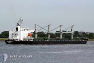
POCHARD S
General Cargo
Current Trip
| Time Travelled | 15 h, 36 mins |
|---|---|
| Remaining Time | --- |
| Distance Travelled | 185.47 nm |
| Remaining Distance | --- |
| AVG Speed | 11.3 Knots |
| MAX Speed | 13.4 Knots |
| AVG Wind | 7.5 knots |
| MAX Wind | 15 knots |
| MIN Temp | 22.6°C / 72.68°F |
| MAX Temp | 25°C / 77°F |
| Draught | 6.3 m |
| Position Received | Now |
Current Position
| Longitude | 14.87531° |
|---|---|
| Latitude | 43.34348° |
| Status | Under way using engine |
| Speed | 12.9 Knots |
| Course | 139.3° |
| Area | Adriatic Sea |
| Station | T-AIS |
| Position Received | Now |
Info
Information
The current position of POCHARD S is in Adriatic Sea with coordinates 43.34348° / 14.87531° as reported on 2024-06-23 03:40 by AIS to our vessel tracker app. The vessel's current speed is 12.9 Knots and is heading at the port of CONSTANTA. The estimated time of arrival as calculated by vessel tracking app is 2024-06-28 12:00 LT
The vessel POCHARD S (IMO: 9363314, MMSI: 636017555) is a General Cargo that was built in 2007 ( 17 years old ). It's sailing under the flag of [LR] Liberia.
In this page you can find informations about the vessels current position, last detected port calls, and current voyage information. If the vessels is not in coverage by AIS you will find the latest position.
The current position of POCHARD S is detected by our AIS receivers and we are not responsible for the reliability of the data. The last position was recorded while the vessel was in Coverage by the Ais receivers of our vessel tracking app.
The current draught of POCHARD S as reported by AIS is 6.3 meters
Weather
| Temperature | 23.4°C / 74.12°F |
|---|---|
| Wind Speed | 11 knots |
| Direction | 324° NW |
| Pressure | 1008.6 hPa |
| Humidity | 68.1 % |
| Cloud Coverage | 3 % |
Featured Company
Most Visited Ports (Last year)
| Port | Arrivals | |
|---|---|---|
| 2 | ||
| 2 | ||
| 1 | ||
| 1 | ||
| 1 | ||
| 1 |
Last Trips
| Origin | Departure | Destination | Arrival | Distance | |
|---|---|---|---|---|---|
| 2024-05-05 21:45 | 2024-06-18 07:04 | 11890.39 nm | |||
| 2024-03-10 05:38 | 2024-04-21 17:48 | 11227.13 nm |
Events
| Time | Event | Details | Position / Dest | Info |
|---|---|---|---|---|
| 2024-06-22 16:44 | Change Sea Area | Croatian part of the Adriatic Sea Italian part of the Adriatic Sea |
45.21113 / 13.02988
Adriatic Sea
RO CND
|
Speed: 11.2 kn Course: 167.6° |
| 2024-06-22 12:18 | Status Changed | Under way using engine Moored |
45.65728 / 13.72668
RO CND
|
Speed: 10 kn Course: 269.2° |
| 2024-06-22 12:05 | PORT DEPARTURE |
|
45.65525 / 13.75790
RO CND
|
Speed: 3.4 kn Course: 311° |
| 2024-06-22 11:57 | START Moving |
45.65722 / 13.76310
[IT] TRIESTE
|
Speed: 3.2 kn Course: 181° |
|
| 2024-06-22 11:51 | Status Changed | Moored Default |
45.65914 / 13.76245
[IT] TRIESTE
|
Speed: 0.2 kn Course: 337° |
| 2024-06-22 11:48 | Status Changed | Default Moored |
45.65984 / 13.76210
[IT] TRIESTE
|
Speed: Course: 338° |
| 2024-06-22 11:15 | Destination Changed | RO CND IT TRS |
45.65984 / 13.76210
[IT] TRIESTE
|
Speed: Course: 338° |
| 2024-06-22 11:15 | ETA Changed | 2024/06/28 12:00 2024/06/27 22:30 |
45.65984 / 13.76210
[IT] TRIESTE
|
Speed: Course: 338° |
| 2024-06-22 11:15 | Status Changed | Moored Default |
45.65984 / 13.76210
[IT] TRIESTE
|
Speed: Course: 338° |
| 2024-06-22 11:12 | Status Changed | Default Moored |
45.65984 / 13.76206
[IT] TRIESTE
|
Speed: Course: 338° |