
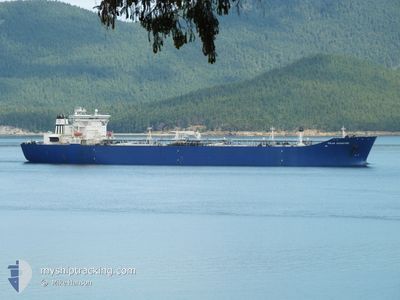
POLAR ADVENTURE
Crude Oil Tanker
Current Position
| Longitude | -126.63005° |
|---|---|
| Latitude | 48.50777° |
| Status | Under way using engine |
| Speed | 11 Knots |
| Course | 276.8° |
| Area | North Pacific Ocean |
| Station | T-AIS |
| Position Received | 4 d ago |
Info
Information
The current position of POLAR ADVENTURE is in North Pacific Ocean with coordinates 48.50777° / -126.63005° as reported on 2024-06-02 14:17 by AIS to our vessel tracker app. The vessel's current speed is 11 Knots and is currently inside the port of VALDEZ.
The vessel POLAR ADVENTURE (IMO: 9244063, MMSI: 303031000) is a Crude Oil Tanker that was built in 2004 ( 20 years old ). It's sailing under the flag of [US] USA.
In this page you can find informations about the vessels current position, last detected port calls, and current voyage information. If the vessels is not in coverage by AIS you will find the latest position.
The current position of POLAR ADVENTURE is detected by our AIS receivers and we are not responsible for the reliability of the data. The last position was recorded while the vessel was in Coverage by the Ais receivers of our vessel tracking app.
The current draught of POLAR ADVENTURE as reported by AIS is 9.5 meters
Weather
| Temperature | 4.8°C / 40.64°F |
|---|---|
| Wind Speed | 2 knots |
| Direction | 7° N |
| Pressure | 1025.1 hPa |
| Humidity | 96 % |
| Cloud Coverage | 100 % |
Featured Company
Last Port Calls
| Port | Arrival | Departure | Time In Port |
|---|---|---|---|
| 2024-06-01 06:39 | 2024-06-01 23:22 | 16 h | |
| 2024-06-01 05:43 | 2024-06-01 06:17 | 34 m | |
| 2024-06-01 00:07 | 2024-06-01 02:11 | 2 h | |
| 2024-05-30 08:37 | 2024-05-30 23:57 | 15 h | |
| 2024-05-25 02:06 | 2024-05-25 20:58 | 18 h | |
| 2024-05-19 02:46 | 2024-05-20 01:34 | 22 h | |
| 2024-05-17 03:05 | 2024-05-18 05:28 | 1 d | |
| 2024-05-09 21:10 | 2024-05-10 14:26 | 17 h | |
| 2024-04-27 19:11 | 2024-05-02 12:46 | 4 d | |
| 2024-04-20 22:06 | 2024-04-21 15:25 | 17 h |
Most Visited Ports (Last year)
| Port | Arrivals | |
|---|---|---|
| 23 | ||
| 18 | ||
| 9 | ||
| 7 | ||
| 7 | ||
| 3 |
Last Trips
| Origin | Departure | Destination | Arrival | Distance | |
|---|---|---|---|---|---|
| 2024-05-31 23:17 | 2024-05-31 23:39 | 0.42 nm | |||
| 2024-05-31 19:11 | 2024-05-31 22:43 | 0.64 nm | |||
| 2024-05-30 16:57 | 2024-05-31 17:07 | 2.45 nm | |||
| 2024-05-25 12:58 | 2024-05-30 01:37 | 1281.29 nm | |||
| 2024-05-19 18:34 | 2024-05-24 18:06 | 1783.76 nm | |||
| 2024-05-17 22:28 | 2024-05-18 19:46 | 44.63 nm | |||
| 2024-05-10 06:26 | 2024-05-16 20:05 | 1767.66 nm | |||
| 2024-05-02 05:46 | 2024-05-09 13:10 | 2113.28 nm | |||
| 2024-04-21 07:25 | 2024-04-27 12:11 | 2111.27 nm | |||
| 2024-04-15 18:20 | 2024-04-20 14:06 | 1783.13 nm |
Events
| Time | Event | Details | Position / Dest | Info |
|---|---|---|---|---|
| 2024-06-02 14:22 | Status Changed | Default Under way using engine |
48.50834 / -126.65334
VDZ
|
Speed: 11 kn Course: 276.8° |
| 2024-06-02 14:17 | OUT of Coverage |
48.50777 / -126.63005
North Pacific Ocean
VDZ
|
Speed: 11 kn Course: 276.8° |
|
| 2024-06-02 09:49 | Change Sea Area | Canadian part of the North Pacific Ocean Canadian part of the The Coastal Waters of Southeast Alaska and British Columbia |
48.52162 / -125.39920
North Pacific Ocean
VDZ
|
Speed: 10.9 kn Course: 268° |
| 2024-06-02 09:49 | Status Changed | Under way using engine Default |
48.52162 / -125.39920
VDZ
|
Speed: 11 kn Course: 269° |
| 2024-06-02 09:46 | IN Coverage |
48.52162 / -125.39920
North Pacific Ocean
VDZ
|
Speed: 10.9 kn Course: 268° |
|
| 2024-06-02 07:04 | Status Changed | Default Under way using engine |
48.49837 / -124.65360
VDZ
|
Speed: 10.4 kn Course: 293° |
| 2024-06-02 06:59 | Status Changed | Under way using engine Default |
48.49347 / -124.63615
VDZ
|
Speed: 10 kn Course: 293° |
| 2024-06-02 06:59 | OUT of Coverage |
48.49347 / -124.63615
The Coastal Waters of Southeast Alaska and British Columbia
VDZ
|
Speed: 10.4 kn Course: 293° |
|
| 2024-06-02 06:51 | IN Coverage |
48.49347 / -124.63615
The Coastal Waters of Southeast Alaska and British Columbia
VDZ
|
Speed: 10.4 kn Course: 293° |
|
| 2024-06-02 05:14 | OUT of Coverage |
48.36478 / -124.19680
The Coastal Waters of Southeast Alaska and British Columbia
VDZ
|
Speed: 10.6 kn Course: 300.4° |