
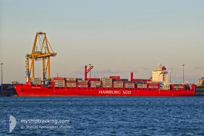
POLAR BRASIL
Cargo D
Current Trip
| Time Travelled | 4 days |
|---|---|
| Remaining Time | --- |
| Distance Travelled | 1612.99 nm |
| Remaining Distance | --- |
| AVG Speed | 16.6 Knots |
| MAX Speed | 20 Knots |
| AVG Wind | 11.9 knots |
| MAX Wind | 21 knots |
| MIN Temp | 23.5°C / 74.3°F |
| MAX Temp | 29.1°C / 84.38°F |
| Draught | 10 m |
| Position Received | 23 h, 18 m ago |
Current Position
| Longitude | -74.68483° |
|---|---|
| Latitude | 23.32397° |
| Status | Under way using engine |
| Speed | 18.1 Knots |
| Course | 1.7° |
| Area | North Atlantic Ocean |
| Station | T-AIS |
| Position Received | 23 h, 18 m ago |
Info
Information
The current position of POLAR BRASIL is in North Atlantic Ocean with coordinates 23.32397° / -74.68483° as reported on 2024-05-31 21:11 by AIS to our vessel tracker app. The vessel's current speed is 18.1 Knots and is heading at the port of TURBO. The estimated time of arrival as calculated by vessel tracking app is 2024-05-24 13:00 LT
The vessel POLAR BRASIL (IMO: 9797216, MMSI: 248556000) is a Cargo D It's sailing under the flag of [MT] Malta.
In this page you can find informations about the vessels current position, last detected port calls, and current voyage information. If the vessels is not in coverage by AIS you will find the latest position.
The current position of POLAR BRASIL is detected by our AIS receivers and we are not responsible for the reliability of the data. The last position was recorded while the vessel was in Coverage by the Ais receivers of our vessel tracking app.
The current draught of POLAR BRASIL as reported by AIS is 10 meters
Weather
| Temperature | 23.6°C / 74.48°F |
|---|---|
| Wind Speed | 15 knots |
| Direction | 60° ENE |
| Pressure | 1021.5 hPa |
| Humidity | 58.7 % |
| Cloud Coverage | 40 % |
Featured Company
Last Port Calls
| Port | Arrival | Departure | Time In Port |
|---|---|---|---|
| 2024-05-27 00:31 | 2024-05-28 08:47 | 1 d | |
| 2024-05-24 13:02 | 2024-05-26 02:49 | 1 d | |
| 2024-05-23 12:22 | 2024-05-23 22:39 | 10 h | |
| 2024-05-18 10:37 | 2024-05-19 12:20 | 1 d | |
| 2024-05-17 08:34 | 2024-05-17 16:20 | 7 h | |
| 2024-05-15 00:01 | 2024-05-15 14:54 | 14 h | |
| 2024-05-06 08:10 | 2024-05-07 23:38 | 1 d | |
| 2024-05-03 12:47 | 2024-05-05 04:02 | 1 d | |
| 2024-04-28 07:58 | 2024-04-29 07:06 | 23 h | |
| 2024-04-25 10:27 | 2024-04-25 18:17 | 7 h |
Most Visited Ports (Last year)
| Port | Arrivals | |
|---|---|---|
| 17 | ||
| 16 | ||
| 16 | ||
| 16 | ||
| 15 | ||
| 13 |
Last Trips
| Origin | Departure | Destination | Arrival | Distance | |
|---|---|---|---|---|---|
| 2024-05-25 21:49 | 2024-05-26 19:31 | 254.23 nm | |||
| 2024-05-23 17:39 | 2024-05-24 08:02 | 181.65 nm | |||
| 2024-05-19 08:20 | 2024-05-23 07:22 | 1449.50 nm | |||
| 2024-05-17 12:20 | 2024-05-18 06:37 | 231.98 nm | |||
| 2024-05-15 10:54 | 2024-05-17 04:34 | 572.30 nm | |||
| 2024-05-07 18:38 | 2024-05-14 20:01 | 2239.03 nm | |||
| 2024-05-04 23:02 | 2024-05-06 03:10 | 250.74 nm | |||
| 2024-04-29 03:06 | 2024-05-03 07:47 | 1582.33 nm | |||
| 2024-04-25 14:17 | 2024-04-28 03:58 | 245.07 nm | |||
| 2024-04-23 03:33 | 2024-04-25 06:27 | 555.06 nm |
Events
| Time | Event | Details | Position / Dest | Info |
|---|---|---|---|---|
| 2024-05-31 21:15 | Status Changed | Default Under way using engine |
23.34667 / -74.68333
TURBO
|
Speed: 18.1 kn Course: 1.7° |
| 2024-05-31 21:11 | OUT of Coverage |
23.32397 / -74.68483
North Atlantic Ocean
|
Speed: 18.1 kn Course: 1.7° |
|
| 2024-05-31 21:05 | Change Sea Area | Bahamas part of the North Atlantic Ocean Colombian part of the Caribbean Sea |
23.29630 / -74.68568
North Atlantic Ocean
|
Speed: 18.1 kn Course: 1.2° |
| 2024-05-31 21:05 | Status Changed | Under way using engine Default |
23.29630 / -74.68568
TURBO
|
Speed: 18 kn Course: 2° |
| 2024-05-31 20:51 | IN Coverage |
23.29630 / -74.68568
North Atlantic Ocean
|
Speed: 18.1 kn Course: 1.2° |
|
| 2024-05-29 12:57 | START Moving | 0.86 nm, West of MOIN |
10.00833 / -83.09333
TURBO
|
Speed: 5 kn Course: 108° |
| 2024-05-29 03:52 | STOP Moving | 1.06 nm, West of MOIN |
10.00985 / -83.09662
TURBO
|
Speed: 0.3 kn Course: 110° |
| 2024-05-29 02:39 | START Moving | 3.72 nm, North East of MOIN |
10.05917 / -83.04410
TURBO
|
Speed: 4.2 kn Course: 262° |
| 2024-05-29 01:55 | STOP Moving | 3.67 nm, North East of MOIN |
10.06333 / -83.05334
TURBO
|
Speed: Course: -1° |
| 2024-05-28 08:47 | PORT DEPARTURE |
|
9.36895 / -79.89291
TURBO
|
Speed: 3.8 kn Course: 307° |