
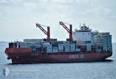
POLAR MEXICO
Cargo
Current Trip
| Time Travelled | 3 days |
|---|---|
| Remaining Time | 5 mins |
| Distance Travelled | 1452.97 nm |
| Remaining Distance | 3.92 nm |
| AVG Speed | 15.7 Knots |
| MAX Speed | 20.2 Knots |
| AVG Wind | 8.1 knots |
| MAX Wind | 17 knots |
| MIN Temp | 22.1°C / 71.78°F |
| MAX Temp | 29.4°C / 84.92°F |
| Draught | 9.5 m |
| Position Received | 1 m ago |
Current Position
| Longitude | -75.53157° |
|---|---|
| Latitude | 10.35728° |
| Status | Under way using engine |
| Speed | 11.7 Knots |
| Course | 344.1° |
| Area | Caribbean Sea |
| Station | T-AIS |
| Position Received | 1 m ago |
Info
Information
The current position of POLAR MEXICO is in Caribbean Sea with coordinates 10.35728° / -75.53157° as reported on 2024-06-06 14:02 by AIS to our vessel tracker app. The vessel's current speed is 11.7 Knots and is heading at the port of CARTAGENA. The estimated time of arrival as calculated by vessel tracking app is 2024-06-06 14:08 LT
The vessel POLAR MEXICO (IMO: 9786750, MMSI: 563066900) is a Cargo It's sailing under the flag of [SG] Singapore.
In this page you can find informations about the vessels current position, last detected port calls, and current voyage information. If the vessels is not in coverage by AIS you will find the latest position.
The current position of POLAR MEXICO is detected by our AIS receivers and we are not responsible for the reliability of the data. The last position was recorded while the vessel was in Coverage by the Ais receivers of our vessel tracking app.
The current draught of POLAR MEXICO as reported by AIS is 9.5 meters
Weather
| Temperature | 29.5°C / 85.1°F |
|---|---|
| Wind Speed | 3 knots |
| Direction | 224° SW |
| Pressure | 1011.7 hPa |
| Humidity | 68.9 % |
| Cloud Coverage | 100 % |
Featured Company
Last Port Calls
| Port | Arrival | Departure | Time In Port |
|---|---|---|---|
| 2024-06-02 08:42 | 2024-06-03 03:49 | 19 h | |
| 2024-05-30 10:31 | 2024-05-30 18:22 | 7 h | |
| 2024-05-27 12:30 | 2024-05-28 03:13 | 14 h | |
| 2024-05-27 11:57 | 2024-05-27 12:01 | 4 m | |
| 2024-05-19 23:22 | 2024-05-21 10:38 | 1 d | |
| 2024-05-17 12:59 | 2024-05-18 21:49 | 1 d | |
| 2024-05-16 12:17 | 2024-05-17 01:04 | 12 h | |
| 2024-05-10 12:41 | 2024-05-11 12:25 | 23 h | |
| 2024-05-09 10:43 | 2024-05-09 18:38 | 7 h | |
| 2024-05-06 12:25 | 2024-05-07 05:39 | 17 h |
Most Visited Ports (Last year)
| Port | Arrivals | |
|---|---|---|
| 20 | ||
| 19 | ||
| 18 | ||
| 17 | ||
| 16 | ||
| 14 |
Last Trips
| Origin | Departure | Destination | Arrival | Distance | |
|---|---|---|---|---|---|
| 2024-05-30 14:22 | 2024-06-02 04:42 | 242.15 nm | |||
| 2024-05-27 23:13 | 2024-05-30 06:31 | 547.04 nm | |||
| 2024-05-27 08:01 | 2024-05-27 08:30 | 2.23 nm | |||
| 2024-05-21 05:38 | 2024-05-27 07:57 | 2235.94 nm | |||
| 2024-05-18 16:49 | 2024-05-19 18:22 | 244.60 nm | |||
| 2024-05-16 20:04 | 2024-05-17 07:59 | 183.66 nm | |||
| 2024-05-11 08:25 | 2024-05-16 07:17 | 1455.04 nm | |||
| 2024-05-09 14:38 | 2024-05-10 08:41 | 233.80 nm | |||
| 2024-05-07 01:39 | 2024-05-09 06:43 | 546.20 nm | |||
| 2024-04-30 07:22 | 2024-05-06 08:25 | 2246.01 nm |
Events
| Time | Event | Details | Position / Dest | Info |
|---|---|---|---|---|
| 2024-06-06 12:24 | Draught Changed | 9.5 9.7 |
10.32507 / -75.72733
USSAV>COCTG
|
Speed: 5.5 kn Course: 154.5° |
| 2024-06-06 12:24 | ETA Changed | 2024/06/06 13:00 2024/06/06 11:00 |
10.32507 / -75.72733
USSAV>COCTG
|
Speed: 5.5 kn Course: 154.5° |
| 2024-06-06 09:16 | IN Coverage |
10.93665 / -75.68863
Caribbean Sea
USSAV>COCTG
|
Speed: 16.1 kn Course: 187.3° |
|
| 2024-06-06 03:55 | OUT of Coverage |
12.40167 / -75.51274
Caribbean Sea
USSAV>COCTG
|
Speed: 17.1 kn Course: 184.6° |
|
| 2024-06-06 03:34 | Status Changed | Under way using engine Default |
12.50169 / -75.50238
USSAV>COCTG
|
Speed: 16.6 kn Course: 187° |
| 2024-06-06 03:06 | Status Changed | Default Under way using engine |
12.62873 / -75.48840
USSAV>COCTG
|
Speed: 16.9 kn Course: 186.7° |
| 2024-06-06 02:18 | Detected in Sea | Colombian part of the Caribbean Sea |
12.85429 / -75.46209
Caribbean Sea
USSAV>COCTG
|
Speed: 16.9 kn Course: 186.2° |
| 2024-06-06 02:18 | IN Coverage |
12.85429 / -75.46209
Caribbean Sea
USSAV>COCTG
|
Speed: 16.9 kn Course: 186.2° |
|
| 2024-06-04 03:08 | Status Changed | Default Under way using engine |
26.60250 / -76.61970
USSAV>COCTG
|
Speed: 18.1 kn Course: 136° |
| 2024-06-04 03:05 | OUT of Coverage |
26.61230 / -76.63023
North Atlantic Ocean
USSAV>COCTG
|
Speed: 18.1 kn Course: 136° |