
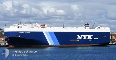
POLARIS LEADER
Vehicles Carrier
Current Trip
PANAMA CANAL
| Time Travelled | 20 days |
|---|---|
| Remaining Time | --- |
| Distance Travelled | 7810.77 nm |
| Remaining Distance | --- |
| AVG Speed | 15.8 Knots |
| MAX Speed | 18.3 Knots |
| AVG Wind | 9.5 knots |
| MAX Wind | 34.7 knots |
| MIN Temp | 11°C / 51.8°F |
| MAX Temp | 30.6°C / 87.08°F |
| Draught | 8.9 m |
| Position Received | 1 h, 4 m ago |
Current Position
| Longitude | -79.47953° |
|---|---|
| Latitude | 8.89558° |
| Status | Under way using engine |
| Speed | 0.6 Knots |
| Course | 6° |
| Area | North Pacific Ocean |
| Station | T-AIS |
| Position Received | 1 h, 4 m ago |
Info
Information
The current position of POLARIS LEADER is in North Pacific Ocean with coordinates 8.89558° / -79.47953° as reported on 2024-06-05 13:23 by AIS to our vessel tracker app. The vessel's current speed is 0.6 Knots
The vessel POLARIS LEADER (IMO: 9372810, MMSI: 563710000) is a Vehicles Carrier that was built in 2009 ( 15 years old ). It's sailing under the flag of [SG] Singapore.
In this page you can find informations about the vessels current position, last detected port calls, and current voyage information. If the vessels is not in coverage by AIS you will find the latest position.
The current position of POLARIS LEADER is detected by our AIS receivers and we are not responsible for the reliability of the data. The last position was recorded while the vessel was in Coverage by the Ais receivers of our vessel tracking app.
The current draught of POLARIS LEADER as reported by AIS is 8.9 meters
Weather
| Temperature | 27.3°C / 81.14°F |
|---|---|
| Wind Speed | 7 knots |
| Direction | 184° S |
| Pressure | 1011.4 hPa |
| Humidity | 84.6 % |
| Cloud Coverage | 100 % |
Featured Company
Last Port Calls
| Port | Arrival | Departure | Time In Port |
|---|---|---|---|
| 2024-05-15 22:00 | 2024-05-16 06:11 | 8 h | |
| 2024-05-14 07:47 | 2024-05-15 21:06 | 1 d | |
| 2024-05-12 23:08 | 2024-05-13 09:28 | 10 h | |
| 2024-05-10 00:36 | 2024-05-12 05:03 | 2 d | |
| 2024-04-22 15:46 | 2024-05-02 06:16 | 9 d | |
| 2024-04-17 08:24 | 2024-04-22 15:07 | 5 d | |
| 2024-04-01 07:28 | 2024-04-02 06:15 | 22 h |
Last Trips
| Origin | Departure | Destination | Arrival | Distance | |
|---|---|---|---|---|---|
| 2024-05-16 06:06 | 2024-05-16 07:00 | 6.45 nm | |||
| 2024-05-13 18:28 | 2024-05-14 16:47 | 210.65 nm | |||
| 2024-05-12 14:03 | 2024-05-13 08:08 | 271.99 nm | |||
| 2024-05-02 15:16 | 2024-05-10 09:36 | 1204.18 nm | |||
| 2024-04-23 00:07 | 2024-04-23 00:46 | 0.30 nm | |||
| 2024-04-02 10:15 | 2024-04-17 17:24 | 5724.77 nm | |||
| 2024-03-31 11:11 | 2024-04-01 11:28 | 323.47 nm |
Events
| Time | Event | Details | Position / Dest | Info |
|---|---|---|---|---|
| 2024-06-05 14:05 | Status Changed | Default Under way using engine |
8.89480 / -79.48112
PANAMA CANAL
|
Speed: 0.6 kn Course: 6° |
| 2024-06-05 14:05 | STOP Moving | 4.86 nm, South of PANAMA CITY |
8.89480 / -79.48112
PANAMA CANAL
|
Speed: 0.3 kn Course: 56° |
| 2024-06-05 13:23 | Detected in Sea | Panamanian part of the North Pacific Ocean |
8.89558 / -79.47953
North Pacific Ocean
PANAMA CANAL
|
Speed: 0.6 kn Course: 307.3° |
| 2024-06-05 13:23 | IN Coverage |
8.89558 / -79.47953
North Pacific Ocean
PANAMA CANAL
|
Speed: 0.6 kn Course: 307.3° |
|
| 2024-06-05 13:23 | OUT of Coverage |
8.89558 / -79.47953
North Pacific Ocean
PANAMA CANAL
|
Speed: 0.6 kn Course: 307.3° |
|
| 2024-05-31 14:36 | Status Changed | Default Under way using engine |
18.99500 / -106.11500
PANAMA CANAL
|
Speed: 15.8 kn Course: 125.7° |
| 2024-05-31 14:34 | OUT of Coverage |
18.99803 / -106.12072
North Pacific Ocean
PANAMA CANAL
|
Speed: 15.8 kn Course: 125.7° |
|
| 2024-05-31 11:14 | Status Changed | Under way using engine Default |
19.51769 / -106.87543
PANAMA CANAL
|
Speed: 16 kn Course: 126° |
| 2024-05-31 11:12 | Status Changed | Default Under way using engine |
19.52333 / -106.88333
PANAMA CANAL
|
Speed: 16.3 kn Course: 126.6° |
| 2024-05-31 10:56 | Status Changed | Under way using engine Default |
19.56707 / -106.94664
PANAMA CANAL
|
Speed: 16 kn Course: 126° |