
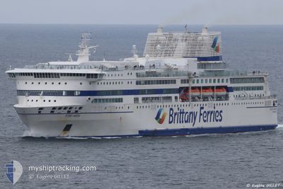
PONT AVEN
Ro-Ro/Passenger Ship
Current Trip
| Time Travelled | 16 h, 18 mins |
|---|---|
| Remaining Time | 2 h, 19 mins |
| Distance Travelled | 359.95 nm |
| Remaining Distance | 71.11 nm |
| AVG Speed | 23.5 Knots |
| MAX Speed | 25.2 Knots |
| AVG Wind | 8 knots |
| MAX Wind | 16 knots |
| MIN Temp | 13.3°C / 55.94°F |
| MAX Temp | 18.3°C / 64.94°F |
| Draught | 6.8 m |
| Position Received | 33 m ago |
Current Position
| Longitude | -4.59118° |
|---|---|
| Latitude | 49.26564° |
| Status | Under way using engine |
| Speed | 23.5 Knots |
| Course | 17.2° |
| Area | English Channel |
| Station | T-AIS |
| Position Received | 33 m ago |
Info
Information
The current position of PONT AVEN is in English Channel with coordinates 49.26564° / -4.59118° as reported on 2024-06-07 06:17 by AIS to our vessel tracker app. The vessel's current speed is 23.5 Knots and is heading at the port of PLYMOUTH. The estimated time of arrival as calculated by vessel tracking app is 2024-06-07 09:09 LT
The vessel PONT AVEN (IMO: 9268708, MMSI: 228183600) is a Ro-Ro/Passenger Ship that was built in 2004 ( 20 years old ). It's sailing under the flag of [FR] France.
In this page you can find informations about the vessels current position, last detected port calls, and current voyage information. If the vessels is not in coverage by AIS you will find the latest position.
The current position of PONT AVEN is detected by our AIS receivers and we are not responsible for the reliability of the data. The last position was recorded while the vessel was in Coverage by the Ais receivers of our vessel tracking app.
The current draught of PONT AVEN as reported by AIS is 6.8 meters
Weather
| Temperature | 13.4°C / 56.12°F |
|---|---|
| Wind Speed | 6 knots |
| Direction | 301° WNW |
| Pressure | 1021.2 hPa |
| Humidity | 64.3 % |
| Cloud Coverage | 8 % |
Featured Company
Last Port Calls
| Port | Arrival | Departure | Time In Port |
|---|---|---|---|
| 2024-06-06 10:48 | 2024-06-06 14:32 | 3 h | |
| 2024-06-05 12:04 | 2024-06-05 14:51 | 2 h | |
| 2024-06-05 04:09 | 2024-06-05 07:21 | 3 h | |
| 2024-06-04 14:15 | 2024-06-04 19:00 | 4 h | |
| 2024-06-03 13:12 | 2024-06-03 17:10 | 3 h | |
| 2024-06-02 13:46 | 2024-06-02 16:53 | 3 h | |
| 2024-06-02 05:39 | 2024-06-02 08:53 | 3 h | |
| 2024-06-01 09:06 | 2024-06-01 15:39 | 6 h | |
| 2024-05-31 17:39 | 2024-05-31 20:53 | 3 h | |
| 2024-05-31 10:08 | 2024-05-31 12:57 | 2 h |
Most Visited Ports (Last year)
| Port | Arrivals | |
|---|---|---|
| 119 | ||
| 90 | ||
| 66 | ||
| 55 | ||
| 19 | ||
| 16 |
Last Trips
| Origin | Departure | Destination | Arrival | Distance | |
|---|---|---|---|---|---|
| 2024-06-05 15:51 | 2024-06-06 12:48 | 430.57 nm | |||
| 2024-06-05 09:21 | 2024-06-05 13:04 | 99.96 nm | |||
| 2024-06-04 20:00 | 2024-06-05 06:09 | 101.77 nm | |||
| 2024-06-03 19:10 | 2024-06-04 15:15 | 429.85 nm | |||
| 2024-06-02 17:53 | 2024-06-03 15:12 | 424.25 nm | |||
| 2024-06-02 10:53 | 2024-06-02 14:46 | 99.97 nm | |||
| 2024-06-01 16:39 | 2024-06-02 07:39 | 257.50 nm | |||
| 2024-05-31 22:53 | 2024-06-01 10:06 | 255.82 nm | |||
| 2024-05-31 13:57 | 2024-05-31 19:39 | 100.11 nm | |||
| 2024-05-30 16:41 | 2024-05-31 11:08 | 434.76 nm |
Events
| Time | Event | Details | Position / Dest | Info |
|---|---|---|---|---|
| 2024-06-07 06:34 | Status Changed | Default Under way using engine |
49.37318 / -4.54411
GBPLY
|
Speed: 23.5 kn Course: 17.2° |
| 2024-06-07 06:07 | Status Changed | Under way using engine Default |
49.20780 / -4.61812
GBPLY
|
Speed: 23.7 kn Course: 16° |
| 2024-06-07 05:50 | Status Changed | Default Under way using engine |
49.09909 / -4.67667
GBPLY
|
Speed: 24 kn Course: 23.8° |
| 2024-06-07 05:22 | Change Sea Area | French part of the English Channel French part of the Celtic Sea |
48.92904 / -4.79326
English Channel
GBPLY
|
Speed: 24.3 kn Course: 24.6° |
| 2024-06-07 04:59 | Status Changed | Under way using engine Default |
48.77714 / -4.85988
GBPLY
|
Speed: 24.2 kn Course: 16° |
| 2024-06-07 04:40 | Status Changed | Default Under way using engine |
48.65477 / -4.90844
GBPLY
|
Speed: 24 kn Course: 15.9° |
| 2024-06-07 01:15 | Change Sea Area | French part of the Celtic Sea French part of the Bay of Biscay |
47.35059 / -4.94541
Celtic Sea
GBPLY
|
Speed: 23.7 kn Course: 347.5° |
| 2024-06-07 01:14 | Status Changed | Under way using engine Default |
47.34760 / -4.94448
GBPLY
|
Speed: 23.1 kn Course: 348° |
| 2024-06-07 01:00 | Status Changed | Default Under way using engine |
47.25373 / -4.91415
GBPLY
|
Speed: 24 kn Course: 348.1° |
| 2024-06-07 00:02 | OUT of Coverage |
46.88507 / -4.79208
Bay of Biscay
GBPLY
|
Speed: 24 kn Course: 348.1° |