
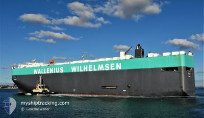
PORGY
Vehicles Carrier
Current Trip
CN XSA > CN SHA
| Time Travelled | 3 h, 32 mins |
|---|---|
| Remaining Time | --- |
| Distance Travelled | 45.84 nm |
| Remaining Distance | --- |
| AVG Speed | 13.8 Knots |
| MAX Speed | 17.5 Knots |
| AVG Wind | 3.4 knots |
| MAX Wind | 5 knots |
| MIN Temp | 21.5°C / 70.7°F |
| MAX Temp | 22.1°C / 71.78°F |
| Draught | 8.8 m |
| Position Received | 2 d ago |
Current Position
| Longitude | 118.14433° |
|---|---|
| Latitude | 23.44952° |
| Status | Under way using engine |
| Speed | 14.7 Knots |
| Course | 61° |
| Area | South China Sea |
| Station | T-AIS |
| Position Received | 2 d ago |
Info
Information
The current position of PORGY is in South China Sea with coordinates 23.44952° / 118.14433° as reported on 2024-06-06 03:50 by AIS to our vessel tracker app. The vessel's current speed is 14.7 Knots
The vessel PORGY (IMO: 9409338, MMSI: 351126000) is a Vehicles Carrier that was built in 2009 ( 15 years old ). It's sailing under the flag of [PA] Panama.
In this page you can find informations about the vessels current position, last detected port calls, and current voyage information. If the vessels is not in coverage by AIS you will find the latest position.
The current position of PORGY is detected by our AIS receivers and we are not responsible for the reliability of the data. The last position was recorded while the vessel was in Coverage by the Ais receivers of our vessel tracking app.
The current draught of PORGY as reported by AIS is 8.8 meters
Weather
| Temperature | 21.7°C / 71.06°F |
|---|---|
| Wind Speed | 1 knots |
| Direction | 165° SSE |
| Pressure | 1007.5 hPa |
| Humidity | 82.8 % |
| Cloud Coverage | 90 % |
Featured Company
Last Port Calls
Most Visited Ports (Last year)
| Port | Arrivals | |
|---|---|---|
| 4 | ||
| 2 | ||
| 2 | ||
| 2 | ||
| 2 | ||
| 2 |
Last Trips
| Origin | Departure | Destination | Arrival | Distance | |
|---|---|---|---|---|---|
| 2024-04-30 14:45 | 2024-06-08 09:56 | 14512.03 nm | |||
| 2024-04-24 18:16 | 2024-04-25 18:46 | 317.18 nm | |||
| 2024-04-10 06:10 | 2024-04-11 16:29 | 556.69 nm | |||
| 2024-04-04 02:27 | 2024-04-09 18:40 | 2194.11 nm | |||
| 2024-02-17 16:22 | 2024-04-02 21:18 | 10054.46 nm |
Events
| Time | Event | Details | Position / Dest | Info |
|---|---|---|---|---|
| 2024-06-08 17:01 | START Moving | 5.07 nm, South East of SHANGHAI |
31.32460 / 121.69113
CN XSA > CN SHA
|
Speed: 4.6 kn Course: 110° |
| 2024-06-08 16:57 | PORT DEPARTURE |
|
31.32458 / 121.68713
CN XSA > CN SHA
|
Speed: 1.6 kn Course: 105° |
| 2024-06-08 01:56 | STOP Moving |
31.32220 / 121.68175
[CN] SHANGHAI
|
Speed: Course: 126° |
|
| 2024-06-08 01:56 | PORT ARRIVAL |
|
31.32220 / 121.68175
[CN] SHANGHAI
|
Speed: 1 kn Course: 116° |
| 2024-06-06 03:50 | OUT of Coverage |
23.44952 / 118.14433
South China Sea
CN XSA > CN SHA
|
Speed: 14.7 kn Course: 61° |
|
| 2024-06-06 03:07 | IN Coverage |
23.35188 / 117.98572
South China Sea
CN XSA > CN SHA
|
Speed: 15.4 kn Course: 47° |
|
| 2024-06-05 14:42 | Status Changed | Default Under way using engine |
21.97197 / 114.65256
CN XSA > CN SHA
|
Speed: 15.6 kn Course: 83° |
| 2024-06-05 14:40 | Status Changed | Under way using engine Default |
21.97097 / 114.64332
CN XSA > CN SHA
|
Speed: 15.5 kn Course: 82° |
| 2024-06-05 14:40 | OUT of Coverage |
21.97097 / 114.64332
South China Sea
CN XSA > CN SHA
|
Speed: 15.6 kn Course: 83° |
|
| 2024-06-05 14:33 | Status Changed | Default Under way using engine |
21.96750 / 114.61152
CN XSA > CN SHA
|
Speed: 15.4 kn Course: 78° |