
PORTO GERMENO
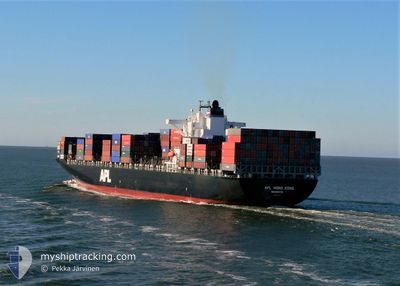
Container Ship
Current Trip
| Time Travelled | 14 h, 54 mins |
|---|---|
| Remaining Time | --- |
| Distance Travelled | 30.29 nm |
| Remaining Distance | --- |
| AVG Speed | 5.7 Knots |
| MAX Speed | 10.9 Knots |
| AVG Wind | 4.4 knots |
| MAX Wind | 6.9 knots |
| MIN Temp | 27°C / 80.6°F |
| MAX Temp | 30.1°C / 86.18°F |
| Draught | 13.8 m |
| Position Received | 1 m ago |
Current Position
| Longitude | 103.56107° |
|---|---|
| Latitude | 1.15813° |
| Status | Under way using engine |
| Speed | 0.6 Knots |
| Course | 238° |
| Area | Singapore Strait |
| Station | T-AIS |
| Position Received | 1 m ago |
Info
Information
The current position of PORTO GERMENO is in Singapore Strait with coordinates 1.15813° / 103.56107° as reported on 2024-06-06 20:20 by AIS to our vessel tracker app. The vessel's current speed is 0.6 Knots
The vessel PORTO GERMENO (IMO: 9260902, MMSI: 636020870) is a Container Ship that was built in 2002 ( 22 years old ). It's sailing under the flag of [LR] Liberia.
In this page you can find informations about the vessels current position, last detected port calls, and current voyage information. If the vessels is not in coverage by AIS you will find the latest position.
The current position of PORTO GERMENO is detected by our AIS receivers and we are not responsible for the reliability of the data. The last position was recorded while the vessel was in Coverage by the Ais receivers of our vessel tracking app.
The current draught of PORTO GERMENO as reported by AIS is 13.8 meters
Weather
| Temperature | 27°C / 80.6°F |
|---|---|
| Wind Speed | 6 knots |
| Direction | 36° NE |
| Pressure | 1009.4 hPa |
| Humidity | 82.2 % |
| Cloud Coverage | 100 % |
Featured Company
Last Port Calls
| Port | Arrival | Departure | Time In Port |
|---|---|---|---|
| 2024-06-04 23:11 | 2024-06-06 05:27 | 1 d | |
| 2024-06-02 06:29 | 2024-06-03 13:10 | 1 d | |
| 2024-05-28 12:48 | 2024-05-29 12:25 | 23 h | |
| 2024-05-25 20:54 | 2024-05-26 17:46 | 20 h | |
| 2024-05-21 16:01 | 2024-05-22 09:04 | 17 h | |
| 2024-05-17 08:31 | 2024-05-18 15:15 | 1 d | |
| 2024-05-08 07:00 | 2024-05-08 15:12 | 8 h | |
| 2024-05-06 21:20 | 2024-05-07 16:44 | 19 h | |
| 2024-05-05 02:20 | 2024-05-05 21:13 | 18 h | |
| 2024-04-28 06:39 | 2024-04-28 19:19 | 12 h |
Most Visited Ports (Last year)
| Port | Arrivals | |
|---|---|---|
| 20 | ||
| 18 | ||
| 18 | ||
| 8 | ||
| 8 | ||
| 8 |
Last Trips
| Origin | Departure | Destination | Arrival | Distance | |
|---|---|---|---|---|---|
| 2024-06-03 20:10 | 2024-06-05 07:11 | 592.73 nm | |||
| 2024-05-29 19:25 | 2024-06-02 13:29 | 802.89 nm | |||
| 2024-05-27 01:46 | 2024-05-28 19:48 | 581.89 nm | |||
| 2024-05-22 17:04 | 2024-05-26 04:54 | 25.22 nm | |||
| 2024-05-18 23:15 | 2024-05-22 00:01 | 149.39 nm | |||
| 2024-05-08 23:12 | 2024-05-17 16:31 | 2565.52 nm | |||
| 2024-05-08 00:44 | 2024-05-08 15:00 | 138.41 nm | |||
| 2024-05-06 05:13 | 2024-05-07 05:20 | 445.05 nm | |||
| 2024-04-29 03:19 | 2024-05-05 10:20 | 1761.53 nm | |||
| 2024-04-28 05:47 | 2024-04-28 14:39 | 70.62 nm |
Events
| Time | Event | Details | Position / Dest | Info |
|---|---|---|---|---|
| 2024-06-06 19:04 | Change Sea Area | Indonesian part of the Singapore Strait Malaysian part of the Singapore Strait |
1.15437 / 103.55003
Singapore Strait
SGSIN
|
Speed: 0.6 kn Course: 99° |
| 2024-06-06 15:56 | Change Sea Area | Malaysian part of the Singapore Strait Indonesian part of the Singapore Strait |
1.15598 / 103.54943
Singapore Strait
SGSIN
|
Speed: 5.5 kn Course: 309° |
| 2024-06-06 15:38 | START Moving | 9.98 nm, South West of JURONG ISLAND |
1.15647 / 103.55875
SGSIN
|
Speed: 3.1 kn Course: 168° |
| 2024-06-06 15:08 | Change Sea Area | Indonesian part of the Singapore Strait Malaysian part of the Singapore Strait |
1.15813 / 103.55358
Singapore Strait
SGSIN
|
Speed: 1.1 kn Course: 118° |
| 2024-06-06 12:31 | ETA Changed | 2024/06/08 10:00 2024/06/08 09:00 |
1.16638 / 103.53303
SGSIN
|
Speed: 0.2 kn Course: 63° |
| 2024-06-06 12:12 | STOP Moving | 10.95 nm, South West of JURONG ISLAND |
1.16480 / 103.53323
SGSIN
|
Speed: 0.3 kn Course: 69° |
| 2024-06-06 11:32 | START Moving | 11.07 nm, South of TANJUNG PELEPAS |
1.16703 / 103.50583
SGSIN
|
Speed: 3.1 kn Course: 110° |
| 2024-06-06 11:15 | ETA Changed | 2024/06/08 09:00 2024/06/06 23:00 |
1.16883 / 103.50797
SGSIN
|
Speed: 1.6 kn Course: 157° |
| 2024-06-06 09:43 | STOP Moving | 11.26 nm, South West of JURONG ISLAND |
1.15163 / 103.53567
SGSIN
|
Speed: 0.3 kn Course: 111° |
| 2024-06-06 09:02 | Change Sea Area | Malaysian part of the Singapore Strait Indonesian part of the Singapore Strait |
1.15513 / 103.51203
Singapore Strait
SGSIN
|
Speed: 3.5 kn Course: 13° |