
PRAIRIE
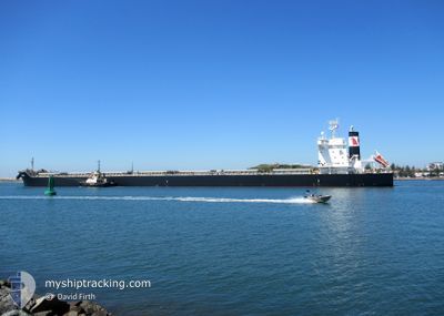
Cargo
Current Trip
| Time Travelled | 9 days |
|---|---|
| Remaining Time | 2 days |
| Distance Travelled | 2826.33 nm |
| Remaining Distance | 782.75 nm |
| AVG Speed | 12.5 Knots |
| MAX Speed | 17.8 Knots |
| AVG Wind | 13.4 knots |
| MAX Wind | 39.4 knots |
| MIN Temp | 5.4°C / 41.72°F |
| MAX Temp | 20.1°C / 68.18°F |
| Draught | 7.8 m |
| Position Received | 8 d ago |
Current Position
| Longitude | -9.44589° |
|---|---|
| Latitude | 49.92226° |
| Status | Under way using engine |
| Speed | 10.9 Knots |
| Course | 259.4° |
| Area | Celtic Sea |
| Station | T-AIS |
| Position Received | 8 d ago |
Info
Information
The current position of PRAIRIE is in Celtic Sea with coordinates 49.92226° / -9.44589° as reported on 2024-05-12 19:36 by AIS to our vessel tracker app. The vessel's current speed is 10.9 Knots and is heading at the port of NORFOLK. The estimated time of arrival as calculated by vessel tracking app is 2024-05-23 12:05 LT
The vessel PRAIRIE (IMO: 9860506, MMSI: 538008657) is a Cargo It's sailing under the flag of [MH] Marshall Is.
In this page you can find informations about the vessels current position, last detected port calls, and current voyage information. If the vessels is not in coverage by AIS you will find the latest position.
The current position of PRAIRIE is detected by our AIS receivers and we are not responsible for the reliability of the data. The last position was recorded while the vessel was in Coverage by the Ais receivers of our vessel tracking app.
The current draught of PRAIRIE as reported by AIS is 7.8 meters
Weather
| Temperature | 19.6°C / 67.28°F |
|---|---|
| Wind Speed | 16 knots |
| Direction | 52° NE |
| Pressure | 1009.4 hPa |
| Humidity | 90.4 % |
| Cloud Coverage | 100 % |
Featured Company
Last Port Calls
Most Visited Ports (Last year)
| Port | Arrivals | |
|---|---|---|
| 2 | ||
| 1 | ||
| 1 | ||
| 1 | ||
| 1 | ||
| 1 |
Last Trips
| Origin | Departure | Destination | Arrival | Distance | |
|---|---|---|---|---|---|
| 2024-04-17 18:27 | 2024-05-06 21:16 | 4919.80 nm | |||
| 2024-03-15 17:37 | 2024-04-15 14:25 | 5567.71 nm | |||
| 2024-03-09 20:23 | 2024-03-12 05:37 | 539.12 nm | |||
| 2024-03-08 07:55 | 2024-03-08 08:43 | 4.58 nm | |||
| 2024-02-15 11:34 | 2024-03-08 07:08 | 5443.32 nm |
Events
| Time | Event | Details | Position / Dest | Info |
|---|---|---|---|---|
| 2024-05-12 19:41 | Status Changed | Default Under way using engine |
49.91978 / -9.46612
US ORF
|
Speed: 10.9 kn Course: 259.4° |
| 2024-05-12 19:36 | OUT of Coverage |
49.92226 / -9.44589
Celtic Sea
US ORF
|
Speed: 10.9 kn Course: 259.4° |
|
| 2024-05-12 19:35 | Status Changed | Under way using engine Default |
49.92274 / -9.44213
US ORF
|
Speed: 10.9 kn Course: 259° |
| 2024-05-12 19:20 | Status Changed | Default Under way using engine |
49.93068 / -9.37156
US ORF
|
Speed: 11 kn Course: 261.3° |
| 2024-05-12 19:00 | Status Changed | Under way using engine Default |
49.94003 / -9.27865
US ORF
|
Speed: 11.2 kn Course: 262° |
| 2024-05-12 18:58 | Status Changed | Default Under way using engine |
49.94096 / -9.26837
US ORF
|
Speed: 11 kn Course: 261.8° |
| 2024-05-12 17:33 | Status Changed | Under way using engine Default |
49.98342 / -8.87858
US ORF
|
Speed: 11 kn Course: 260° |
| 2024-05-12 17:22 | Status Changed | Default Under way using engine |
49.98953 / -8.82774
US ORF
|
Speed: 10.8 kn Course: 303.9° |
| 2024-05-12 17:14 | Detected in Sea | Irish part of the Celtic Sea |
49.98279 / -8.79420
Celtic Sea
US ORF
|
Speed: 11.3 kn Course: 312.8° |
| 2024-05-12 16:12 | Status Changed | Under way using engine Default |
49.84929 / -8.57761
US ORF
|
Speed: 11 kn Course: 314° |