
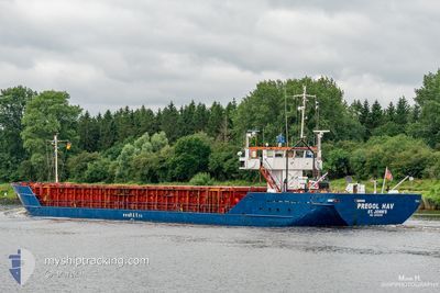
PREGOL HAV
General Cargo
Current Trip
| Time Travelled | 4 days |
|---|---|
| Remaining Time | 20 h, 17 mins |
| Distance Travelled | 443.01 nm |
| Remaining Distance | 165.35 nm |
| AVG Speed | 7.3 Knots |
| MAX Speed | 10.2 Knots |
| AVG Wind | 13.3 knots |
| MAX Wind | 20 knots |
| MIN Temp | 7.7°C / 45.86°F |
| MAX Temp | 17.2°C / 62.96°F |
| Draught | 4.5 m |
| Position Received | 1 m ago |
Current Position
| Longitude | 11.65544° |
|---|---|
| Latitude | 54.43467° |
| Status | Under way using engine |
| Speed | 7.7 Knots |
| Course | 119.2° |
| Area | Baltic Sea |
| Station | T-AIS |
| Position Received | 1 m ago |
Info
Information
The current position of PREGOL HAV is in Baltic Sea with coordinates 54.43467° / 11.65544° as reported on 2024-06-15 21:11 by AIS to our vessel tracker app. The vessel's current speed is 7.7 Knots and is heading at the port of SOLVESBORG. The estimated time of arrival as calculated by vessel tracking app is 2024-06-16 17:29 LT
The vessel PREGOL HAV (IMO: 8519239, MMSI: 305966000) is a General Cargo that was built in 1985 ( 39 years old ). It's sailing under the flag of [AG] Antigua Barbuda.
In this page you can find informations about the vessels current position, last detected port calls, and current voyage information. If the vessels is not in coverage by AIS you will find the latest position.
The current position of PREGOL HAV is detected by our AIS receivers and we are not responsible for the reliability of the data. The last position was recorded while the vessel was in Coverage by the Ais receivers of our vessel tracking app.
The current draught of PREGOL HAV as reported by AIS is 4.5 meters
Weather
| Temperature | 15°C / 59°F |
|---|---|
| Wind Speed | 13 knots |
| Direction | 209° SSW |
| Pressure | 1007.2 hPa |
| Humidity | 81.9 % |
| Cloud Coverage | 48 % |
Featured Company
Last Port Calls
| Port | Arrival | Departure | Time In Port |
|---|---|---|---|
| 2024-06-08 00:56 | 2024-06-11 16:36 | 3 d | |
| 2024-06-06 11:20 | 2024-06-06 23:30 | 12 h | |
| 2024-05-27 14:20 | 2024-05-29 16:42 | 2 d | |
| 2024-05-23 04:34 | 2024-05-24 04:14 | 23 h | |
| 2024-05-20 04:53 | 2024-05-20 17:13 | 12 h | |
| 2024-05-16 00:11 | 2024-05-16 01:18 | 1 h | |
| 2024-04-26 04:42 | 2024-04-26 19:10 | 14 h | |
| 2024-04-21 22:37 | 2024-04-22 21:40 | 23 h | |
| 2024-04-20 02:20 |
Most Visited Ports (Last year)
| Port | Arrivals | |
|---|---|---|
| 8 | ||
| 4 | ||
| 3 | ||
| 3 | ||
| 3 | ||
| 2 |
Last Trips
| Origin | Departure | Destination | Arrival | Distance | |
|---|---|---|---|---|---|
| 2024-06-07 00:30 | 2024-06-08 02:56 | 145.82 nm | |||
| 2024-05-29 17:42 | 2024-06-06 12:20 | 987.48 nm | |||
| 2024-05-24 06:14 | 2024-05-27 15:20 | 173.28 nm | |||
| 2024-05-20 19:13 | 2024-05-23 06:34 | 470.07 nm | |||
| 2024-05-16 03:18 | 2024-05-20 06:53 | 789.95 nm | |||
| 2024-04-26 20:10 | 2024-05-16 02:11 | 954.70 nm | |||
| 2024-04-22 23:40 | 2024-04-26 05:42 | 631.04 nm | |||
| 2024-04-20 04:20 | 2024-04-22 00:37 | 101.02 nm |
Events
| Time | Event | Details | Position / Dest | Info |
|---|---|---|---|---|
| 2024-06-15 20:11 | Change Sea Area | Danish part of the Baltic Sea German part of the Baltic Sea |
54.49489 / 11.45151
Baltic Sea
SESOL
|
Speed: 7.6 kn Course: 113.2° |
| 2024-06-15 16:59 | Change Sea Area | German part of the Baltic Sea Danish part of the Baltic Sea |
54.56728 / 10.78004
Baltic Sea
SESOL
|
Speed: 8.2 kn Course: 82.9° |
| 2024-06-15 16:11 | Change Sea Area | Danish part of the Baltic Sea German part of the Baltic Sea |
54.55973 / 10.58975
Baltic Sea
SESOL
|
Speed: 8.4 kn Course: 85.4° |
| 2024-06-15 14:38 | Change Sea Area | German part of the Baltic Sea German part of the North Sea |
54.45990 / 10.27227
Baltic Sea
SESOL
|
Speed: 8.5 kn Course: 41.5° |
| 2024-06-15 13:43 | START Moving | 1.32 nm, South West of STICKENHΟRN SPORT |
54.36563 / 10.14451
SESOL
|
Speed: 3.7 kn Course: 100° |
| 2024-06-15 12:57 | STOP Moving | 1.37 nm, South West of STICKENHΟRN SPORT |
54.36608 / 10.14136
SESOL
|
Speed: 0.3 kn Course: 108° |
| 2024-06-15 09:28 | START Moving | 3.71 nm, South West of RENDSBURG |
54.26704 / 9.62791
SESOL
|
Speed: 3.3 kn Course: 14° |
| 2024-06-15 09:18 | STOP Moving | 3.87 nm, South West of RENDSBURG |
54.26429 / 9.62627
SESOL
|
Speed: 0.3 kn Course: 22° |
| 2024-06-15 08:17 | ETA Changed | 2024/06/16 18:00 2024/06/16 15:00 |
54.19131 / 9.52673
SESOL
|
Speed: 6.8 kn Course: 70.7° |
| 2024-06-15 07:13 | Status Changed | Under way using engine Default |
54.13954 / 9.34104
SESOL
|
Speed: 6.5 kn Course: 26° |