
PRESIDENTFDROOSEVELT
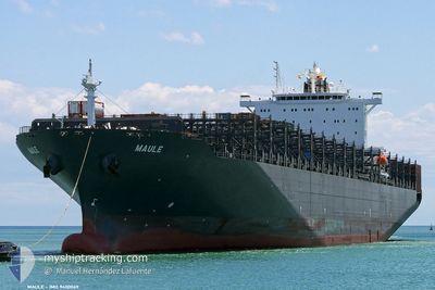
Container Ship
Current Trip
| Time Travelled | 7 days |
|---|---|
| Remaining Time | 5 days |
| Distance Travelled | 2983.08 nm |
| Remaining Distance | 2344.91 nm |
| AVG Speed | 17.6 Knots |
| MAX Speed | 20.5 Knots |
| AVG Wind | 20.6 knots |
| MAX Wind | 33.7 knots |
| MIN Temp | 3.9°C / 39.02°F |
| MAX Temp | 19.1°C / 66.38°F |
| Draught | 12.3 m |
| Position Received | 5 d ago |
Current Position
| Longitude | 141.89241° |
|---|---|
| Latitude | 41.65783° |
| Status | Under way using engine |
| Speed | 17.5 Knots |
| Course | 82.8° |
| Area | North Pacific Ocean |
| Station | T-AIS |
| Position Received | 5 d ago |
Info
Information
The current position of PRESIDENTFDROOSEVELT is in North Pacific Ocean with coordinates 41.65783° / 141.89241° as reported on 2024-05-17 01:07 by AIS to our vessel tracker app. The vessel's current speed is 17.5 Knots and is heading at the port of LOS ANGELES. The estimated time of arrival as calculated by vessel tracking app is 2024-05-27 18:07 LT
The vessel PRESIDENTFDROOSEVELT (IMO: 9400069, MMSI: 369751000) is a Container Ship that was built in 2010 ( 14 years old ). It's sailing under the flag of [US] USA.
In this page you can find informations about the vessels current position, last detected port calls, and current voyage information. If the vessels is not in coverage by AIS you will find the latest position.
The current position of PRESIDENTFDROOSEVELT is detected by our AIS receivers and we are not responsible for the reliability of the data. The last position was recorded while the vessel was in Coverage by the Ais receivers of our vessel tracking app.
The current draught of PRESIDENTFDROOSEVELT as reported by AIS is 12.3 meters
Weather
| Temperature | 6.6°C / 43.88°F |
|---|---|
| Wind Speed | 11 knots |
| Direction | 272° W |
| Pressure | 1021.9 hPa |
| Humidity | 80.1 % |
| Cloud Coverage | 100 % |
Featured Company
Last Port Calls
| Port | Arrival | Departure | Time In Port |
|---|---|---|---|
| 2024-05-14 00:04 | 2024-05-15 05:12 | 1 d | |
| 2024-05-10 17:40 | 2024-05-11 17:04 | 23 h | |
| 2024-05-08 03:36 | 2024-05-08 18:20 | 14 h | |
| 2024-05-04 06:56 | 2024-05-05 02:39 | 19 h | |
| 2024-04-29 07:46 | 2024-04-30 08:45 | 1 d | |
| 2024-04-16 12:49 | 2024-04-19 02:59 | 2 d | |
| 2024-04-12 09:15 | 2024-04-15 02:46 | 2 d | |
| 2024-03-30 18:51 | 2024-03-31 19:48 | 1 d | |
| 2024-03-28 07:08 | 2024-03-29 07:29 | 1 d | |
| 2024-03-24 07:49 | 2024-03-25 03:41 | 19 h |
Most Visited Ports (Last year)
| Port | Arrivals | |
|---|---|---|
| 16 | ||
| 8 | ||
| 8 | ||
| 8 | ||
| 7 | ||
| 7 |
Last Trips
| Origin | Departure | Destination | Arrival | Distance | |
|---|---|---|---|---|---|
| 2024-05-12 01:04 | 2024-05-14 09:04 | 532.26 nm | |||
| 2024-05-09 02:20 | 2024-05-11 01:40 | 479.75 nm | |||
| 2024-05-05 11:39 | 2024-05-08 11:36 | 680.48 nm | |||
| 2024-04-30 17:45 | 2024-05-04 15:56 | 1420.33 nm | |||
| 2024-04-18 19:59 | 2024-04-29 16:46 | 4582.87 nm | |||
| 2024-04-14 19:46 | 2024-04-16 05:49 | 381.38 nm | |||
| 2024-04-01 04:48 | 2024-04-12 02:15 | 5384.22 nm | |||
| 2024-03-29 15:29 | 2024-03-31 03:51 | 509.56 nm | |||
| 2024-03-25 11:41 | 2024-03-28 15:08 | 400.85 nm | |||
| 2024-03-22 04:41 | 2024-03-24 15:49 | 516.17 nm |
Events
| Time | Event | Details | Position / Dest | Info |
|---|---|---|---|---|
| 2024-05-17 01:16 | Status Changed | Default Under way using engine |
41.66098 / 141.94757
USLAX
|
Speed: 17.5 kn Course: 82.8° |
| 2024-05-17 01:07 | OUT of Coverage |
41.65783 / 141.89241
North Pacific Ocean
USLAX
|
Speed: 17.5 kn Course: 82.8° |
|
| 2024-05-17 00:50 | Status Changed | Under way using engine Default |
41.64571 / 141.78133
USLAX
|
Speed: 17.2 kn Course: 82° |
| 2024-05-17 00:46 | Status Changed | Default Under way using engine |
41.64225 / 141.75551
USLAX
|
Speed: 17.4 kn Course: 82.7° |
| 2024-05-17 00:12 | Status Changed | Under way using engine Default |
41.61680 / 141.53185
USLAX
|
Speed: 18.9 kn Course: 92° |
| 2024-05-17 00:05 | Status Changed | Default Under way using engine |
41.61822 / 141.47888
USLAX
|
Speed: 18.7 kn Course: 89.8° |
| 2024-05-16 23:55 | Status Changed | Under way using engine Default |
41.61837 / 141.41461
USLAX
|
Speed: 18.7 kn Course: 91° |
| 2024-05-16 23:49 | Status Changed | Default Under way using engine |
41.61884 / 141.36578
USLAX
|
Speed: 18.3 kn Course: 91° |
| 2024-05-16 23:39 | Change Sea Area | Japanese part of the North Pacific Ocean Japanese part of the Japan Sea |
41.61978 / 141.30391
North Pacific Ocean
USLAX
|
Speed: 17.9 kn Course: 91.1° |
| 2024-05-16 23:12 | Status Changed | Under way using engine Default |
41.61632 / 141.11989
USLAX
|
Speed: 18.8 kn Course: 90° |