
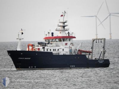
PRINCE MADOG
Other Type
Current Trip
SURVEY
| Time Travelled | 35 days |
|---|---|
| Remaining Time | --- |
| Distance Travelled | 916.69 nm |
| Remaining Distance | --- |
| AVG Speed | 6.7 Knots |
| MAX Speed | 12.7 Knots |
| AVG Wind | 11.9 knots |
| MAX Wind | 23 knots |
| MIN Temp | 9°C / 48.2°F |
| MAX Temp | 20.3°C / 68.54°F |
| Draught | 3.2 m |
| Position Received | 11 m ago |
Current Position
| Longitude | -3.81747° |
|---|---|
| Latitude | 53.39649° |
| Status | Restricted manoeuverability |
| Speed | 7.3 Knots |
| Course | 225° |
| Area | Irish Sea and St. George's Channel |
| Station | T-AIS |
| Position Received | 11 m ago |
Info
Information
The current position of PRINCE MADOG is in Irish Sea and St. George's Channel with coordinates 53.39649° / -3.81747° as reported on 2024-06-29 04:03 by AIS to our vessel tracker app. The vessel's current speed is 7.3 Knots
The vessel PRINCE MADOG (IMO: 922961100, MMSI: 235234000) is a Other Type It's sailing under the flag of [GB] United Kingdom.
In this page you can find informations about the vessels current position, last detected port calls, and current voyage information. If the vessels is not in coverage by AIS you will find the latest position.
The current position of PRINCE MADOG is detected by our AIS receivers and we are not responsible for the reliability of the data. The last position was recorded while the vessel was in Coverage by the Ais receivers of our vessel tracking app.
The current draught of PRINCE MADOG as reported by AIS is 3.2 meters
Weather
| Temperature | 13.5°C / 56.3°F |
|---|---|
| Wind Speed | 10 knots |
| Direction | 225° SW |
| Pressure | 1014.5 hPa |
| Humidity | 80.1 % |
| Cloud Coverage | 100 % |
Featured Company
Most Visited Ports (Last year)
| Port | Arrivals | |
|---|---|---|
| 4 | ||
| 2 | ||
| 1 | ||
| 1 |
Events
| Time | Event | Details | Position / Dest | Info |
|---|---|---|---|---|
| 2024-06-29 00:14 | START Moving | 9.85 nm, North of DEGANWY |
53.44373 / -3.72702
SURVEY
|
Speed: 3.4 kn Course: 179° |
| 2024-06-29 00:04 | STOP Moving | 9.72 nm, North of DEGANWY |
53.44161 / -3.72783
SURVEY
|
Speed: 0.3 kn Course: 252° |
| 2024-06-28 18:00 | START Moving | 9.67 nm, South West of LIVERPOOL ANCH |
53.35362 / -3.57805
SURVEY
|
Speed: 6.7 kn Course: 282.4° |
| 2024-06-28 17:53 | STOP Moving | 9.58 nm, South West of LIVERPOOL ANCH |
53.35381 / -3.57447
SURVEY
|
Speed: 0.1 kn Course: 232° |
| 2024-06-28 16:37 | IN Coverage |
53.38292 / -3.80116
Irish Sea and St. George's Channel
SURVEY
|
Speed: 6.8 kn Course: 98.8° |
|
| 2024-06-28 14:00 | OUT of Coverage |
53.23347 / -4.14402
Irish Sea and St. George's Channel
SURVEY
|
Speed: 8 kn Course: 40.1° |
|
| 2024-06-28 13:59 | IN Coverage |
53.23347 / -4.14402
Irish Sea and St. George's Channel
SURVEY
|
Speed: 8 kn Course: 40.1° |
|
| 2024-06-28 12:16 | OUT of Coverage |
53.23294 / -4.14466
Irish Sea and St. George's Channel
SURVEY
|
Speed: 4.7 kn Course: 218.7° |
|
| 2024-06-28 12:15 | ETA Changed | 2024/06/29 18:00 2024/06/21 07:20 |
53.23384 / -4.14380
SURVEY
|
Speed: 9.1 kn Course: 42.4° |
| 2024-06-28 12:09 | IN Coverage |
53.23384 / -4.14380
Irish Sea and St. George's Channel
|
Speed: 9.1 kn Course: 42.4° |