
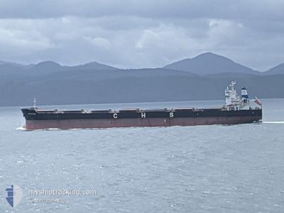
PRINCESS GRACE
Bulk Carrier
Current Trip
| Time Travelled | 7 days |
|---|---|
| Remaining Time | --- |
| Distance Travelled | 1944.84 nm |
| Remaining Distance | --- |
| AVG Speed | 11.3 Knots |
| MAX Speed | 15.2 Knots |
| AVG Wind | 12.5 knots |
| MAX Wind | 24 knots |
| MIN Temp | 4.8°C / 40.64°F |
| MAX Temp | 10.9°C / 51.62°F |
| Draught | 12 m |
| Position Received | 17 h, 22 m ago |
Current Position
| Longitude | -166.90515° |
|---|---|
| Latitude | 54.41089° |
| Status | Under way using engine |
| Speed | 11.8 Knots |
| Course | 273.5° |
| Area | Bering Sea |
| Station | T-AIS |
| Position Received | 17 h, 22 m ago |
Info
Information
The current position of PRINCESS GRACE is in Bering Sea with coordinates 54.41089° / -166.90515° as reported on 2024-06-01 02:23 by AIS to our vessel tracker app. The vessel's current speed is 11.8 Knots and is heading at the port of KUSHIRO. The estimated time of arrival as calculated by vessel tracking app is 2024-06-07 06:00 LT
The vessel PRINCESS GRACE (IMO: 9500261, MMSI: 538009150) is a Bulk Carrier that was built in 2011 ( 13 years old ). It's sailing under the flag of [MH] Marshall Is.
In this page you can find informations about the vessels current position, last detected port calls, and current voyage information. If the vessels is not in coverage by AIS you will find the latest position.
The current position of PRINCESS GRACE is detected by our AIS receivers and we are not responsible for the reliability of the data. The last position was recorded while the vessel was in Coverage by the Ais receivers of our vessel tracking app.
The current draught of PRINCESS GRACE as reported by AIS is 12 meters
Weather
| Temperature | 4.8°C / 40.64°F |
|---|---|
| Wind Speed | 5 knots |
| Direction | 334° NNW |
| Pressure | 994.3 hPa |
| Humidity | 85.8 % |
| Cloud Coverage | 100 % |
Featured Company
Most Visited Ports (Last year)
| Port | Arrivals | |
|---|---|---|
| 1 | ||
| 1 | ||
| 1 | ||
| 1 | ||
| 1 | ||
| 1 |
Events
| Time | Event | Details | Position / Dest | Info |
|---|---|---|---|---|
| 2024-06-01 02:28 | Status Changed | Default Under way using engine |
54.41122 / -166.93501
JP KUH
|
Speed: 11.8 kn Course: 273.5° |
| 2024-06-01 02:23 | Detected in Sea | United States (Alaska) part of the Bering Sea |
54.41089 / -166.90515
Bering Sea
JP KUH
|
Speed: 11.8 kn Course: 273.5° |
| 2024-06-01 02:23 | Status Changed | Under way using engine Default |
54.41089 / -166.90515
JP KUH
|
Speed: 11.7 kn Course: 270° |
| 2024-06-01 02:23 | OUT of Coverage |
54.41089 / -166.90515
Bering Sea
JP KUH
|
Speed: 11.8 kn Course: 273.5° |
|
| 2024-06-01 02:15 | IN Coverage |
54.41089 / -166.90515
Bering Sea
JP KUH
|
Speed: 11.8 kn Course: 273.5° |
|
| 2024-05-26 11:44 | Status Changed | Default Under way using engine |
48.64925 / -127.27402
JP KUH
|
Speed: 11.3 kn Course: 277.5° |
| 2024-05-26 11:39 | Status Changed | Under way using engine Default |
48.64719 / -127.24990
JP KUH
|
Speed: 11.2 kn Course: 280° |
| 2024-05-26 11:39 | OUT of Coverage |
48.64719 / -127.24990
North Pacific Ocean
JP KUH
|
Speed: 11.3 kn Course: 277.5° |
|
| 2024-05-26 11:26 | Status Changed | Default Under way using engine |
48.64159 / -127.19034
JP KUH
|
Speed: 11.2 kn Course: 279.4° |
| 2024-05-26 03:44 | Status Changed | Under way using engine Default |
48.52005 / -124.98010
JP KUH
|
Speed: 12.4 kn Course: 271° |