
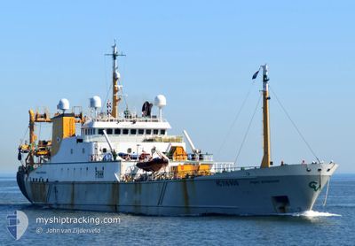
PRINS BERNHARD
Trawler
Current Trip
| Time Travelled | 10 days |
|---|---|
| Remaining Time | --- |
| Distance Travelled | 691.64 nm |
| Remaining Distance | --- |
| AVG Speed | 5.3 Knots |
| MAX Speed | 10.9 Knots |
| AVG Wind | 15.5 knots |
| MAX Wind | 18.8 knots |
| MIN Temp | 11°C / 51.8°F |
| MAX Temp | 13.9°C / 57.02°F |
| Draught | 6.2 m |
| Position Received | 2 m ago |
Current Position
| Longitude | -0.27375° |
|---|---|
| Latitude | 60.70475° |
| Status | Under way using engine |
| Speed | 10.7 Knots |
| Course | 176.1° |
| Area | North Sea |
| Station | T-AIS |
| Position Received | 2 m ago |
Info
Information
The current position of PRINS BERNHARD is in North Sea with coordinates 60.70475° / -0.27375° as reported on 2024-06-02 01:46 by AIS to our vessel tracker app. The vessel's current speed is 10.7 Knots and is heading at the port of DEN HELDER.
The vessel PRINS BERNHARD (IMO: 8224406, MMSI: 227302000) is a Trawler that was built in 1983 ( 41 years old ). It's sailing under the flag of [FR] France.
In this page you can find informations about the vessels current position, last detected port calls, and current voyage information. If the vessels is not in coverage by AIS you will find the latest position.
The current position of PRINS BERNHARD is detected by our AIS receivers and we are not responsible for the reliability of the data. The last position was recorded while the vessel was in Coverage by the Ais receivers of our vessel tracking app.
The current draught of PRINS BERNHARD as reported by AIS is 6.2 meters
Weather
| Temperature | 11.3°C / 52.34°F |
|---|---|
| Wind Speed | 11 knots |
| Direction | 274° W |
| Pressure | 1024.5 hPa |
| Humidity | 77.9 % |
| Cloud Coverage | 18 % |
Featured Company
Most Visited Ports (Last year)
| Port | Arrivals | |
|---|---|---|
| 10 | ||
| 4 |
Events
| Time | Event | Details | Position / Dest | Info |
|---|---|---|---|---|
| 2024-06-01 18:06 | ETA Changed | 2025/05/24 07:00 2024/05/24 07:00 |
60.87834 / -.04997
FISHING GROUNDS
|
Speed: 7.7 kn Course: 196.1° |
| 2024-06-01 17:26 | IN Coverage |
60.91692 / -.09523
North Sea
|
Speed: 5.1 kn Course: 346.1° |
|
| 2024-06-01 15:33 | OUT of Coverage |
60.86571 / -.20615
North Sea
|
Speed: 5.7 kn Course: 109.5° |
|
| 2024-06-01 13:48 | IN Coverage |
60.88095 / -.06965
North Sea
|
Speed: 4.4 kn Course: 50.5° |
|
| 2024-06-01 10:09 | OUT of Coverage |
60.98275 / -.04070
North Sea
|
Speed: 6.6 kn Course: 16.7° |
|
| 2024-06-01 09:05 | IN Coverage |
60.93476 / .11954
North Sea
|
Speed: 8.9 kn Course: 20.3° |
|
| 2024-06-01 05:50 | OUT of Coverage |
60.75646 / .51816
North Sea
|
Speed: 10.9 kn Course: 134.9° |
|
| 2024-06-01 05:47 | IN Coverage |
60.75646 / .51816
North Sea
|
Speed: 10.9 kn Course: 134.9° |
|
| 2024-06-01 03:59 | OUT of Coverage |
60.64224 / .30288
North Sea
|
Speed: 10.2 kn Course: 82.9° |
|
| 2024-06-01 03:59 | IN Coverage |
60.64224 / .30288
North Sea
|
Speed: 10.2 kn Course: 82.9° |