
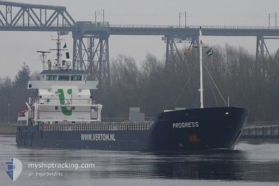
PROGRESS
General Cargo
Current Trip
| Time Travelled | 4 days |
|---|---|
| Remaining Time | --- |
| Distance Travelled | 1018.65 nm |
| Remaining Distance | --- |
| AVG Speed | 9.2 Knots |
| MAX Speed | 11.3 Knots |
| AVG Wind | 12 knots |
| MAX Wind | 21.3 knots |
| MIN Temp | 11.9°C / 53.42°F |
| MAX Temp | 16.5°C / 61.7°F |
| Draught | 5.6 m |
| Position Received | 1 m ago |
Current Position
| Longitude | -10.12436° |
|---|---|
| Latitude | 39.62880° |
| Status | Under way using engine |
| Speed | 9.5 Knots |
| Course | 181° |
| Area | North Atlantic Ocean |
| Station | T-AIS |
| Position Received | 1 m ago |
Info
Information
The current position of PROGRESS is in North Atlantic Ocean with coordinates 39.62880° / -10.12436° as reported on 2024-05-18 13:51 by AIS to our vessel tracker app. The vessel's current speed is 9.5 Knots and is heading at the port of VOLOS. The estimated time of arrival as calculated by vessel tracking app is 2024-05-27 20:00 LT
The vessel PROGRESS (IMO: 9371828, MMSI: 246303000) is a General Cargo that was built in 2009 ( 15 years old ). It's sailing under the flag of [NL] Netherlands.
In this page you can find informations about the vessels current position, last detected port calls, and current voyage information. If the vessels is not in coverage by AIS you will find the latest position.
The current position of PROGRESS is detected by our AIS receivers and we are not responsible for the reliability of the data. The last position was recorded while the vessel was in Coverage by the Ais receivers of our vessel tracking app.
The current draught of PROGRESS as reported by AIS is 5.6 meters
Weather
| Temperature | 15.7°C / 60.26°F |
|---|---|
| Wind Speed | 12 knots |
| Direction | 329° NNW |
| Pressure | 1016 hPa |
| Humidity | 77.1 % |
| Cloud Coverage | 94 % |
Featured Company
Last Port Calls
| Port | Arrival | Departure | Time In Port |
|---|---|---|---|
| 2024-05-11 15:49 | 2024-05-14 02:28 | 2 d | |
| 2024-05-11 13:53 | 2024-05-11 13:55 | 2 m | |
| 2024-04-30 01:42 | 2024-04-30 01:48 | 5 m | |
| 2024-04-27 14:27 | 2024-04-29 16:18 | 2 d | |
| 2024-04-22 15:08 | 2024-04-27 04:24 | 4 d | |
| 2024-04-13 20:52 | 2024-04-17 06:27 | 3 d | |
| 2024-04-08 23:07 | 2024-04-08 23:11 | 3 m | |
| 2024-03-31 16:19 | 2024-04-02 17:19 | 2 d | |
| 2024-03-21 21:34 | 2024-03-26 20:35 | 4 d | |
| 2024-03-12 17:48 | 2024-03-12 18:59 | 1 h |
Last Trips
| Origin | Departure | Destination | Arrival | Distance | |
|---|---|---|---|---|---|
| 2024-05-11 15:55 | 2024-05-11 17:49 | 4.55 nm | |||
| 2024-04-30 03:48 | 2024-05-11 15:53 | 599.47 nm | |||
| 2024-04-29 18:18 | 2024-04-30 03:42 | 0.67 nm | |||
| 2024-04-27 06:24 | 2024-04-27 16:27 | 42.55 nm | |||
| 2024-04-17 09:27 | 2024-04-22 17:08 | 740.84 nm | |||
| 2024-04-09 01:11 | 2024-04-13 23:52 | 843.83 nm | |||
| 2024-04-02 18:19 | 2024-04-09 01:07 | 1427.47 nm | |||
| 2024-03-26 20:35 | 2024-03-31 17:19 | 712.98 nm | |||
| 2024-03-12 19:59 | 2024-03-21 21:34 | 2009.18 nm | |||
| 2024-03-10 09:42 | 2024-03-12 18:48 | 467.69 nm |
Events
| Time | Event | Details | Position / Dest | Info |
|---|---|---|---|---|
| 2024-05-18 13:14 | Status Changed | Under way using engine Default |
39.72754 / -10.12465
GRVOL
|
Speed: 9.1 kn Course: 182° |
| 2024-05-18 12:58 | Status Changed | Default Under way using engine |
39.76799 / -10.12427
GRVOL
|
Speed: 9.6 kn Course: 181.6° |
| 2024-05-18 12:58 | Status Changed | Under way using engine Default |
39.76942 / -10.12425
GRVOL
|
Speed: 9.9 kn Course: 178° |
| 2024-05-18 12:46 | Status Changed | Default Under way using engine |
39.80100 / -10.12410
GRVOL
|
Speed: 9.6 kn Course: 183° |
| 2024-05-18 12:41 | Change Sea Area | Portuguese part of the North Atlantic Ocean French part of the English Channel |
39.81618 / -10.12389
North Atlantic Ocean
GRVOL
|
Speed: 9.6 kn Course: 183° |
| 2024-05-18 12:41 | Status Changed | Under way using engine Default |
39.81618 / -10.12389
GRVOL
|
Speed: 9.6 kn Course: 180° |
| 2024-05-18 12:38 | IN Coverage |
39.81618 / -10.12389
North Atlantic Ocean
GRVOL
|
Speed: 9.6 kn Course: 183° |
|
| 2024-05-15 16:03 | Status Changed | Default Under way using engine |
49.50715 / -4.25573
GRVOL
|
Speed: 10.3 kn Course: 238.5° |
| 2024-05-15 15:57 | OUT of Coverage |
49.51590 / -4.23553
English Channel
GRVOL
|
Speed: 10.3 kn Course: 238.5° |
|
| 2024-05-15 15:56 | Detected in Sea | French part of the English Channel |
49.51737 / -4.23183
English Channel
GRVOL
|
Speed: 10 kn Course: 237.3° |