
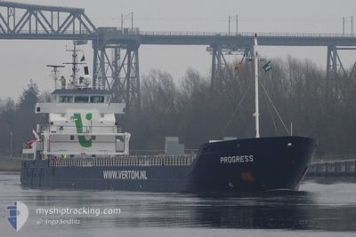
PROGRESS
General Cargo
Current Trip
| Trip Time | 13 h, 19 mins |
|---|---|
| Trip Distance | 135.72 nm |
| AVG Speed | 10.5 Knots |
| MAX Speed | 10.5 Knots |
| Draught | 4 m |
| AVG Wind | 6 knots |
| MAX Wind | 13.8 knots |
| MIN Temp | 19.3°C / 66.74°F |
| MAX Temp | 25.9°C / 78.62°F |
| Position Received | 9 d ago |
Current Position
| Longitude | 29.10465° |
|---|---|
| Latitude | 41.49446° |
| Status | Under way using engine |
| Speed | 10.9 Knots |
| Course | 341° |
| Area | Black Sea |
| Station | T-AIS |
| Position Received | 9 d ago |
Info
Information
The current position of PROGRESS is in Black Sea with coordinates 41.49446° / 29.10465° as reported on 2024-06-01 00:22 by AIS to our vessel tracker app. The vessel's current speed is 10.9 Knots and is currently inside the port of VARNA.
The vessel PROGRESS (IMO: 9371828, MMSI: 246303000) is a General Cargo that was built in 2009 ( 15 years old ). It's sailing under the flag of [NL] Netherlands.
In this page you can find informations about the vessels current position, last detected port calls, and current voyage information. If the vessels is not in coverage by AIS you will find the latest position.
The current position of PROGRESS is detected by our AIS receivers and we are not responsible for the reliability of the data. The last position was recorded while the vessel was in Coverage by the Ais receivers of our vessel tracking app.
The current draught of PROGRESS as reported by AIS is 4 meters
Weather
| Temperature | 19.2°C / 66.56°F |
|---|---|
| Wind Speed | 6 knots |
| Direction | 203° SSW |
| Pressure | 1011.7 hPa |
| Humidity | 82.3 % |
| Cloud Coverage | 25 % |
Featured Company
Last Port Calls
| Port | Arrival | Departure | Time In Port |
|---|---|---|---|
| 2024-06-01 11:54 | |||
| 2024-05-31 22:02 | 2024-05-31 22:35 | 32 m | |
| 2024-05-27 07:09 | 2024-05-29 14:16 | 2 d | |
| 2024-05-11 15:49 | 2024-05-14 02:28 | 2 d | |
| 2024-05-11 13:53 | 2024-05-11 13:55 | 2 m | |
| 2024-04-30 01:42 | 2024-04-30 01:48 | 5 m | |
| 2024-04-27 14:27 | 2024-04-29 16:18 | 2 d | |
| 2024-04-22 15:08 | 2024-04-27 04:24 | 4 d | |
| 2024-04-13 20:52 | 2024-04-17 06:27 | 3 d | |
| 2024-04-08 23:07 | 2024-04-08 23:11 | 3 m |
Last Trips
| Origin | Departure | Destination | Arrival | Distance | |
|---|---|---|---|---|---|
| 2024-06-01 01:35 | 2024-06-01 14:54 | 135.72 nm | |||
| 2024-05-29 17:16 | 2024-06-01 01:02 | 363.25 nm | |||
| 2024-05-14 04:28 | 2024-05-27 10:09 | 3063.61 nm | |||
| 2024-05-11 15:55 | 2024-05-11 17:49 | 4.55 nm | |||
| 2024-04-30 03:48 | 2024-05-11 15:53 | 599.47 nm | |||
| 2024-04-29 18:18 | 2024-04-30 03:42 | 0.67 nm | |||
| 2024-04-27 06:24 | 2024-04-27 16:27 | 42.55 nm | |||
| 2024-04-17 09:27 | 2024-04-22 17:08 | 740.84 nm | |||
| 2024-04-09 01:11 | 2024-04-13 23:52 | 843.83 nm | |||
| 2024-04-02 18:19 | 2024-04-09 01:07 | 1427.47 nm |
Events
| Time | Event | Details | Position / Dest | Info |
|---|---|---|---|---|
| 2024-06-01 13:06 | STOP Moving |
43.19241 / 27.89871
[BG] VARNA
|
Speed: 0.1 kn Course: 95° |
|
| 2024-06-01 11:54 | PORT ARRIVAL |
|
43.18480 / 27.92009
[BG] VARNA
|
Speed: 2.4 kn Course: 262° |
| 2024-06-01 00:24 | Status Changed | Default Under way using engine |
41.49966 / 29.10222
BGVAR
|
Speed: 10.9 kn Course: 341° |
| 2024-06-01 00:22 | Status Changed | Under way using engine Default |
41.49446 / 29.10465
BGVAR
|
Speed: 10.9 kn Course: 338° |
| 2024-06-01 00:22 | OUT of Coverage |
41.49446 / 29.10465
Black Sea
BGVAR
|
Speed: 10.9 kn Course: 341° |
|
| 2024-06-01 00:17 | Status Changed | Default Under way using engine |
41.47913 / 29.11188
BGVAR
|
Speed: 10.9 kn Course: 340.6° |
| 2024-05-31 23:35 | START Moving | 8.74 nm, North East of RUMELI FENERI |
41.36493 / 29.19044
BGVAR
|
Speed: 11.2 kn Course: 327.9° |
| 2024-05-31 23:34 | STOP Moving | 8.63 nm, North East of RUMELI FENERI |
41.36225 / 29.19261
BGVAR
|
Speed: Course: 328° |
| 2024-05-31 22:41 | Change Sea Area | Turkish part of the Black Sea Turkish part of the Sea of Marmara |
41.22894 / 29.14713
Black Sea
BGVAR
|
Speed: 10.4 kn Course: 45.7° |
| 2024-05-31 22:35 | PORT DEPARTURE |
|
41.21816 / 29.13085
BGVAR
|
Speed: 7.5 kn Course: 41° |