
PROMITHEAS
Oil Products Tanker
Current Trip
| Time Travelled | 45 days |
|---|---|
| Remaining Time | 22 h, 29 mins |
| Distance Travelled | 3408.42 nm |
| Remaining Distance | 267.40 nm |
| AVG Speed | 11.7 Knots |
| MAX Speed | 11.7 Knots |
| AVG Wind | 11.3 knots |
| MAX Wind | 25.2 knots |
| MIN Temp | 9.6°C / 49.28°F |
| MAX Temp | 26.9°C / 80.42°F |
| Draught | 8.6 m |
| Position Received | 1 m ago |
Current Position
| Longitude | -5.46672° |
|---|---|
| Latitude | 35.94061° |
| Status | Under way using engine |
| Speed | 12 Knots |
| Course | 74.2° |
| Area | Strait of Gibraltar |
| Station | T-AIS |
| Position Received | 1 m ago |
Info
Information
The current position of PROMITHEAS is in Strait of Gibraltar with coordinates 35.94061° / -5.46672° as reported on 2024-05-04 15:13 by AIS to our vessel tracker app. The vessel's current speed is 12 Knots and is heading at the port of ARZEW. The estimated time of arrival as calculated by vessel tracking app is 2024-05-05 13:44 LT
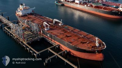
The vessel PROMITHEAS (IMO: 9305611, MMSI: 240547000) is a Oil Products Tanker that was built in 2006 ( 18 years old ). It's sailing under the flag of [GR] Greece.
In this page you can find informations about the vessels current position, last detected port calls, and current voyage information. If the vessels is not in coverage by AIS you will find the latest position.
The current position of PROMITHEAS is detected by our AIS receivers and we are not responsible for the reliability of the data. The last position was recorded while the vessel was in Coverage by the Ais receivers of our vessel tracking app.
The current draught of PROMITHEAS as reported by AIS is 8.6 meters
Weather
| Temperature | 20.6°C / 69.08°F |
|---|---|
| Wind Speed | 10 knots |
| Direction | 246° WSW |
| Pressure | 1017.3 hPa |
| Humidity | 56.7 % |
| Cloud Coverage | 6 % |
Featured Company
Events
| Time | Event | Details | Position / Dest | Info |
|---|---|---|---|---|
| 2024-05-04 13:19 | Change Sea Area | Moroccan part of the Strait of Gibraltar Moroccan part of the North Atlantic Ocean |
35.88908 / -5.93204
Strait of Gibraltar
ESHUV>DZAZW
|
Speed: 11.9 kn Course: 89.5° |
| 2024-05-04 13:03 | Status Changed | Under way using engine Default |
35.88544 / -5.99851
ESHUV>DZAZW
|
Speed: 11.9 kn Course: 88° |
| 2024-05-04 12:54 | Status Changed | Default Under way using engine |
35.88419 / -6.03294
ESHUV>DZAZW
|
Speed: 11.9 kn Course: 90.8° |
| 2024-05-04 11:25 | Status Changed | Under way using engine Default |
35.89146 / -6.38538
ESHUV>DZAZW
|
Speed: 11 kn Course: 96° |
| 2024-05-04 11:21 | Status Changed | Default Under way using engine |
35.89247 / -6.39802
ESHUV>DZAZW
|
Speed: 10.9 kn Course: 97.6° |
| 2024-05-04 11:05 | Change Sea Area | Moroccan part of the North Atlantic Ocean Spanish part of the North Atlantic Ocean |
35.90196 / -6.45786
North Atlantic Ocean
ESHUV>DZAZW
|
Speed: 10.3 kn Course: 104.3° |
| 2024-05-04 06:36 | ETA Changed | 2024/05/05 19:00 2024/05/05 01:00 |
36.62775 / -6.86386
ESHUV>DZAZW
|
Speed: 11.1 kn Course: 174.4° |
| 2024-05-04 06:29 | ETA Changed | 2024/05/05 01:00 2025/04/22 01:00 |
36.64853 / -6.86623
ESHUV>DZAZW
|
Speed: 11.1 kn Course: 175° |
| 2024-05-04 05:04 | START Moving | 15.08 nm, South of HUELVA |
36.89524 / -6.89471
ESHUV>DZAZW
|
Speed: 3.6 kn Course: 112° |
| 2024-05-04 05:03 | Status Changed | Under way using engine Default |
36.89498 / -6.89546
ESHUV>DZAZW
|
Speed: 0.6 kn Course: 37° |