
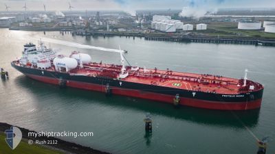
PROTEUS IWONA
Tanker
Current Trip
| Time Travelled | 3 days |
|---|---|
| Remaining Time | --- |
| Distance Travelled | 267.72 nm |
| Remaining Distance | --- |
| AVG Speed | 8.7 Knots |
| MAX Speed | 13.4 Knots |
| AVG Wind | 11.5 knots |
| MAX Wind | 18.9 knots |
| MIN Temp | 18.3°C / 64.94°F |
| MAX Temp | 23.2°C / 73.76°F |
| Draught | 10.4 m |
| Position Received | 6 h, 45 m ago |
Current Position
| Longitude | -8.69822° |
|---|---|
| Latitude | 33.17441° |
| Status | At anchor |
| Speed | |
| Course | 4° |
| Area | North Atlantic Ocean |
| Station | T-AIS |
| Position Received | 6 h, 45 m ago |
Info
Information
The current position of PROTEUS IWONA is in North Atlantic Ocean with coordinates 33.17441° / -8.69822° as reported on 2024-06-25 23:15 by AIS to our vessel tracker app. The vessel's current speed is 0 Knots
The vessel PROTEUS IWONA (IMO: 9914670, MMSI: 563162800) is a Tanker It's sailing under the flag of [SG] Singapore.
In this page you can find informations about the vessels current position, last detected port calls, and current voyage information. If the vessels is not in coverage by AIS you will find the latest position.
The current position of PROTEUS IWONA is detected by our AIS receivers and we are not responsible for the reliability of the data. The last position was recorded while the vessel was in Coverage by the Ais receivers of our vessel tracking app.
The current draught of PROTEUS IWONA as reported by AIS is 10.4 meters
Weather
| Temperature | 19.6°C / 67.28°F |
|---|---|
| Wind Speed | 9 knots |
| Direction | 2° N |
| Pressure | 1012 hPa |
| Humidity | 82.4 % |
| Cloud Coverage | 100 % |
Featured Company
Last Port Calls
| Port | Arrival | Departure | Time In Port |
|---|---|---|---|
| 2024-06-21 19:41 | 2024-06-23 05:15 | 1 d | |
| 2024-06-14 06:17 | 2024-06-14 15:45 | 9 h | |
| 2024-06-10 04:12 | 2024-06-11 05:34 | 1 d | |
| 2024-06-05 03:33 | 2024-06-05 12:25 | 8 h | |
| 2024-05-16 19:48 | 2024-05-21 21:53 | 5 d | |
| 2024-05-11 01:18 | 2024-05-13 02:42 | 2 d |
Most Visited Ports (Last year)
| Port | Arrivals | |
|---|---|---|
| 5 | ||
| 2 | ||
| 2 | ||
| 2 | ||
| 2 | ||
| 2 |
Last Trips
| Origin | Departure | Destination | Arrival | Distance | |
|---|---|---|---|---|---|
| 2024-06-11 08:34 | 2024-06-21 20:41 | 2612.21 nm | |||
| 2024-06-11 08:34 | 2024-06-14 08:17 | 520.78 nm | |||
| 2024-05-21 23:53 | 2024-06-10 07:12 | 4358.37 nm | |||
| 2024-05-21 23:53 | 2024-06-05 05:33 | 3692.76 nm | |||
| 2024-05-13 03:42 | 2024-05-16 21:48 | 433.96 nm | |||
| 2024-03-27 09:31 | 2024-05-11 02:18 | 11203.51 nm |
Events
| Time | Event | Details | Position / Dest | Info |
|---|---|---|---|---|
| 2024-06-25 23:21 | Status Changed | Default At anchor |
33.17451 / -8.69815
MA JFL
|
Speed: Course: 4° |
| 2024-06-25 23:15 | Status Changed | At anchor Default |
33.17441 / -8.69822
MA JFL
|
Speed: 0.3 kn Course: 2° |
| 2024-06-25 23:15 | IN Coverage |
33.17441 / -8.69822
North Atlantic Ocean
|
Speed: Course: 75° |
|
| 2024-06-25 23:15 | OUT of Coverage |
33.17441 / -8.69822
North Atlantic Ocean
|
Speed: Course: 75° |
|
| 2024-06-25 15:39 | Status Changed | Default At anchor |
33.17448 / -8.69809
MA JFL
|
Speed: Course: 358° |
| 2024-06-25 15:36 | OUT of Coverage |
33.17454 / -8.69808
North Atlantic Ocean
|
Speed: Course: 190.9° |
|
| 2024-06-25 15:27 | Status Changed | At anchor Default |
33.17443 / -8.69816
MA JFL
|
Speed: 0.1 kn Course: 341° |
| 2024-06-25 15:27 | IN Coverage |
33.17443 / -8.69816
North Atlantic Ocean
|
Speed: Course: 249.3° |
|
| 2024-06-25 07:48 | Status Changed | Default At anchor |
33.17461 / -8.69799
MA JFL
|
Speed: 0.1 kn Course: 358° |
| 2024-06-25 07:45 | OUT of Coverage |
33.17453 / -8.69803
North Atlantic Ocean
|
Speed: 0.1 kn Course: 354.9° |