
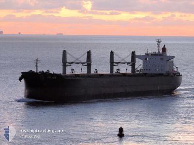
PRT ACE
Cargo
Current Trip
| Time Travelled | 11 days |
|---|---|
| Remaining Time | --- |
| Distance Travelled | 2980.00 nm |
| Remaining Distance | --- |
| AVG Speed | 11.3 Knots |
| MAX Speed | 14.9 Knots |
| AVG Wind | 12.7 knots |
| MAX Wind | 36.4 knots |
| MIN Temp | 7.7°C / 45.86°F |
| MAX Temp | 21.8°C / 71.24°F |
| Draught | 8.5 m |
| Position Received | 5 d ago |
Current Position
| Longitude | -28.31260° |
|---|---|
| Latitude | 49.38613° |
| Status | Under way using engine |
| Speed | 11.3 Knots |
| Course | 254.2° |
| Area | North Atlantic Ocean |
| Station | T-AIS |
| Position Received | 5 d ago |
Info
Information
The current position of PRT ACE is in North Atlantic Ocean with coordinates 49.38613° / -28.31260° as reported on 2024-05-17 10:06 by AIS to our vessel tracker app. The vessel's current speed is 11.3 Knots and is heading at the port of NEW HAVEN. The estimated time of arrival as calculated by vessel tracking app is 2024-05-23 16:00 LT
The vessel PRT ACE (IMO: 9713466, MMSI: 354013000) is a Cargo It's sailing under the flag of [PA] Panama.
In this page you can find informations about the vessels current position, last detected port calls, and current voyage information. If the vessels is not in coverage by AIS you will find the latest position.
The current position of PRT ACE is detected by our AIS receivers and we are not responsible for the reliability of the data. The last position was recorded while the vessel was in Coverage by the Ais receivers of our vessel tracking app.
The current draught of PRT ACE as reported by AIS is 8.5 meters
Weather
| Temperature | 20°C / 68°F |
|---|---|
| Wind Speed | 11 knots |
| Direction | 264° W |
| Pressure | 1017.2 hPa |
| Humidity | 86.6 % |
| Cloud Coverage | 8 % |
Featured Company
Last Port Calls
| Port | Arrival | Departure | Time In Port |
|---|---|---|---|
| 2024-05-06 11:55 | 2024-05-11 18:26 | 5 d | |
| 2024-04-27 05:10 | 2024-05-02 13:32 | 5 d | |
| 2024-03-15 08:37 | 2024-03-19 05:21 | 3 d | |
| 2024-03-03 13:30 | 2024-03-05 14:15 | 2 d |
Most Visited Ports (Last year)
| Port | Arrivals | |
|---|---|---|
| 3 | ||
| 2 | ||
| 2 | ||
| 1 | ||
| 1 | ||
| 1 |
Last Trips
| Origin | Departure | Destination | Arrival | Distance | |
|---|---|---|---|---|---|
| 2024-05-02 14:32 | 2024-05-06 13:55 | 385.54 nm | |||
| 2024-03-19 01:21 | 2024-04-27 06:10 | 4222.82 nm | |||
| 2024-03-05 09:15 | 2024-03-15 04:37 | 1452.18 nm | |||
| 2024-02-13 20:16 | 2024-03-03 08:30 | 1681.77 nm |
Events
| Time | Event | Details | Position / Dest | Info |
|---|---|---|---|---|
| 2024-05-17 10:14 | Status Changed | Default Under way using engine |
49.37968 / -28.34875
USHVN
|
Speed: 11.3 kn Course: 254.2° |
| 2024-05-17 10:06 | OUT of Coverage |
49.38613 / -28.31260
North Atlantic Ocean
USHVN
|
Speed: 11.3 kn Course: 254.2° |
|
| 2024-05-17 09:58 | Status Changed | Under way using engine Default |
49.39199 / -28.27480
USHVN
|
Speed: 11.5 kn Course: 255° |
| 2024-05-17 09:44 | Status Changed | Default Under way using engine |
49.40305 / -28.20533
USHVN
|
Speed: 11.5 kn Course: 255.7° |
| 2024-05-17 09:23 | Detected in Sea | High seas of the North Atlantic Ocean |
49.41962 / -28.10594
North Atlantic Ocean
USHVN
|
Speed: 11.4 kn Course: 255.2° |
| 2024-05-17 09:22 | Status Changed | Under way using engine Default |
49.42018 / -28.10281
USHVN
|
Speed: 11.3 kn Course: 257° |
| 2024-05-17 09:12 | IN Coverage |
49.41962 / -28.10594
North Atlantic Ocean
USHVN
|
Speed: 11.4 kn Course: 255.2° |
|
| 2024-05-13 14:42 | Status Changed | Default Under way using engine |
50.14034 / -7.74066
USHVN
|
Speed: 11.2 kn Course: 300.5° |
| 2024-05-13 14:36 | OUT of Coverage |
50.13190 / -7.71863
Celtic Sea
USHVN
|
Speed: 11.2 kn Course: 300.5° |
|
| 2024-05-13 13:48 | Status Changed | Under way using engine Default |
50.05894 / -7.51981
USHVN
|
Speed: 10.8 kn Course: 302° |