
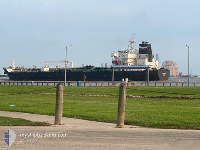
PS ROMA
Oil/Chemical Tanker
Current Trip
LAST UPDATE TIME
| Time Travelled | 12 days |
|---|---|
| Remaining Time | --- |
| Distance Travelled | 2913.09 nm |
| Remaining Distance | --- |
| AVG Speed | 10.9 Knots |
| MAX Speed | 13.3 Knots |
| AVG Wind | 10.9 knots |
| MAX Wind | 23 knots |
| MIN Temp | 17.3°C / 63.14°F |
| MAX Temp | 31.3°C / 88.34°F |
| Draught | 11.6 m |
| Position Received | 5 d ago |
Current Position
| Longitude | -79.59333° |
|---|---|
| Latitude | 8.99817° |
| Status | Under way using engine |
| Speed | |
| Course | 137° |
| Area | Caribbean Sea |
| Station | T-AIS |
| Position Received | 5 d ago |
Info
Information
The current position of PS ROMA is in Caribbean Sea with coordinates 8.99817° / -79.59333° as reported on 2024-05-11 22:30 by AIS to our vessel tracker app. The vessel's current speed is 0 Knots
The vessel PS ROMA (IMO: 9510462, MMSI: 247437400) is a Oil/Chemical Tanker that was built in 2011 ( 13 years old ). It's sailing under the flag of [IT] Italy.
In this page you can find informations about the vessels current position, last detected port calls, and current voyage information. If the vessels is not in coverage by AIS you will find the latest position.
The current position of PS ROMA is detected by our AIS receivers and we are not responsible for the reliability of the data. The last position was recorded while the vessel was in Coverage by the Ais receivers of our vessel tracking app.
The current draught of PS ROMA as reported by AIS is 11.6 meters
Weather
| Temperature | 17.5°C / 63.5°F |
|---|---|
| Wind Speed | 10 knots |
| Direction | 154° SSE |
| Pressure | 1015.3 hPa |
| Humidity | 94.3 % |
| Cloud Coverage | 93 % |
Featured Company
Last Port Calls
| Port | Arrival | Departure | Time In Port |
|---|---|---|---|
| 2024-05-02 19:34 | 2024-05-04 23:01 | 2 d | |
| 2024-04-06 19:33 | 2024-04-08 09:29 | 1 d | |
| 2024-03-26 03:44 | 2024-03-28 01:09 | 1 d | |
| 2024-03-08 00:47 | 2024-03-08 21:07 | 20 h |
Most Visited Ports (Last year)
| Port | Arrivals | |
|---|---|---|
| 4 | ||
| 3 | ||
| 3 | ||
| 1 | ||
| 1 | ||
| 1 |
Last Trips
Events
| Time | Event | Details | Position / Dest | Info |
|---|---|---|---|---|
| 2024-05-16 19:33 | STOP Moving | 3.68 nm, North West of CALLAO |
-12.00867 / -77.19566
LAST UPDATE TIME
|
Speed: 0.2 kn Course: 153° |
| 2024-05-11 23:15 | START Moving | 2.04 nm, North of RODMAN |
8.98817 / -79.58400
LAST UPDATE TIME
|
Speed: 5.9 kn Course: 142° |
| 2024-05-11 22:38 | Status Changed | Default Under way using engine |
8.99800 / -79.59317
LAST UPDATE TIME
|
Speed: Course: 137° |
| 2024-05-11 22:30 | OUT of Coverage |
8.99817 / -79.59333
Caribbean Sea
LAST UPDATE TIME
|
Speed: Course: 304.9° |
|
| 2024-05-11 22:27 | Status Changed | Under way using engine Default |
8.99817 / -79.59333
LAST UPDATE TIME
|
Speed: Course: 137° |
| 2024-05-11 22:26 | Status Changed | Default Under way using engine |
8.99817 / -79.59333
LAST UPDATE TIME
|
Speed: Course: 137° |
| 2024-05-11 22:17 | ETA Changed | 2024/05/11 22:15 2024/05/11 22:12 |
8.99817 / -79.59333
LAST UPDATE TIME
|
Speed: 0.7 kn Course: 137° |
| 2024-05-11 22:13 | ETA Changed | 2024/05/11 22:12 2024/05/11 22:05 |
8.99900 / -79.59420
LAST UPDATE TIME
|
Speed: 0.9 kn Course: 137° |
| 2024-05-11 22:11 | ETA Changed | 2024/05/11 22:05 2024/05/11 22:02 |
9.00017 / -79.59530
LAST UPDATE TIME
|
Speed: 0.8 kn Course: 137° |
| 2024-05-11 22:05 | ETA Changed | 2024/05/11 22:02 2024/05/11 21:56 |
9.00083 / -79.59600
LAST UPDATE TIME
|
Speed: 0.9 kn Course: 137° |