
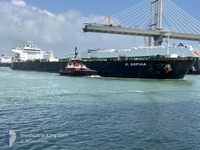
P.SOPHIA
Crude Oil Tanker
Current Trip
| Time Travelled | 12 days |
|---|---|
| Remaining Time | --- |
| Distance Travelled | 3649.39 nm |
| Remaining Distance | --- |
| AVG Speed | 12.2 Knots |
| MAX Speed | 14.4 Knots |
| AVG Wind | 11.6 knots |
| MAX Wind | 23 knots |
| MIN Temp | 12.1°C / 53.78°F |
| MAX Temp | 28.5°C / 83.3°F |
| Draught | 13.7 m |
| Position Received | 8 d ago |
Current Position
| Longitude | -78.71755° |
|---|---|
| Latitude | 27.61675° |
| Status | Under way using engine |
| Speed | 12.3 Knots |
| Course | 72° |
| Area | North Atlantic Ocean |
| Station | T-AIS |
| Position Received | 8 d ago |
Info
Information
The current position of P.SOPHIA is in North Atlantic Ocean with coordinates 27.61675° / -78.71755° as reported on 2024-05-24 22:42 by AIS to our vessel tracker app. The vessel's current speed is 12.3 Knots and is heading at the port of FREDERICIA. The estimated time of arrival as calculated by vessel tracking app is 2024-06-07 23:00 LT
The vessel P.SOPHIA (IMO: 9414034, MMSI: 538010103) is a Crude Oil Tanker that was built in 2009 ( 15 years old ). It's sailing under the flag of [MH] Marshall Is.
In this page you can find informations about the vessels current position, last detected port calls, and current voyage information. If the vessels is not in coverage by AIS you will find the latest position.
The current position of P.SOPHIA is detected by our AIS receivers and we are not responsible for the reliability of the data. The last position was recorded while the vessel was in Coverage by the Ais receivers of our vessel tracking app.
The current draught of P.SOPHIA as reported by AIS is 13.7 meters
Weather
| Temperature | 13°C / 55.4°F |
|---|---|
| Wind Speed | 10 knots |
| Direction | 168° SSE |
| Pressure | 1027.9 hPa |
| Humidity | 95.3 % |
| Cloud Coverage | 10 % |
Featured Company
Last Port Calls
| Port | Arrival | Departure | Time In Port |
|---|---|---|---|
| 2024-05-18 17:58 | 2024-05-20 16:06 | 1 d |
Most Visited Ports (Last year)
| Port | Arrivals | |
|---|---|---|
| 3 | ||
| 2 | ||
| 1 | ||
| 1 | ||
| 1 | ||
| 1 |
Last Trips
| Origin | Departure | Destination | Arrival | Distance |
|---|
Events
| Time | Event | Details | Position / Dest | Info |
|---|---|---|---|---|
| 2024-05-24 22:58 | Status Changed | Default Under way using engine |
27.63488 / -78.66002
USCRP>DKFRC
|
Speed: 12.3 kn Course: 72° |
| 2024-05-24 22:42 | Status Changed | Under way using engine Default |
27.61675 / -78.71755
USCRP>DKFRC
|
Speed: 12.3 kn Course: 72° |
| 2024-05-24 22:42 | OUT of Coverage |
27.61675 / -78.71755
North Atlantic Ocean
USCRP>DKFRC
|
Speed: 12.3 kn Course: 72° |
|
| 2024-05-24 22:38 | Status Changed | Default Under way using engine |
27.61258 / -78.73231
USCRP>DKFRC
|
Speed: 12.3 kn Course: 72° |
| 2024-05-24 20:51 | Status Changed | Under way using engine Default |
27.49013 / -79.12386
USCRP>DKFRC
|
Speed: 12.7 kn Course: 69° |
| 2024-05-24 20:39 | IN Coverage |
27.49258 / -79.11656
North Atlantic Ocean
USCRP>DKFRC
|
Speed: 12.4 kn Course: 69° |
|
| 2024-05-24 14:44 | Status Changed | Default Under way using engine |
26.25565 / -79.38890
USCRP>DKFRC
|
Speed: 12.6 kn Course: 4° |
| 2024-05-24 14:40 | OUT of Coverage |
26.24017 / -79.39058
North Atlantic Ocean
USCRP>DKFRC
|
Speed: 12.6 kn Course: 4° |
|
| 2024-05-24 14:39 | Status Changed | Under way using engine Default |
26.23660 / -79.39087
USCRP>DKFRC
|
Speed: 12.5 kn Course: 5° |
| 2024-05-24 14:14 | Status Changed | Default Under way using engine |
26.14892 / -79.39896
USCRP>DKFRC
|
Speed: 12.5 kn Course: 4° |