
PURPOSE
Yacht
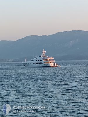
Current Trip
LIPARI
| Time Travelled | 2 days |
|---|---|
| Remaining Time | --- |
| Distance Travelled | 82.52 nm |
| Remaining Distance | --- |
| AVG Speed | 7.3 Knots |
| MAX Speed | 11.3 Knots |
| AVG Wind | 7.1 knots |
| MAX Wind | 11 knots |
| MIN Temp | 20.4°C / 68.72°F |
| MAX Temp | 25.1°C / 77.18°F |
| Draught | 3.5 m |
| Position Received | 3 m ago |
Current Position
| Longitude | 13.33305° |
|---|---|
| Latitude | 38.20477° |
| Status | At anchor |
| Speed | |
| Course | 17° |
| Area | Tyrrhenian Sea |
| Station | T-AIS |
| Position Received | 3 m ago |
Info
Information
The current position of PURPOSE is in Tyrrhenian Sea with coordinates 38.20477° / 13.33305° as reported on 2024-06-16 10:03 by AIS to our vessel tracker app. The vessel's current speed is 0 Knots
The vessel PURPOSE (IMO: 9332444, MMSI: 319660000) is a Yacht that was built in 2005 ( 19 years old ). It's sailing under the flag of [KY] Cayman Is.
In this page you can find informations about the vessels current position, last detected port calls, and current voyage information. If the vessels is not in coverage by AIS you will find the latest position.
The current position of PURPOSE is detected by our AIS receivers and we are not responsible for the reliability of the data. The last position was recorded while the vessel was in Coverage by the Ais receivers of our vessel tracking app.
The current draught of PURPOSE as reported by AIS is 3.5 meters
Weather
| Temperature | 24.8°C / 76.64°F |
|---|---|
| Wind Speed | 7 knots |
| Direction | 319° NW |
| Pressure | 1013.9 hPa |
| Humidity | 62.4 % |
| Cloud Coverage | 100 % |
Featured Company
Last Port Calls
| Port | Arrival | Departure | Time In Port |
|---|---|---|---|
| 2024-06-13 10:04 | 2024-06-13 20:09 | 10 h | |
| 2024-06-06 09:50 | 2024-06-08 09:05 | 1 d | |
| 2024-05-29 13:29 | 2024-05-31 19:23 | 2 d | |
| 2024-05-27 12:55 | |||
| 2024-05-17 13:47 | 2024-05-23 08:11 | 5 d | |
| 2024-04-19 19:06 | 2024-05-07 15:28 | 17 d | |
| 2024-04-15 14:14 | 2024-04-15 17:30 | 3 h | |
| 2024-04-13 16:46 |
Most Visited Ports (Last year)
| Port | Arrivals | |
|---|---|---|
| 10 | ||
| 3 | ||
| 3 | ||
| 2 | ||
| 2 | ||
| 2 |
Last Trips
| Origin | Departure | Destination | Arrival | Distance | |
|---|---|---|---|---|---|
| 2024-06-08 11:05 | 2024-06-13 12:04 | 235.09 nm | |||
| 2024-05-31 21:23 | 2024-06-06 11:50 | 536.71 nm | |||
| 2024-05-27 14:55 | 2024-05-29 15:29 | 141.09 nm | |||
| 2024-05-07 17:28 | 2024-05-17 15:47 | 407.48 nm | |||
| 2024-04-15 19:30 | 2024-04-19 21:06 | 787.19 nm | |||
| 2024-04-13 19:46 | 2024-04-15 16:14 | 366.18 nm |
Events
| Time | Event | Details | Position / Dest | Info |
|---|---|---|---|---|
| 2024-06-15 19:32 | Destination Changed | LIPARI PALERMO |
38.20538 / 13.33259
LIPARI
|
Speed: 0.1 kn Course: 103° |
| 2024-06-14 04:23 | Status Changed | At anchor Towing Astern |
38.20453 / 13.33325
PALERMO
|
Speed: Course: 339° |
| 2024-06-14 04:13 | STOP Moving | 5.28 nm, North West of PALERMO |
38.20484 / 13.33302
PALERMO
|
Speed: 0.1 kn Course: 10° |
| 2024-06-14 01:33 | IN Coverage |
38.26778 / 13.82433
Tyrrhenian Sea
PALERMO
|
Speed: 10.7 kn Course: 262.7° |
|
| 2024-06-13 21:57 | OUT of Coverage |
38.37863 / 14.63870
Tyrrhenian Sea
PALERMO
|
Speed: 10.9 kn Course: 258.7° |
|
| 2024-06-13 20:09 | START Moving | 0.38 nm, South East of LIPARI |
38.46571 / 14.96638
PALERMO
|
Speed: 6 kn Course: 136° |
| 2024-06-13 20:09 | PORT DEPARTURE |
|
38.46571 / 14.96638
PALERMO
|
Speed: 0.2 kn Course: 336° |
| 2024-06-13 19:55 | Status Changed | Towing Astern At anchor |
38.46465 / 14.96164
[IT] LIPARI
|
Speed: Course: 328° |
| 2024-06-13 19:50 | Destination Changed | PALERMO VOLCANO |
38.46415 / 14.96145
[IT] LIPARI
|
Speed: Course: 328° |
| 2024-06-13 19:50 | ETA Changed | 2024/06/14 09:00 2024/12/05 09:00 |
38.46415 / 14.96145
[IT] LIPARI
|
Speed: Course: 328° |