
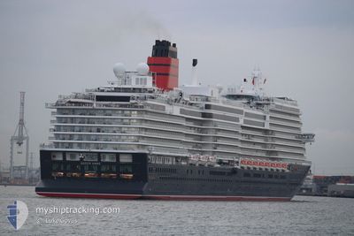
QUEEN ANNE
Passenger
Current Trip
| Time Travelled | 4 days |
|---|---|
| Remaining Time | --- |
| Distance Travelled | 966.49 nm |
| Remaining Distance | --- |
| AVG Speed | 15 Knots |
| MAX Speed | 20.4 Knots |
| AVG Wind | 9.1 knots |
| MAX Wind | 14 knots |
| MIN Temp | 12.7°C / 54.86°F |
| MAX Temp | 17.3°C / 63.14°F |
| Draught | 8 m |
| Position Received | 2 d ago |
Current Position
| Longitude | -13.46693° |
|---|---|
| Latitude | 38.16045° |
| Status | Under way using engine |
| Speed | 15.6 Knots |
| Course | 203.6° |
| Area | North Atlantic Ocean |
| Station | T-AIS |
| Position Received | 2 d ago |
Info
Information
The current position of QUEEN ANNE is in North Atlantic Ocean with coordinates 38.16045° / -13.46693° as reported on 2024-05-13 06:27 by AIS to our vessel tracker app. The vessel's current speed is 15.6 Knots
The vessel QUEEN ANNE (IMO: 9839399, MMSI: 310835000) is a Passenger It's sailing under the flag of [BM] Bermuda.
In this page you can find informations about the vessels current position, last detected port calls, and current voyage information. If the vessels is not in coverage by AIS you will find the latest position.
The current position of QUEEN ANNE is detected by our AIS receivers and we are not responsible for the reliability of the data. The last position was recorded while the vessel was in Coverage by the Ais receivers of our vessel tracking app.
The current draught of QUEEN ANNE as reported by AIS is 8 meters
Weather
| Temperature | 17.2°C / 62.96°F |
|---|---|
| Wind Speed | 14 knots |
| Direction | 297° WNW |
| Pressure | 1018.4 hPa |
| Humidity | 92.4 % |
| Cloud Coverage | 98 % |
Featured Company
Last Port Calls
| Port | Arrival | Departure | Time In Port |
|---|---|---|---|
| 2024-05-10 03:40 | 2024-05-10 17:36 | 13 h | |
| 2024-05-07 05:59 | 2024-05-07 17:54 | 11 h | |
| 2024-05-05 04:38 | 2024-05-05 16:31 | 11 h | |
| 2024-04-30 17:52 | 2024-05-03 20:54 | 3 d | |
| 2024-04-24 08:32 |
Most Visited Ports (Last year)
| Port | Arrivals | |
|---|---|---|
| 2 | ||
| 1 | ||
| 1 |
Last Trips
| Origin | Departure | Destination | Arrival | Distance | |
|---|---|---|---|---|---|
| 2024-05-07 18:54 | 2024-05-10 04:40 | 923.31 nm | |||
| 2024-05-05 18:31 | 2024-05-07 06:59 | 399.57 nm | |||
| 2024-05-03 21:54 | 2024-05-05 06:38 | 581.65 nm | |||
| 2024-04-24 10:32 | 2024-04-30 18:52 | 2949.24 nm |
Events
| Time | Event | Details | Position / Dest | Info |
|---|---|---|---|---|
| 2024-05-13 06:27 | OUT of Coverage |
38.16045 / -13.46693
North Atlantic Ocean
GB SOU>PT FNC
|
Speed: 15.6 kn Course: 203.6° |
|
| 2024-05-13 04:46 | IN Coverage |
38.56599 / -13.25120
North Atlantic Ocean
GB SOU>PT FNC
|
Speed: 15.9 kn Course: 205.6° |
|
| 2024-05-13 03:41 | OUT of Coverage |
38.82687 / -13.10965
North Atlantic Ocean
GB SOU>PT FNC
|
Speed: 15.5 kn Course: 204.6° |
|
| 2024-05-13 01:23 | IN Coverage |
39.37520 / -12.81080
North Atlantic Ocean
GB SOU>PT FNC
|
Speed: 15.8 kn Course: 202.5° |
|
| 2024-05-12 23:11 | OUT of Coverage |
39.90513 / -12.52286
North Atlantic Ocean
GB SOU>PT FNC
|
Speed: 15.4 kn Course: 201.5° |
|
| 2024-05-12 21:34 | IN Coverage |
40.28593 / -12.31244
North Atlantic Ocean
GB SOU>PT FNC
|
Speed: 15.3 kn Course: 200.8° |
|
| 2024-05-12 20:02 | OUT of Coverage |
40.62339 / -12.12723
North Atlantic Ocean
GB SOU>PT FNC
|
Speed: 15.3 kn Course: 200.4° |
|
| 2024-05-12 15:49 | Change Sea Area | Portuguese part of the North Atlantic Ocean Spanish part of the North Atlantic Ocean |
41.61652 / -11.57349
North Atlantic Ocean
GB SOU>PT FNC
|
Speed: 15.5 kn Course: 203.9° |
| 2024-05-12 12:08 | IN Coverage |
42.47638 / -11.08633
North Atlantic Ocean
GB SOU>PT FNC
|
Speed: 15 kn Course: 203.1° |
|
| 2024-05-12 10:18 | OUT of Coverage |
42.92350 / -10.83064
North Atlantic Ocean
GB SOU>PT FNC
|
Speed: 15.3 kn Course: 201.3° |