
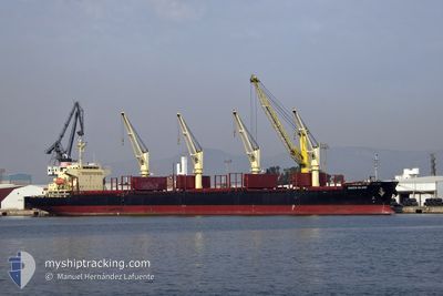
QUEEN ISLAND
Cargo
Current Trip
| Trip Time | 4 days |
|---|---|
| Trip Distance | 1299.00 nm |
| AVG Speed | 11.4 Knots |
| MAX Speed | 14.8 Knots |
| Draught | 7 m |
| AVG Wind | 14.4 knots |
| MAX Wind | 28 knots |
| MIN Temp | 12.7°C / 54.86°F |
| MAX Temp | 23.6°C / 74.48°F |
| Position Received | 1 m ago |
Current Position
| Longitude | 0.55075° |
|---|---|
| Latitude | 40.57186° |
| Status | Moored |
| Speed | |
| Course | 66° |
| Area | Balearic Sea |
| Station | T-AIS |
| Position Received | 1 m ago |
Info
Information
The current position of QUEEN ISLAND is in Balearic Sea with coordinates 40.57186° / 0.55075° as reported on 2024-06-26 16:54 by AIS to our vessel tracker app. The vessel's current speed is 0 Knots and is currently inside the port of ALCANAR.
The vessel QUEEN ISLAND (IMO: 9741188, MMSI: 354141000) is a Cargo It's sailing under the flag of [PA] Panama.
In this page you can find informations about the vessels current position, last detected port calls, and current voyage information. If the vessels is not in coverage by AIS you will find the latest position.
The current position of QUEEN ISLAND is detected by our AIS receivers and we are not responsible for the reliability of the data. The last position was recorded while the vessel was in Coverage by the Ais receivers of our vessel tracking app.
The current draught of QUEEN ISLAND as reported by AIS is 7 meters
Weather
| Temperature | 24.4°C / 75.92°F |
|---|---|
| Wind Speed | 10 knots |
| Direction | 157° SSE |
| Pressure | 1010.7 hPa |
| Humidity | 64.7 % |
| Cloud Coverage | 100 % |
Featured Company
Last Trips
| Origin | Departure | Destination | Arrival | Distance | |
|---|---|---|---|---|---|
| 2024-06-21 21:32 | 2024-06-26 10:27 | 1299.00 nm | |||
| 2024-04-25 19:27 | 2024-06-20 01:01 | 12746.76 nm | |||
| 2024-04-23 06:48 | 2024-04-23 07:44 | 2.56 nm | |||
| 2024-04-10 15:10 | 2024-04-20 15:12 | 850.61 nm | |||
| 2024-03-12 06:44 | 2024-04-05 07:49 | 6109.91 nm |
Events
| Time | Event | Details | Position / Dest | Info |
|---|---|---|---|---|
| 2024-06-26 09:03 | Status Changed | Moored Under way using engine |
40.57186 / .55081
[ES] ALCANAR
|
Speed: Course: 65° |
| 2024-06-26 08:47 | STOP Moving |
40.57188 / .55110
[ES] ALCANAR
|
Speed: 0.3 kn Course: 63° |
|
| 2024-06-26 08:27 | PORT ARRIVAL |
|
40.57358 / .55625
[ES] ALCANAR
|
Speed: 1.1 kn Course: 66° |
| 2024-06-26 05:15 | Status Changed | Under way using engine Default |
40.20527 / .76926
ES ACA
|
Speed: 12 kn Course: 343° |
| 2024-06-26 05:08 | IN Coverage |
40.21081 / .76773
Balearic Sea
ES ACA
|
Speed: 12.3 kn Course: 349.8° |
|
| 2024-06-26 04:07 | Status Changed | Default Under way using engine |
39.98176 / .86056
ES ACA
|
Speed: 12.3 kn Course: 342.3° |
| 2024-06-26 04:02 | OUT of Coverage |
39.96663 / .86686
Balearic Sea
ES ACA
|
Speed: 12.3 kn Course: 342.3° |
|
| 2024-06-26 03:27 | Status Changed | Under way using engine Default |
39.86238 / .86686
ES ACA
|
Speed: 11.6 kn Course: 46° |
| 2024-06-26 03:15 | Status Changed | Default Under way using engine |
39.83435 / .82962
ES ACA
|
Speed: 11.5 kn Course: 44.4° |
| 2024-06-26 02:46 | Status Changed | Under way using engine Default |
39.75601 / .77599
ES ACA
|
Speed: 11.7 kn Course: 13° |