
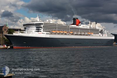
QUEEN MARY 2
Passengers Ship
Current Trip
| Time Travelled | 5 days |
|---|---|
| Remaining Time | 22 h, 24 mins |
| Distance Travelled | 2641.39 nm |
| Remaining Distance | 503.51 nm |
| AVG Speed | 20.9 Knots |
| MAX Speed | 24 Knots |
| AVG Wind | 14.4 knots |
| MAX Wind | 23 knots |
| MIN Temp | 6°C / 42.8°F |
| MAX Temp | 21.7°C / 71.06°F |
| Draught | 10.3 m |
| Position Received | 4 d ago |
Current Position
| Longitude | -64.32687° |
|---|---|
| Latitude | 41.95213° |
| Status | Under way using engine |
| Speed | 20.8 Knots |
| Course | 69° |
| Area | North Atlantic Ocean |
| Station | T-AIS |
| Position Received | 4 d ago |
Info
Information
The current position of QUEEN MARY 2 is in North Atlantic Ocean with coordinates 41.95213° / -64.32687° as reported on 2024-05-24 21:04 by AIS to our vessel tracker app. The vessel's current speed is 20.8 Knots and is heading at the port of SOUTHAMPTON. The estimated time of arrival as calculated by vessel tracking app is 2024-05-30 01:54 LT
The vessel QUEEN MARY 2 (IMO: 9241061, MMSI: 310627000) is a Passengers Ship that was built in 2003 ( 21 years old ). It's sailing under the flag of [BM] Bermuda.
In this page you can find informations about the vessels current position, last detected port calls, and current voyage information. If the vessels is not in coverage by AIS you will find the latest position.
The current position of QUEEN MARY 2 is detected by our AIS receivers and we are not responsible for the reliability of the data. The last position was recorded while the vessel was in Coverage by the Ais receivers of our vessel tracking app.
The current draught of QUEEN MARY 2 as reported by AIS is 10.3 meters
Weather
| Temperature | 12.8°C / 55.04°F |
|---|---|
| Wind Speed | 11 knots |
| Direction | 295° WNW |
| Pressure | 1013.6 hPa |
| Humidity | 87.6 % |
| Cloud Coverage | 57 % |
Featured Company
Last Port Calls
| Port | Arrival | Departure | Time In Port |
|---|---|---|---|
| 2024-05-23 07:57 | 2024-05-23 22:42 | 14 h | |
| 2024-05-16 04:09 | 2024-05-16 22:00 | 17 h | |
| 2024-05-14 03:50 | 2024-05-14 19:37 | 15 h | |
| 2024-05-12 04:55 | 2024-05-12 17:09 | 12 h | |
| 2024-05-05 09:17 | 2024-05-05 23:04 | 13 h | |
| 2024-04-28 02:14 | 2024-04-28 17:02 | 14 h | |
| 2024-04-25 17:39 | 2024-04-25 19:16 | 1 h | |
| 2024-04-25 06:33 | 2024-04-25 17:22 | 10 h | |
| 2024-04-23 05:03 | 2024-04-23 18:27 | 13 h | |
| 2024-04-15 09:05 | 2024-04-15 18:50 | 9 h |
Last Trips
| Origin | Departure | Destination | Arrival | Distance | |
|---|---|---|---|---|---|
| 2024-05-16 23:00 | 2024-05-23 03:57 | 3140.62 nm | |||
| 2024-05-14 21:37 | 2024-05-16 05:09 | 519.11 nm | |||
| 2024-05-12 18:09 | 2024-05-14 05:50 | 533.58 nm | |||
| 2024-05-05 19:04 | 2024-05-12 05:55 | 3125.02 nm | |||
| 2024-04-28 18:02 | 2024-05-05 05:17 | 3132.64 nm | |||
| 2024-04-25 20:16 | 2024-04-28 03:14 | 916.58 nm | |||
| 2024-04-25 18:22 | 2024-04-25 18:39 | 0.51 nm | |||
| 2024-04-23 19:27 | 2024-04-25 07:33 | 713.98 nm | |||
| 2024-04-15 20:50 | 2024-04-23 06:03 | 3835.81 nm | |||
| 2024-04-14 02:57 | 2024-04-15 11:05 | 723.06 nm |
Events
| Time | Event | Details | Position / Dest | Info |
|---|---|---|---|---|
| 2024-05-24 21:06 | Status Changed | Default Under way using engine |
41.95667 / -64.31167
USNYC>GBSOU
|
Speed: 20.8 kn Course: 69° |
| 2024-05-24 21:04 | OUT of Coverage |
41.95213 / -64.32687
North Atlantic Ocean
USNYC>GBSOU
|
Speed: 20.8 kn Course: 69° |
|
| 2024-05-24 20:46 | Change Sea Area | Canadian part of the North Atlantic Ocean United States part of the North Atlantic Ocean |
41.91581 / -64.45643
North Atlantic Ocean
USNYC>GBSOU
|
Speed: 20.7 kn Course: 68.6° |
| 2024-05-24 20:46 | Status Changed | Under way using engine Default |
41.91581 / -64.45643
USNYC>GBSOU
|
Speed: 21 kn Course: 70° |
| 2024-05-24 20:27 | IN Coverage |
41.91581 / -64.45643
North Atlantic Ocean
USNYC>GBSOU
|
Speed: 20.7 kn Course: 68.6° |
|
| 2024-05-24 01:18 | Status Changed | Default Under way using engine |
40.39167 / -73.13834
USNYC>GBSOU
|
Speed: 19 kn Course: 93° |
| 2024-05-24 01:14 | Status Changed | Under way using engine Default |
40.39342 / -73.16658
USNYC>GBSOU
|
Speed: 19 kn Course: 93° |
| 2024-05-24 01:14 | OUT of Coverage |
40.39342 / -73.16658
North Atlantic Ocean
USNYC>GBSOU
|
Speed: 19 kn Course: 93° |
|
| 2024-05-24 00:45 | Status Changed | Default Under way using engine |
40.40167 / -73.36500
USNYC>GBSOU
|
Speed: 18.8 kn Course: 92.9° |
| 2024-05-23 22:42 | PORT DEPARTURE |
|
40.57614 / -74.03457
USNYC>GBSOU
|
Speed: 15 kn Course: 167° |