
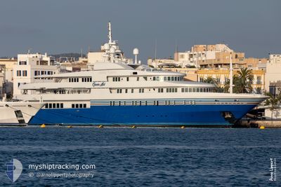
QUEEN MIRI
Yacht
Current Trip
VENICE
| Time Travelled | 5 h, 23 mins |
|---|---|
| Remaining Time | --- |
| Distance Travelled | 0.20 nm |
| Remaining Distance | --- |
| AVG Speed | --- |
| MAX Speed | --- |
| AVG Wind | 5.5 knots |
| MAX Wind | 5.7 knots |
| MIN Temp | 20.7°C / 69.26°F |
| MAX Temp | 20.8°C / 69.44°F |
| Draught | 4.5 m |
| Position Received | 9 m ago |
Current Position
| Longitude | 12.32261° |
|---|---|
| Latitude | 45.43004° |
| Status | Moored |
| Speed | |
| Course | 284° |
| Area | Adriatic Sea |
| Station | T-AIS |
| Position Received | 9 m ago |
Info
Information
The current position of QUEEN MIRI is in Adriatic Sea with coordinates 45.43004° / 12.32261° as reported on 2024-05-25 19:23 by AIS to our vessel tracker app. The vessel's current speed is 0 Knots
The vessel QUEEN MIRI (IMO: 9288203, MMSI: 538071066) is a Yacht that was built in 2004 ( 20 years old ). It's sailing under the flag of [MH] Marshall Is.
In this page you can find informations about the vessels current position, last detected port calls, and current voyage information. If the vessels is not in coverage by AIS you will find the latest position.
The current position of QUEEN MIRI is detected by our AIS receivers and we are not responsible for the reliability of the data. The last position was recorded while the vessel was in Coverage by the Ais receivers of our vessel tracking app.
The current draught of QUEEN MIRI as reported by AIS is 4.5 meters
Weather
| Temperature | 18.4°C / 65.12°F |
|---|---|
| Wind Speed | 5 knots |
| Direction | 253° WSW |
| Pressure | 1015.5 hPa |
| Humidity | 72.5 % |
| Cloud Coverage | 21 % |
Featured Company
Events
| Time | Event | Details | Position / Dest | Info |
|---|---|---|---|---|
| 2024-05-25 19:23 | IN Coverage |
45.43004 / 12.32261
Adriatic Sea
|
Speed: Course: 167° |
|
| 2024-05-25 17:50 | OUT of Coverage |
45.43004 / 12.32260
Adriatic Sea
|
Speed: Course: 177.7° |
|
| 2024-05-25 14:21 | Status Changed | Moored Under way using engine |
45.42996 / 12.32244
VENICE
|
Speed: Course: 283° |
| 2024-05-25 14:09 | Status Changed | Under way using engine Moored |
45.43038 / 12.31780
VENICE
|
Speed: Course: 262° |
| 2024-05-25 14:09 | PORT DEPARTURE |
|
45.43038 / 12.31780
VENICE
|
Speed: Course: 262° |
| 2024-05-25 13:25 | IN Coverage |
45.43110 / 12.31271
Adriatic Sea
[IT] VENEZIA
|
Speed: Course: 182.9° |
|
| 2024-05-25 11:19 | OUT of Coverage |
45.43109 / 12.31271
Adriatic Sea
[IT] VENEZIA
|
Speed: Course: 173.6° |
|
| 2024-05-25 11:19 | IN Coverage |
45.43109 / 12.31271
Adriatic Sea
[IT] VENEZIA
|
Speed: Course: 173.6° |
|
| 2024-05-25 08:43 | OUT of Coverage |
45.43108 / 12.31269
Adriatic Sea
[IT] VENEZIA
|
Speed: Course: 182.3° |
|
| 2024-05-25 07:43 | IN Coverage |
45.43108 / 12.31269
Adriatic Sea
[IT] VENEZIA
|
Speed: Course: 177.4° |