
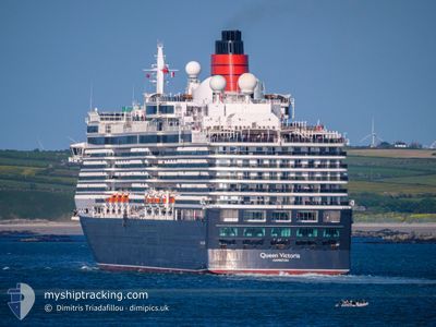
QUEEN VICTORIA
Passengers Ship
Current Trip
| Time Travelled | 2 days |
|---|---|
| Remaining Time | 8 h, 18 mins |
| Distance Travelled | 591.76 nm |
| Remaining Distance | 119.83 nm |
| AVG Speed | 14.3 Knots |
| MAX Speed | 16.3 Knots |
| AVG Wind | 9.4 knots |
| MAX Wind | 19.8 knots |
| MIN Temp | 17°C / 62.6°F |
| MAX Temp | 24.5°C / 76.1°F |
| Draught | 8 m |
| Position Received | 1 m ago |
Current Position
| Longitude | 16.07509° |
|---|---|
| Latitude | 37.42824° |
| Status | Under way using engine |
| Speed | 14.4 Knots |
| Course | 218.5° |
| Area | Ionian Sea |
| Station | T-AIS |
| Position Received | 1 m ago |
Info
Information
The current position of QUEEN VICTORIA is in Ionian Sea with coordinates 37.42824° / 16.07509° as reported on 2024-06-06 20:13 by AIS to our vessel tracker app. The vessel's current speed is 14.4 Knots and is heading at the port of VALLETTA. The estimated time of arrival as calculated by vessel tracking app is 2024-06-07 04:32 LT
The vessel QUEEN VICTORIA (IMO: 9320556, MMSI: 310624000) is a Passengers Ship that was built in 2007 ( 17 years old ). It's sailing under the flag of [BM] Bermuda.
In this page you can find informations about the vessels current position, last detected port calls, and current voyage information. If the vessels is not in coverage by AIS you will find the latest position.
The current position of QUEEN VICTORIA is detected by our AIS receivers and we are not responsible for the reliability of the data. The last position was recorded while the vessel was in Coverage by the Ais receivers of our vessel tracking app.
The current draught of QUEEN VICTORIA as reported by AIS is 8 meters
Weather
| Temperature | 21.8°C / 71.24°F |
|---|---|
| Wind Speed | 17 knots |
| Direction | 328° NNW |
| Pressure | 1016.7 hPa |
| Humidity | 78.6 % |
| Cloud Coverage | --- |
Featured Company
Last Port Calls
| Port | Arrival | Departure | Time In Port |
|---|---|---|---|
| 2024-06-04 05:26 | 2024-06-04 15:49 | 10 h | |
| 2024-06-03 02:33 | 2024-06-03 17:56 | 15 h | |
| 2024-06-01 04:47 | 2024-06-01 15:54 | 11 h | |
| 2024-05-31 04:57 | 2024-05-31 16:03 | 11 h | |
| 2024-05-30 04:03 | 2024-05-30 14:56 | 10 h | |
| 2024-05-29 04:00 | 2024-05-29 14:58 | 10 h | |
| 2024-05-27 02:29 | 2024-05-27 17:31 | 15 h | |
| 2024-05-25 04:15 | 2024-05-25 15:07 | 10 h | |
| 2024-05-23 03:39 | 2024-05-24 04:48 | 1 d | |
| 2024-05-22 03:55 | 2024-05-22 15:01 | 11 h |
Last Trips
| Origin | Departure | Destination | Arrival | Distance | |
|---|---|---|---|---|---|
| 2024-06-03 19:56 | 2024-06-04 07:26 | 165.66 nm | |||
| 2024-06-01 17:54 | 2024-06-03 04:33 | 352.68 nm | |||
| 2024-05-31 18:03 | 2024-06-01 06:47 | 146.49 nm | |||
| 2024-05-30 17:56 | 2024-05-31 06:57 | 194.52 nm | |||
| 2024-05-29 17:58 | 2024-05-30 07:03 | 122.44 nm | |||
| 2024-05-27 19:31 | 2024-05-29 07:00 | 572.33 nm | |||
| 2024-05-25 18:07 | 2024-05-27 04:29 | 602.99 nm | |||
| 2024-05-24 07:48 | 2024-05-25 07:15 | 262.32 nm | |||
| 2024-05-22 18:01 | 2024-05-23 06:39 | 142.04 nm | |||
| 2024-05-20 20:14 | 2024-05-22 06:55 | 396.58 nm |
Events
| Time | Event | Details | Position / Dest | Info |
|---|---|---|---|---|
| 2024-06-06 17:43 | IN Coverage |
37.88748 / 16.55053
Ionian Sea
MTMLA
|
Speed: 14.5 kn Course: 219.5° |
|
| 2024-06-06 16:33 | OUT of Coverage |
38.10480 / 16.77486
Ionian Sea
MTMLA
|
Speed: 13.9 kn Course: 219.9° |
|
| 2024-06-06 14:31 | IN Coverage |
38.46950 / 17.15378
Ionian Sea
MTMLA
|
Speed: 14.2 kn Course: 219.2° |
|
| 2024-06-06 09:43 | Status Changed | Default Under way using engine |
39.38377 / 18.06458
MTMLA
|
Speed: 14.2 kn Course: 217.7° |
| 2024-06-06 09:27 | Change Sea Area | Italian part of the Ionian Sea Italian part of the Adriatic Sea |
39.43384 / 18.11532
Ionian Sea
MTMLA
|
Speed: 14.2 kn Course: 217.7° |
| 2024-06-06 09:27 | Status Changed | Under way using engine Default |
39.43384 / 18.11532
MTMLA
|
Speed: 14 kn Course: 218° |
| 2024-06-06 09:27 | IN Coverage |
39.43384 / 18.11532
Ionian Sea
MTMLA
|
Speed: 14.2 kn Course: 217.7° |
|
| 2024-06-06 09:27 | OUT of Coverage |
39.43384 / 18.11532
Ionian Sea
MTMLA
|
Speed: 14.2 kn Course: 217.7° |
|
| 2024-06-06 07:03 | Status Changed | Default Under way using engine |
39.89906 / 18.52823
MTMLA
|
Speed: 14.2 kn Course: 200.6° |
| 2024-06-06 06:36 | OUT of Coverage |
39.99616 / 18.57225
Adriatic Sea
MTMLA
|
Speed: 14.2 kn Course: 200.6° |