
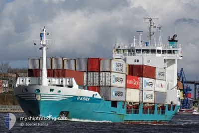
RAGNA
Container Ship
Current Trip
| Time Travelled | 10 h, 37 mins |
|---|---|
| Remaining Time | 1 day |
| Distance Travelled | 127.60 nm |
| Remaining Distance | 469.67 nm |
| AVG Speed | 14.4 Knots |
| MAX Speed | 15.1 Knots |
| AVG Wind | 19.5 knots |
| MAX Wind | 23.6 knots |
| MIN Temp | 13°C / 55.4°F |
| MAX Temp | 15.8°C / 60.44°F |
| Draught | 6 m |
| Position Received | 3 h, 34 m ago |
Current Position
| Longitude | 18.33533° |
|---|---|
| Latitude | 55.15667° |
| Status | Under way using engine |
| Speed | 13.5 Knots |
| Course | 250° |
| Area | Baltic Sea |
| Station | T-AIS |
| Position Received | 3 h, 34 m ago |
Info
Information
The current position of RAGNA is in Baltic Sea with coordinates 55.15667° / 18.33533° as reported on 2024-06-08 23:33 by AIS to our vessel tracker app. The vessel's current speed is 13.5 Knots and is heading at the port of OSLO. The estimated time of arrival as calculated by vessel tracking app is 2024-06-10 12:46 LT
The vessel RAGNA (IMO: 9173329, MMSI: 211265530) is a Container Ship that was built in 1998 ( 26 years old ). It's sailing under the flag of [DE] Germany.
In this page you can find informations about the vessels current position, last detected port calls, and current voyage information. If the vessels is not in coverage by AIS you will find the latest position.
The current position of RAGNA is detected by our AIS receivers and we are not responsible for the reliability of the data. The last position was recorded while the vessel was in Coverage by the Ais receivers of our vessel tracking app.
The current draught of RAGNA as reported by AIS is 6 meters
Weather
| Temperature | 12.9°C / 55.22°F |
|---|---|
| Wind Speed | 19 knots |
| Direction | 277° W |
| Pressure | 1003.9 hPa |
| Humidity | 79.5 % |
| Cloud Coverage | 69 % |
Featured Company
Last Port Calls
| Port | Arrival | Departure | Time In Port |
|---|---|---|---|
| 2024-06-08 10:40 | 2024-06-08 16:30 | 5 h | |
| 2024-06-07 14:58 | 2024-06-07 22:13 | 7 h | |
| 2024-05-31 10:19 | 2024-05-31 15:13 | 4 h | |
| 2024-05-28 13:00 | 2024-05-28 20:21 | 7 h | |
| 2024-05-24 19:08 | 2024-05-25 10:51 | 15 h | |
| 2024-05-20 23:51 | 2024-05-21 08:36 | 8 h | |
| 2024-05-18 03:07 | 2024-05-18 12:59 | 9 h | |
| 2024-05-03 10:00 | 2024-05-03 23:03 | 13 h | |
| 2024-04-30 05:28 | 2024-04-30 15:06 | 9 h | |
| 2024-04-26 07:10 | 2024-04-27 01:24 | 18 h |
Last Trips
| Origin | Departure | Destination | Arrival | Distance | |
|---|---|---|---|---|---|
| 2024-06-08 00:13 | 2024-06-08 13:40 | 117.81 nm | |||
| 2024-05-31 17:13 | 2024-06-07 16:58 | 7.62 nm | |||
| 2024-05-28 21:21 | 2024-05-31 12:19 | 877.89 nm | |||
| 2024-05-25 12:51 | 2024-05-28 14:00 | 880.04 nm | |||
| 2024-05-21 09:36 | 2024-05-24 21:08 | 876.59 nm | |||
| 2024-05-18 14:59 | 2024-05-21 00:51 | 870.60 nm | |||
| 2024-05-04 01:03 | 2024-05-18 05:07 | 8.87 nm | |||
| 2024-04-30 16:06 | 2024-05-03 12:00 | 865.67 nm | |||
| 2024-04-27 03:24 | 2024-04-30 06:28 | 877.29 nm | |||
| 2024-04-22 21:08 | 2024-04-26 09:10 | 806.06 nm |
Events
| Time | Event | Details | Position / Dest | Info |
|---|---|---|---|---|
| 2024-06-09 00:04 | Status Changed | Default Under way using engine |
55.11633 / 18.14700
NOOSL
|
Speed: 13.5 kn Course: 250° |
| 2024-06-08 23:33 | OUT of Coverage |
55.15667 / 18.33533
Baltic Sea
NOOSL
|
Speed: 13.5 kn Course: 250° |
|
| 2024-06-08 22:34 | Status Changed | Under way using engine Default |
55.24000 / 18.69117
NOOSL
|
Speed: 12 kn Course: 247° |
| 2024-06-08 22:23 | Status Changed | Default Under way using engine |
55.25516 / 18.75500
NOOSL
|
Speed: 13.4 kn Course: 249° |
| 2024-06-08 21:37 | ETA Changed | 2024/06/10 08:00 2024/06/10 10:00 |
55.31983 / 19.04617
NOOSL
|
Speed: 14.3 kn Course: 248° |
| 2024-06-08 21:34 | Change Sea Area | Polish part of the Baltic Sea Russian part of the Baltic Sea |
55.32433 / 19.06633
Baltic Sea
NOOSL
|
Speed: 14.3 kn Course: 248° |
| 2024-06-08 20:33 | ETA Changed | 2024/06/10 10:00 2024/06/10 16:00 |
55.41383 / 19.47033
NOOSL
|
Speed: 14.8 kn Course: 249° |
| 2024-06-08 20:03 | Status Changed | Under way using engine Default |
55.45717 / 19.67283
NOOSL
|
Speed: 15 kn Course: 250° |
| 2024-06-08 19:57 | Status Changed | Default Under way using engine |
55.46550 / 19.71317
NOOSL
|
Speed: 15.1 kn Course: 250° |
| 2024-06-08 19:52 | Status Changed | Under way using engine Default |
55.47333 / 19.74983
NOOSL
|
Speed: 15.2 kn Course: 250° |