
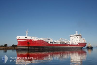
RAMELIA
Tanker D
Current Trip
| Time Travelled | 17 h, 41 mins |
|---|---|
| Remaining Time | 1 day |
| Distance Travelled | 204.22 nm |
| Remaining Distance | 396.42 nm |
| AVG Speed | 11.1 Knots |
| MAX Speed | 12 Knots |
| AVG Wind | 5.7 knots |
| MAX Wind | 11.1 knots |
| MIN Temp | 12.4°C / 54.32°F |
| MAX Temp | 15.5°C / 59.9°F |
| Draught | 8.5 m |
| Position Received | 38 m ago |
Current Position
| Longitude | -3.93446° |
|---|---|
| Latitude | 49.68657° |
| Status | Under way using engine |
| Speed | 11.7 Knots |
| Course | 77.4° |
| Area | English Channel |
| Station | T-AIS |
| Position Received | 38 m ago |
Info
Information
The current position of RAMELIA is in English Channel with coordinates 49.68657° / -3.93446° as reported on 2024-05-17 03:28 by AIS to our vessel tracker app. The vessel's current speed is 11.7 Knots and is heading at the port of AMSTERDAM. The estimated time of arrival as calculated by vessel tracking app is 2024-05-18 13:21 LT
The vessel RAMELIA (IMO: 9818280, MMSI: 265013000) is a Tanker D It's sailing under the flag of [SE] Sweden.
In this page you can find informations about the vessels current position, last detected port calls, and current voyage information. If the vessels is not in coverage by AIS you will find the latest position.
The current position of RAMELIA is detected by our AIS receivers and we are not responsible for the reliability of the data. The last position was recorded while the vessel was in Coverage by the Ais receivers of our vessel tracking app.
The current draught of RAMELIA as reported by AIS is 8.5 meters
Weather
| Temperature | 13.2°C / 55.76°F |
|---|---|
| Wind Speed | 8 knots |
| Direction | 65° ENE |
| Pressure | 1006 hPa |
| Humidity | 84 % |
| Cloud Coverage | 96 % |
Featured Company
Last Port Calls
| Port | Arrival | Departure | Time In Port |
|---|---|---|---|
| 2024-05-13 08:41 | 2024-05-16 10:25 | 3 d | |
| 2024-05-07 19:50 | 2024-05-09 20:51 | 2 d | |
| 2024-05-06 09:54 | 2024-05-07 08:09 | 22 h | |
| 2024-05-03 21:36 | 2024-05-05 18:32 | 1 d | |
| 2024-04-27 03:14 | 2024-04-29 18:02 | 2 d | |
| 2024-04-21 05:10 | 2024-04-21 22:42 | 17 h | |
| 2024-04-19 18:49 | 2024-04-20 08:24 | 13 h | |
| 2024-04-13 00:08 | 2024-04-16 21:28 | 3 d | |
| 2024-04-06 18:38 | 2024-04-09 21:44 | 3 d | |
| 2024-04-06 18:25 | 2024-04-06 18:32 | 6 m |
Last Trips
| Origin | Departure | Destination | Arrival | Distance | |
|---|---|---|---|---|---|
| 2024-05-09 21:51 | 2024-05-13 09:41 | 166.78 nm | |||
| 2024-05-07 09:09 | 2024-05-07 20:50 | 127.53 nm | |||
| 2024-05-05 19:32 | 2024-05-06 10:54 | 150.10 nm | |||
| 2024-04-29 19:02 | 2024-05-03 22:36 | 1038.95 nm | |||
| 2024-04-22 00:42 | 2024-04-27 04:14 | 544.29 nm | |||
| 2024-04-20 10:24 | 2024-04-21 07:10 | 238.01 nm | |||
| 2024-04-16 23:28 | 2024-04-19 20:49 | 731.01 nm | |||
| 2024-04-09 23:44 | 2024-04-13 02:08 | 282.94 nm | |||
| 2024-04-06 20:32 | 2024-04-06 20:38 | 0.40 nm | |||
| 2024-03-23 21:58 | 2024-04-06 20:25 | 504.50 nm |
Events
| Time | Event | Details | Position / Dest | Info |
|---|---|---|---|---|
| 2024-05-17 03:34 | Status Changed | Default Under way using engine |
49.69120 / -3.90172
NL AMS
|
Speed: 11.7 kn Course: 77.4° |
| 2024-05-16 22:29 | Change Sea Area | United Kingdom part of the English Channel United Kingdom part of the Celtic Sea |
49.79607 / -5.40762
English Channel
NL AMS
|
Speed: 11.8 kn Course: 104.8° |
| 2024-05-16 22:29 | Status Changed | Under way using engine Default |
49.79607 / -5.40762
NL AMS
|
Speed: 11.7 kn Course: 104° |
| 2024-05-16 22:29 | IN Coverage |
49.79607 / -5.40762
English Channel
NL AMS
|
Speed: 11.8 kn Course: 104.8° |
|
| 2024-05-16 19:58 | Status Changed | Default Under way using engine |
49.98961 / -6.00917
NL AMS
|
Speed: 11.7 kn Course: 180.2° |
| 2024-05-16 19:51 | OUT of Coverage |
50.01354 / -6.00928
Celtic Sea
NL AMS
|
Speed: 11.7 kn Course: 180.2° |
|
| 2024-05-16 19:49 | Status Changed | Under way using engine Default |
50.02063 / -6.00925
NL AMS
|
Speed: 11.8 kn Course: 180° |
| 2024-05-16 19:49 | IN Coverage |
50.02063 / -6.00925
Celtic Sea
NL AMS
|
Speed: 11.7 kn Course: 180.8° |
|
| 2024-05-16 16:46 | Status Changed | Default Under way using engine |
50.60518 / -5.86813
NL AMS
|
Speed: 11.8 kn Course: 200.7° |
| 2024-05-16 16:40 | OUT of Coverage |
50.62623 / -5.85571
Celtic Sea
NL AMS
|
Speed: 11.8 kn Course: 200.7° |