
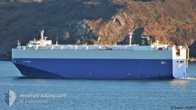
RCC PASSION
Vehicles Carrier
Current Trip
| Time Travelled | 3 days |
|---|---|
| Remaining Time | 1 day |
| Distance Travelled | 1156.96 nm |
| Remaining Distance | 716.63 nm |
| AVG Speed | 14.7 Knots |
| MAX Speed | 16.6 Knots |
| AVG Wind | 13.9 knots |
| MAX Wind | 27.8 knots |
| MIN Temp | 12.1°C / 53.78°F |
| MAX Temp | 20.1°C / 68.18°F |
| Draught | 8.6 m |
| Position Received | 35 m ago |
Current Position
| Longitude | -9.24952° |
|---|---|
| Latitude | 43.95004° |
| Status | Under way using engine |
| Speed | 14.8 Knots |
| Course | 28.7° |
| Area | North Atlantic Ocean |
| Station | T-AIS |
| Position Received | 35 m ago |
Info
Information
The current position of RCC PASSION is in North Atlantic Ocean with coordinates 43.95004° / -9.24952° as reported on 2024-05-18 00:15 by AIS to our vessel tracker app. The vessel's current speed is 14.8 Knots and is heading at the port of SHEERNESS. The estimated time of arrival as calculated by vessel tracking app is 2024-05-19 23:42 LT
The vessel RCC PASSION (IMO: 9453107, MMSI: 311048200) is a Vehicles Carrier that was built in 2011 ( 13 years old ). It's sailing under the flag of [BS] Bahamas.
In this page you can find informations about the vessels current position, last detected port calls, and current voyage information. If the vessels is not in coverage by AIS you will find the latest position.
The current position of RCC PASSION is detected by our AIS receivers and we are not responsible for the reliability of the data. The last position was recorded while the vessel was in Coverage by the Ais receivers of our vessel tracking app.
The current draught of RCC PASSION as reported by AIS is 8.6 meters
Weather
| Temperature | 13.3°C / 55.94°F |
|---|---|
| Wind Speed | 20 knots |
| Direction | 307° NW |
| Pressure | 1011.5 hPa |
| Humidity | 92.2 % |
| Cloud Coverage | 100 % |
Featured Company
Last Port Calls
| Port | Arrival | Departure | Time In Port |
|---|---|---|---|
| 2024-05-12 21:06 | 2024-05-14 18:29 | 1 d | |
| 2024-05-10 02:39 | 2024-05-10 16:59 | 14 h | |
| 2024-05-08 08:46 | 2024-05-09 11:51 | 1 d | |
| 2024-05-05 04:19 | 2024-05-06 00:21 | 20 h | |
| 2024-05-01 13:40 | 2024-05-02 08:41 | 19 h | |
| 2024-04-28 02:09 | 2024-04-28 13:10 | 11 h | |
| 2024-04-24 10:16 | 2024-04-24 20:24 | 10 h | |
| 2024-04-19 14:07 | 2024-04-20 14:41 | 1 d | |
| 2024-04-18 08:18 | 2024-04-18 17:31 | 9 h | |
| 2024-04-15 14:15 | 2024-04-16 19:09 | 1 d |
Last Trips
| Origin | Departure | Destination | Arrival | Distance | |
|---|---|---|---|---|---|
| 2024-05-10 18:59 | 2024-05-12 23:06 | 465.65 nm | |||
| 2024-05-09 13:51 | 2024-05-10 04:39 | 206.88 nm | |||
| 2024-05-06 01:21 | 2024-05-08 10:46 | 893.95 nm | |||
| 2024-05-02 09:41 | 2024-05-05 05:19 | 385.99 nm | |||
| 2024-04-28 14:10 | 2024-05-01 14:40 | 1115.34 nm | |||
| 2024-04-24 21:24 | 2024-04-28 03:09 | 357.17 nm | |||
| 2024-04-20 15:41 | 2024-04-24 11:16 | 1320.87 nm | |||
| 2024-04-18 18:31 | 2024-04-19 15:07 | 302.94 nm | |||
| 2024-04-16 21:09 | 2024-04-18 09:18 | 536.40 nm | |||
| 2024-04-14 12:13 | 2024-04-15 16:15 | 444.97 nm |
Events
| Time | Event | Details | Position / Dest | Info |
|---|---|---|---|---|
| 2024-05-18 00:29 | Status Changed | Default Under way using engine |
44.00098 / -9.20839
GBSHS
|
Speed: 14.8 kn Course: 28.7° |
| 2024-05-18 00:15 | Status Changed | Under way using engine Default |
43.95004 / -9.24952
GBSHS
|
Speed: 15 kn Course: 27° |
| 2024-05-18 00:15 | IN Coverage |
43.95004 / -9.24952
North Atlantic Ocean
GBSHS
|
Speed: 14.8 kn Course: 28.7° |
|
| 2024-05-17 23:14 | Status Changed | Default Under way using engine |
43.72590 / -9.40763
GBSHS
|
Speed: 14.8 kn Course: 26.1° |
| 2024-05-17 23:07 | OUT of Coverage |
43.69882 / -9.42658
North Atlantic Ocean
GBSHS
|
Speed: 14.8 kn Course: 26.1° |
|
| 2024-05-17 22:58 | Status Changed | Under way using engine Default |
43.66562 / -9.44975
GBSHS
|
Speed: 15 kn Course: 26° |
| 2024-05-17 22:45 | Status Changed | Default Under way using engine |
43.62033 / -9.48099
GBSHS
|
Speed: 15.3 kn Course: 27° |
| 2024-05-17 22:16 | Status Changed | Under way using engine Default |
43.50938 / -9.55764
GBSHS
|
Speed: 15 kn Course: 27° |
| 2024-05-17 22:06 | Status Changed | Default Under way using engine |
43.47288 / -9.58319
GBSHS
|
Speed: 14.4 kn Course: 26.9° |
| 2024-05-17 21:19 | Change Sea Area | Spanish part of the North Atlantic Ocean Portuguese part of the North Atlantic Ocean |
43.30782 / -9.72456
North Atlantic Ocean
GBSHS
|
Speed: 15.1 kn Course: 33.7° |