
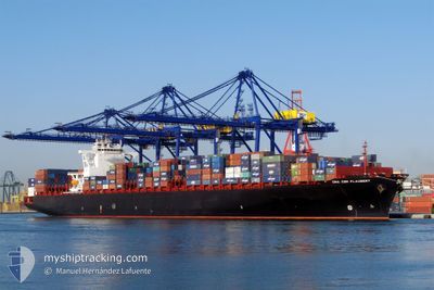
RDO CONCORD
Container Ship
Current Trip
| Time Travelled | 6 h, 47 mins |
|---|---|
| Remaining Time | --- |
| Distance Travelled | 110.55 nm |
| Remaining Distance | --- |
| AVG Speed | 16.1 Knots |
| MAX Speed | 17.9 Knots |
| AVG Wind | 9.1 knots |
| MAX Wind | 11.8 knots |
| MIN Temp | 20°C / 68°F |
| MAX Temp | 22.6°C / 72.68°F |
| Draught | 10 m |
| Position Received | 10 m ago |
Current Position
| Longitude | -74.19872° |
|---|---|
| Latitude | 37.45528° |
| Status | Under way using engine |
| Speed | 17.7 Knots |
| Course | 63.8° |
| Area | North Atlantic Ocean |
| Station | T-AIS |
| Position Received | 10 m ago |
Info
Information
The current position of RDO CONCORD is in North Atlantic Ocean with coordinates 37.45528° / -74.19872° as reported on 2024-06-12 01:02 by AIS to our vessel tracker app. The vessel's current speed is 17.7 Knots and is heading at the port of ROTTERDAM. The estimated time of arrival as calculated by vessel tracking app is 2024-06-21 04:00 LT
The vessel RDO CONCORD (IMO: 9401283, MMSI: 636092919) is a Container Ship that was built in 2009 ( 15 years old ). It's sailing under the flag of [LR] Liberia.
In this page you can find informations about the vessels current position, last detected port calls, and current voyage information. If the vessels is not in coverage by AIS you will find the latest position.
The current position of RDO CONCORD is detected by our AIS receivers and we are not responsible for the reliability of the data. The last position was recorded while the vessel was in Coverage by the Ais receivers of our vessel tracking app.
The current draught of RDO CONCORD as reported by AIS is 10 meters
Weather
| Temperature | 20°C / 68°F |
|---|---|
| Wind Speed | 8 knots |
| Direction | 359° N |
| Pressure | 1014.3 hPa |
| Humidity | 81 % |
| Cloud Coverage | --- |
Featured Company
Last Port Calls
| Port | Arrival | Departure | Time In Port |
|---|---|---|---|
| 2024-06-11 01:56 | 2024-06-11 18:26 | 16 h | |
| 2024-06-07 20:06 | 2024-06-08 10:55 | 14 h | |
| 2024-06-05 08:16 | 2024-06-06 13:53 | 1 d | |
| 2024-05-26 17:25 | 2024-05-27 10:44 | 17 h | |
| 2024-05-24 02:56 | 2024-05-24 23:04 | 20 h | |
| 2024-05-19 10:45 | 2024-05-20 01:35 | 14 h | |
| 2024-05-18 03:14 | 2024-05-18 17:56 | 14 h | |
| 2024-05-08 08:26 | 2024-05-09 05:52 | 21 h | |
| 2024-05-07 07:53 | 2024-05-07 22:17 | 14 h | |
| 2024-05-04 06:01 | 2024-05-05 00:28 | 18 h |
Most Visited Ports (Last year)
| Port | Arrivals | |
|---|---|---|
| 6 | ||
| 5 | ||
| 4 | ||
| 4 | ||
| 4 | ||
| 4 |
Last Trips
| Origin | Departure | Destination | Arrival | Distance | |
|---|---|---|---|---|---|
| 2024-06-08 06:55 | 2024-06-10 21:56 | 316.03 nm | |||
| 2024-06-06 09:53 | 2024-06-07 16:06 | 279.94 nm | |||
| 2024-05-27 12:44 | 2024-06-05 04:16 | 3629.77 nm | |||
| 2024-05-25 01:04 | 2024-05-26 19:25 | 361.08 nm | |||
| 2024-05-20 03:35 | 2024-05-24 04:56 | 275.35 nm | |||
| 2024-05-18 18:56 | 2024-05-19 12:45 | 145.33 nm | |||
| 2024-05-09 01:52 | 2024-05-18 04:14 | 3845.79 nm | |||
| 2024-05-07 18:17 | 2024-05-08 04:26 | 125.74 nm | |||
| 2024-05-04 20:28 | 2024-05-07 03:53 | 476.51 nm | |||
| 2024-04-05 08:47 | 2024-05-04 02:01 | 11470.55 nm |
Events
| Time | Event | Details | Position / Dest | Info |
|---|---|---|---|---|
| 2024-06-12 01:07 | Status Changed | Default Under way using engine |
37.46333 / -74.17333
NLRTM
|
Speed: 17.7 kn Course: 63.8° |
| 2024-06-12 01:01 | Status Changed | Under way using engine Default |
37.45134 / -74.20870
NLRTM
|
Speed: 17.9 kn Course: 64° |
| 2024-06-12 00:46 | Status Changed | Default Under way using engine |
37.41833 / -74.29166
NLRTM
|
Speed: 17.6 kn Course: 69.5° |
| 2024-06-12 00:34 | Status Changed | Under way using engine Default |
37.39789 / -74.35763
NLRTM
|
Speed: 17.6 kn Course: 65° |
| 2024-06-12 00:23 | Status Changed | Default Under way using engine |
37.37550 / -74.41769
NLRTM
|
Speed: 17.5 kn Course: 64.8° |
| 2024-06-11 23:48 | Status Changed | Under way using engine Default |
37.30383 / -74.61063
NLRTM
|
Speed: 17.1 kn Course: 65° |
| 2024-06-11 23:31 | IN Coverage |
37.30383 / -74.61063
North Atlantic Ocean
NLRTM
|
Speed: 17.1 kn Course: 64.9° |
|
| 2024-06-11 19:39 | Status Changed | Default Under way using engine |
36.91150 / -75.93231
NLRTM
|
Speed: 16.2 kn Course: 115.7° |
| 2024-06-11 19:32 | OUT of Coverage |
36.93215 / -75.97012
North Atlantic Ocean
NLRTM
|
Speed: 16.2 kn Course: 115.7° |
|
| 2024-06-11 18:26 | PORT DEPARTURE |
|
37.00599 / -76.26799
NLRTM
|
Speed: 16.4 kn Course: 77° |