
REA
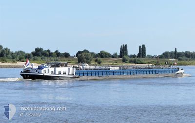
Tanker
Current Trip
| Time Travelled | 19 h, 11 mins |
|---|---|
| Remaining Time | 13 h, 24 mins |
| Distance Travelled | 7.89 nm |
| Remaining Distance | 70.65 nm |
| AVG Speed | 5.3 Knots |
| MAX Speed | 7.1 Knots |
| AVG Wind | 5 knots |
| MAX Wind | 6.8 knots |
| MIN Temp | 16.8°C / 62.24°F |
| MAX Temp | 18.5°C / 65.3°F |
| Draught | 1 m |
| Position Received | 2 h, 8 m ago |
Current Position
| Longitude | 6.25059° |
|---|---|
| Latitude | 51.82552° |
| Status | Under way using engine |
| Speed | 4.7 Knots |
| Course | 110° |
| Area | North Sea |
| Station | T-AIS |
| Position Received | 2 h, 8 m ago |
Info
Information
The current position of REA is in North Sea with coordinates 51.82552° / 6.25059° as reported on 2024-06-18 11:03 by AIS to our vessel tracker app. The vessel's current speed is 4.7 Knots and is heading at the port of HAMM. The estimated time of arrival as calculated by vessel tracking app is 2024-06-19 02:35 LT
The vessel REA (MMSI: 244690543) is a Tanker It's sailing under the flag of [NL] Netherlands.
In this page you can find informations about the vessels current position, last detected port calls, and current voyage information. If the vessels is not in coverage by AIS you will find the latest position.
The current position of REA is detected by our AIS receivers and we are not responsible for the reliability of the data. The last position was recorded while the vessel was in Coverage by the Ais receivers of our vessel tracking app.
The current draught of REA as reported by AIS is 1 meters
Weather
| Temperature | 18.9°C / 66.02°F |
|---|---|
| Wind Speed | 7 knots |
| Direction | 51° NE |
| Pressure | 1013 hPa |
| Humidity | 79.2 % |
| Cloud Coverage | 100 % |
Featured Company
Last Port Calls
| Port | Arrival | Departure | Time In Port |
|---|---|---|---|
| 2024-06-17 17:15 | 2024-06-17 18:00 | 45 m | |
| 2024-06-16 21:12 | 2024-06-17 04:45 | 7 h | |
| 2024-06-16 12:49 | 2024-06-16 20:43 | 7 h | |
| 2024-06-15 17:06 | 2024-06-16 12:39 | 19 h | |
| 2024-06-14 19:56 | 2024-06-15 04:15 | 8 h | |
| 2024-06-14 01:41 | 2024-06-14 16:35 | 14 h | |
| 2024-06-13 12:37 | 2024-06-13 13:43 | 1 h | |
| 2024-06-12 07:45 | 2024-06-13 11:47 | 1 d | |
| 2024-06-09 17:42 | 2024-06-11 05:07 | 1 d | |
| 2024-06-08 17:28 | 2024-06-08 17:46 | 18 m |
Most Visited Ports (Last year)
| Port | Arrivals | |
|---|---|---|
| 50 | ||
| 42 | ||
| 41 | ||
| 25 | ||
| 24 | ||
| 17 |
Last Trips
| Origin | Departure | Destination | Arrival | Distance | |
|---|---|---|---|---|---|
| 2024-06-17 06:45 | 2024-06-17 19:15 | 71.51 nm | |||
| 2024-06-16 22:43 | 2024-06-16 23:12 | 1.50 nm | |||
| 2024-06-16 14:39 | 2024-06-16 14:49 | 0.30 nm | |||
| 2024-06-15 06:15 | 2024-06-15 19:06 | 140.25 nm | |||
| 2024-06-14 18:35 | 2024-06-14 21:56 | 40.12 nm | |||
| 2024-06-13 15:43 | 2024-06-14 03:41 | 57.70 nm | |||
| 2024-06-13 13:47 | 2024-06-13 14:37 | 3.08 nm | |||
| 2024-06-11 07:07 | 2024-06-12 09:45 | 64.05 nm | |||
| 2024-06-08 19:46 | 2024-06-09 19:42 | 64.81 nm | |||
| 2024-06-08 11:47 | 2024-06-08 19:28 | 19.23 nm |
Events
| Time | Event | Details | Position / Dest | Info |
|---|---|---|---|---|
| 2024-06-18 11:03 | OUT of Coverage |
51.82552 / 6.25059
North Sea
HAMM
|
Speed: 4.7 kn Course: 110° |
|
| 2024-06-18 10:14 | Status Changed | Under way using engine Moored |
51.84236 / 6.15610
HAMM
|
Speed: 4.7 kn Course: 112.5° |
| 2024-06-18 10:04 | START Moving | 1.25 nm, East of TOLKAMER |
51.84918 / 6.13735
HAMM
|
Speed: 4.8 kn Course: 133.2° |
| 2024-06-18 09:45 | IN Coverage |
51.85030 / 6.14234
North Sea
HAMM
|
Speed: Course: 511° |
|
| 2024-06-18 08:21 | OUT of Coverage |
51.85030 / 6.14233
North Sea
HAMM
|
Speed: Course: 511° |
|
| 2024-06-18 08:21 | IN Coverage |
51.85030 / 6.14233
North Sea
HAMM
|
Speed: Course: 511° |
|
| 2024-06-18 06:42 | OUT of Coverage |
51.85032 / 6.14233
North Sea
HAMM
|
Speed: Course: 511° |
|
| 2024-06-18 06:42 | Status Changed | Moored Under way using engine |
51.85032 / 6.14233
HAMM
|
Speed: Course: 511° |
| 2024-06-17 18:37 | STOP Moving | 1.43 nm, East of TOLKAMER |
51.85032 / 6.14228
HAMM
|
Speed: 0.2 kn Course: 511° |
| 2024-06-17 18:00 | PORT DEPARTURE |
|
51.86350 / 6.06644
HAMM
|
Speed: 5.3 kn Course: 125.7° |