
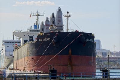
RED ORCHID
Cargo
Current Trip
| Time Travelled | 16 days |
|---|---|
| Remaining Time | 30 days |
| Distance Travelled | 1959.84 nm |
| Remaining Distance | 7798.24 nm |
| AVG Speed | 9.6 Knots |
| MAX Speed | 14.2 Knots |
| AVG Wind | 8.1 knots |
| MAX Wind | 28.3 knots |
| MIN Temp | 27.7°C / 81.86°F |
| MAX Temp | 36.3°C / 97.34°F |
| Draught | 10.3 m |
| Position Received | 5 d ago |
Current Position
| Longitude | 57.29176° |
|---|---|
| Latitude | 24.88064° |
| Status | Under way using engine |
| Speed | 11.5 Knots |
| Course | 128.5° |
| Area | Gulf of Oman |
| Station | T-AIS |
| Position Received | 5 d ago |
Info
Information
The current position of RED ORCHID is in Gulf of Oman with coordinates 24.88064° / 57.29176° as reported on 2024-06-21 20:31 by AIS to our vessel tracker app. The vessel's current speed is 11.5 Knots and is heading at the port of SANTOS. The estimated time of arrival as calculated by vessel tracking app is 2024-07-27 19:32 LT
The vessel RED ORCHID (IMO: 9757890, MMSI: 374249000) is a Cargo It's sailing under the flag of [PA] Panama.
In this page you can find informations about the vessels current position, last detected port calls, and current voyage information. If the vessels is not in coverage by AIS you will find the latest position.
The current position of RED ORCHID is detected by our AIS receivers and we are not responsible for the reliability of the data. The last position was recorded while the vessel was in Coverage by the Ais receivers of our vessel tracking app.
The current draught of RED ORCHID as reported by AIS is 10.3 meters
Weather
| Temperature | 28.2°C / 82.76°F |
|---|---|
| Wind Speed | 25 knots |
| Direction | 229° SW |
| Pressure | 1005.9 hPa |
| Humidity | 80.1 % |
| Cloud Coverage | 100 % |
Featured Company
Events
| Time | Event | Details | Position / Dest | Info |
|---|---|---|---|---|
| 2024-06-21 20:37 | Status Changed | Default Under way using engine |
24.86740 / 57.30978
SANTOS
|
Speed: 11.5 kn Course: 128.5° |
| 2024-06-21 20:31 | OUT of Coverage |
24.88064 / 57.29176
Gulf of Oman
|
Speed: 11.5 kn Course: 128.5° |
|
| 2024-06-21 18:49 | Change Sea Area | Omani part of the Gulf of Oman United Arab Emirates part of the Gulf of Oman |
25.08079 / 57.00845
Gulf of Oman
|
Speed: 11.6 kn Course: 125° |
| 2024-06-21 18:44 | Status Changed | Under way using engine Default |
25.09131 / 56.99187
SANTOS
|
Speed: 11.7 kn Course: 125° |
| 2024-06-21 18:40 | Status Changed | Default Under way using engine |
25.09809 / 56.98108
SANTOS
|
Speed: 11.7 kn Course: 123.8° |
| 2024-06-21 15:39 | Draught Changed | 10.3 9.7 |
25.22311 / 56.49822
SANTOS
|
Speed: 4.4 kn Course: 161° |
| 2024-06-21 15:31 | START Moving | 8.79 nm, North East of FUJAIRAH |
25.23234 / 56.49733
SANTOS
|
Speed: 3.1 kn Course: 173° |
| 2024-06-21 15:19 | ETA Changed | 2024/07/22 05:00 2024/06/21 05:00 |
25.23717 / 56.49663
SANTOS
|
Speed: 0.1 kn Course: 164° |
| 2024-06-21 15:18 | Status Changed | Under way using engine At anchor |
25.23711 / 56.49662
SANTOS
|
Speed: 0.1 kn Course: 165° |
| 2024-06-21 15:17 | Destination Changed | SANTOS AEFJR |
25.23704 / 56.49665
SANTOS
|
Speed: Course: 166° |