
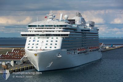
REGAL PRINCESS
Passengers Ship
Current Trip
| Time Travelled | 1 day |
|---|---|
| Remaining Time | 5 h, 30 mins |
| Distance Travelled | 214.56 nm |
| Remaining Distance | 93.60 nm |
| AVG Speed | 13.4 Knots |
| MAX Speed | 17.9 Knots |
| AVG Wind | 7.7 knots |
| MAX Wind | 17 knots |
| MIN Temp | 11.1°C / 51.98°F |
| MAX Temp | 13.5°C / 56.3°F |
| Draught | 8.6 m |
| Position Received | 8 m ago |
Current Position
| Longitude | -5.22706° |
|---|---|
| Latitude | 53.43457° |
| Status | Under way using engine |
| Speed | 16 Knots |
| Course | 75.7° |
| Area | Irish Sea and St. George's Channel |
| Station | T-AIS |
| Position Received | 8 m ago |
Info
Information
The current position of REGAL PRINCESS is in Irish Sea and St. George's Channel with coordinates 53.43457° / -5.22706° as reported on 2024-05-18 21:27 by AIS to our vessel tracker app. The vessel's current speed is 16 Knots and is heading at the port of BELFAST. The estimated time of arrival as calculated by vessel tracking app is 2024-05-19 03:06 LT
The vessel REGAL PRINCESS (IMO: 9584724, MMSI: 310674000) is a Passengers Ship that was built in 2014 ( 10 years old ). It's sailing under the flag of [BM] Bermuda.
In this page you can find informations about the vessels current position, last detected port calls, and current voyage information. If the vessels is not in coverage by AIS you will find the latest position.
The current position of REGAL PRINCESS is detected by our AIS receivers and we are not responsible for the reliability of the data. The last position was recorded while the vessel was in Coverage by the Ais receivers of our vessel tracking app.
The current draught of REGAL PRINCESS as reported by AIS is 8.6 meters
Weather
| Temperature | 11.9°C / 53.42°F |
|---|---|
| Wind Speed | 17 knots |
| Direction | 14° NNE |
| Pressure | 1016.9 hPa |
| Humidity | 90 % |
| Cloud Coverage | 7 % |
Featured Company
Last Port Calls
| Port | Arrival | Departure | Time In Port |
|---|---|---|---|
| 2024-05-17 05:26 | 2024-05-17 17:50 | 12 h | |
| 2024-05-17 05:14 | 2024-05-17 05:22 | 7 m | |
| 2024-05-15 04:54 | 2024-05-15 15:29 | 10 h | |
| 2024-05-14 04:20 | 2024-05-14 18:21 | 14 h | |
| 2024-05-11 05:44 | 2024-05-11 17:27 | 11 h | |
| 2024-05-08 06:37 | 2024-05-08 19:03 | 12 h | |
| 2024-05-07 05:54 | 2024-05-07 19:14 | 13 h | |
| 2024-05-05 05:26 | 2024-05-05 17:18 | 11 h | |
| 2024-05-05 05:10 | 2024-05-05 05:18 | 7 m | |
| 2024-05-03 05:24 | 2024-05-03 15:44 | 10 h |
Last Trips
| Origin | Departure | Destination | Arrival | Distance | |
|---|---|---|---|---|---|
| 2024-05-17 06:22 | 2024-05-17 06:26 | 0.82 nm | |||
| 2024-05-15 16:29 | 2024-05-17 06:14 | 497.59 nm | |||
| 2024-05-14 20:21 | 2024-05-15 05:54 | 119.20 nm | |||
| 2024-05-11 18:27 | 2024-05-14 06:20 | 790.38 nm | |||
| 2024-05-08 20:03 | 2024-05-11 06:44 | 703.20 nm | |||
| 2024-05-07 20:14 | 2024-05-08 07:37 | 119.62 nm | |||
| 2024-05-05 18:18 | 2024-05-07 06:54 | 329.52 nm | |||
| 2024-05-05 06:18 | 2024-05-05 06:26 | 1.40 nm | |||
| 2024-05-03 16:44 | 2024-05-05 06:10 | 500.63 nm | |||
| 2024-05-02 20:32 | 2024-05-03 06:24 | 118.39 nm |
Events
| Time | Event | Details | Position / Dest | Info |
|---|---|---|---|---|
| 2024-05-18 21:34 | Status Changed | Default Under way using engine |
53.45092 / -5.18341
IE DLG>GB BEL
|
Speed: 16 kn Course: 75.7° |
| 2024-05-18 21:25 | Status Changed | Under way using engine Default |
53.43279 / -5.23836
IE DLG>GB BEL
|
Speed: 15.8 kn Course: 76° |
| 2024-05-18 21:22 | Status Changed | Default Under way using engine |
53.42957 / -5.25899
IE DLG>GB BEL
|
Speed: 16 kn Course: 77.6° |
| 2024-05-18 21:16 | Change Sea Area | United Kingdom part of the Irish Sea and St. George's Channel Irish part of the Irish Sea and St. George's Channel |
53.42319 / -5.30318
Irish Sea and St. George's Channel
IE DLG>GB BEL
|
Speed: 16 kn Course: 77.6° |
| 2024-05-18 20:28 | ETA Changed | 2024/05/19 05:00 2024/05/19 05:15 |
53.37917 / -5.65858
IE DLG>GB BEL
|
Speed: 16 kn Course: 85° |
| 2024-05-18 19:09 | START Moving | 1.69 nm, North East of DUN LAOGHAIRE |
53.31119 / -6.08917
IE DLG>GB BEL
|
Speed: 3.1 kn Course: 41° |
| 2024-05-18 18:56 | Status Changed | Under way using engine At anchor |
53.30934 / -6.09207
IE DLG>GB BEL
|
Speed: 0.8 kn Course: 41° |
| 2024-05-18 13:55 | ETA Changed | 2024/05/19 05:15 2024/05/18 05:00 |
53.30789 / -6.09180
IE DLG>GB BEL
|
Speed: 0.1 kn Course: 20° |
| 2024-05-18 13:48 | Destination Changed | IE DLG>GB BEL IE COB>IE DLG |
53.30789 / -6.09182
IE DLG>GB BEL
|
Speed: Course: 22° |
| 2024-05-18 05:43 | Status Changed | At anchor Under way using engine |
53.30880 / -6.09174
IE COB>IE DLG
|
Speed: 0.7 kn Course: 287° |