
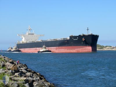
REIHOU
Bulk Carrier
Current Trip
| Time Travelled | 22 days |
|---|---|
| Remaining Time | --- |
| Distance Travelled | 4666.28 nm |
| Remaining Distance | --- |
| AVG Speed | 11.3 Knots |
| MAX Speed | 15.3 Knots |
| AVG Wind | 13.8 knots |
| MAX Wind | 27.2 knots |
| MIN Temp | 17.1°C / 62.78°F |
| MAX Temp | 29.7°C / 85.46°F |
| Draught | 11.9 m |
| Position Received | 4 d ago |
Current Position
| Longitude | 136.49221° |
|---|---|
| Latitude | 33.51354° |
| Status | Under way using engine |
| Speed | 2 Knots |
| Course | 15° |
| Area | Philippine Sea |
| Station | T-AIS |
| Position Received | 4 d ago |
Info
Information
The current position of REIHOU is in Philippine Sea with coordinates 33.51354° / 136.49221° as reported on 2024-06-07 21:44 by AIS to our vessel tracker app. The vessel's current speed is 2 Knots and is heading at the port of KINUURA. The estimated time of arrival as calculated by vessel tracking app is 2024-06-05 12:00 LT
The vessel REIHOU (IMO: 9641388, MMSI: 431978000) is a Bulk Carrier that was built in 2013 ( 11 years old ). It's sailing under the flag of [JP] Japan.
In this page you can find informations about the vessels current position, last detected port calls, and current voyage information. If the vessels is not in coverage by AIS you will find the latest position.
The current position of REIHOU is detected by our AIS receivers and we are not responsible for the reliability of the data. The last position was recorded while the vessel was in Coverage by the Ais receivers of our vessel tracking app.
The current draught of REIHOU as reported by AIS is 11.9 meters
Weather
| Temperature | 23.7°C / 74.66°F |
|---|---|
| Wind Speed | 11 knots |
| Direction | 84° E |
| Pressure | 1007 hPa |
| Humidity | 81.6 % |
| Cloud Coverage | 100 % |
Featured Company
Events
| Time | Event | Details | Position / Dest | Info |
|---|---|---|---|---|
| 2024-06-11 03:40 | STOP Moving |
33.06294 / 137.18507
JP KNU
|
Speed: 0.1 kn Course: 147° |
|
| 2024-06-10 21:00 | START Moving | 15.73 nm, South East of WAGU |
34.14773 / 137.09473
JP KNU
|
Speed: 4.5 kn Course: 180° |
| 2024-06-09 10:17 | STOP Moving |
33.85565 / 137.69588
JP KNU
|
Speed: 0.3 kn Course: 46° |
|
| 2024-06-07 21:48 | Status Changed | Default Under way using engine |
33.51265 / 136.48953
JP KNU
|
Speed: 2 kn Course: 15° |
| 2024-06-07 21:44 | OUT of Coverage |
33.51354 / 136.49221
Philippine Sea
|
Speed: 2 kn Course: 247.6° |
|
| 2024-06-07 21:41 | Detected in Sea | Japanese part of the Philippine Sea |
33.51423 / 136.49426
Philippine Sea
|
Speed: 2.1 kn Course: 249.2° |
| 2024-06-07 21:41 | Status Changed | Under way using engine Default |
33.51423 / 136.49426
JP KNU
|
Speed: 2 kn Course: 11° |
| 2024-06-07 21:41 | IN Coverage |
33.51423 / 136.49426
Philippine Sea
|
Speed: 2.1 kn Course: 249.2° |
|
| 2024-06-05 11:17 | STOP Moving |
33.82844 / 137.60585
JP KNU
|
Speed: 0.3 kn Course: 29° |