
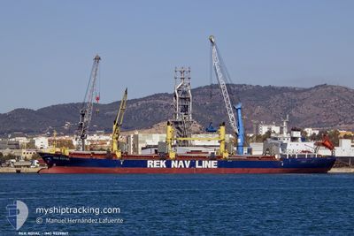
REK ROYAL
Bulk Carrier
Current Trip
EGALY
| Time Travelled | 3 h, 41 mins |
|---|---|
| Remaining Time | --- |
| Distance Travelled | 8.77 nm |
| Remaining Distance | --- |
| AVG Speed | 6.9 Knots |
| MAX Speed | 8.6 Knots |
| AVG Wind | 10.6 knots |
| MAX Wind | 12 knots |
| MIN Temp | 22.1°C / 71.78°F |
| MAX Temp | 22.5°C / 72.5°F |
| Draught | 8.5 m |
| Position Received | 1 h, 20 m ago |
Current Position
| Longitude | 29.67268° |
|---|---|
| Latitude | 31.21933° |
| Status | Moored |
| Speed | |
| Course | --- |
| Area | Mediterranean Sea - Eastern Basin |
| Station | T-AIS |
| Position Received | 1 h, 20 m ago |
Info
Information
The current position of REK ROYAL is in Mediterranean Sea - Eastern Basin with coordinates 31.21933° / 29.67268° as reported on 2024-05-23 06:56 by AIS to our vessel tracker app. The vessel's current speed is 0 Knots
The vessel REK ROYAL (IMO: 9229867, MMSI: 353539000) is a Bulk Carrier that was built in 2002 ( 22 years old ). It's sailing under the flag of [PA] Panama.
In this page you can find informations about the vessels current position, last detected port calls, and current voyage information. If the vessels is not in coverage by AIS you will find the latest position.
The current position of REK ROYAL is detected by our AIS receivers and we are not responsible for the reliability of the data. The last position was recorded while the vessel was in Coverage by the Ais receivers of our vessel tracking app.
The current draught of REK ROYAL as reported by AIS is 8.5 meters
Weather
| Temperature | 22°C / 71.6°F |
|---|---|
| Wind Speed | 11 knots |
| Direction | 313° NW |
| Pressure | 1014.1 hPa |
| Humidity | 84.5 % |
| Cloud Coverage | 100 % |
Featured Company
Last Port Calls
| Port | Arrival | Departure | Time In Port |
|---|---|---|---|
| 2024-05-18 21:20 | 2024-05-23 04:36 | 4 d | |
| 2024-05-15 14:31 | 2024-05-16 10:52 | 20 h | |
| 2024-05-07 02:56 | 2024-05-10 04:49 | 3 d | |
| 2024-05-06 18:12 | 2024-05-07 02:44 | 8 h | |
| 2024-05-06 04:50 | 2024-05-06 18:08 | 13 h | |
| 2024-05-05 21:44 | |||
| 2024-05-03 02:28 | 2024-05-05 21:35 | 2 d | |
| 2024-05-02 18:04 | 2024-05-03 00:58 | 6 h | |
| 2024-04-02 12:33 | 2024-04-09 17:47 | 7 d | |
| 2024-03-27 06:00 | 2024-03-29 23:17 | 2 d |
Most Visited Ports (Last year)
| Port | Arrivals | |
|---|---|---|
| 6 | ||
| 5 | ||
| 3 | ||
| 3 | ||
| 2 | ||
| 1 |
Last Trips
| Origin | Departure | Destination | Arrival | Distance | |
|---|---|---|---|---|---|
| 2024-05-16 12:52 | 2024-05-18 23:20 | 28.02 nm | |||
| 2024-05-10 07:49 | 2024-05-15 16:31 | 1307.44 nm | |||
| 2024-05-07 05:44 | 2024-05-07 05:56 | 2.03 nm | |||
| 2024-05-06 21:08 | 2024-05-06 21:12 | 0.59 nm | |||
| 2024-05-06 21:08 | 2024-05-06 07:50 | 0.59 nm | |||
| 2024-05-06 00:35 | 2024-05-06 00:44 | 0.34 nm | |||
| 2024-05-03 03:58 | 2024-05-03 05:28 | 4.49 nm | |||
| 2024-04-09 19:47 | 2024-05-02 21:04 | 1787.19 nm | |||
| 2024-03-30 00:17 | 2024-04-02 14:33 | 119.32 nm | |||
| 2024-03-20 22:18 | 2024-03-27 07:00 | 1445.60 nm |
Events
| Time | Event | Details | Position / Dest | Info |
|---|---|---|---|---|
| 2024-05-23 06:59 | Status Changed | Default Moored |
31.21928 / 29.67262
EGALY
|
Speed: Course: 511° |
| 2024-05-23 06:58 | Draught Changed | 8.5 9.2 |
31.21933 / 29.67268
EGALY
|
Speed: Course: 511° |
| 2024-05-23 06:56 | OUT of Coverage |
31.21933 / 29.67268
Mediterranean Sea - Eastern Basin
|
Speed: Course: 511° |
|
| 2024-05-23 06:53 | Status Changed | Moored Default |
31.21935 / 29.67262
EGALY
|
Speed: 0.1 kn Course: -1° |
| 2024-05-23 06:53 | IN Coverage |
31.21935 / 29.67262
Mediterranean Sea - Eastern Basin
|
Speed: Course: 511° |
|
| 2024-05-23 06:35 | STOP Moving | 8.14 nm, North West of EL DEKHEILA |
31.21938 / 29.67270
EGALY
|
Speed: 0.1 kn Course: -1° |
| 2024-05-23 05:56 | Status Changed | Default Moored |
31.21333 / 29.67833
EGALY
|
Speed: 2.5 kn Course: 511° |
| 2024-05-23 05:51 | OUT of Coverage |
31.21226 / 29.68206
Mediterranean Sea - Eastern Basin
|
Speed: 2.5 kn Course: 319.9° |
|
| 2024-05-23 05:51 | Status Changed | Moored Default |
31.21179 / 29.68251
EGALY
|
Speed: 3 kn Course: -1° |
| 2024-05-23 05:14 | Status Changed | Default Moored |
31.18192 / 29.74737
EGALY
|
Speed: 8.4 kn Course: 285.6° |