
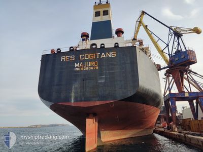
RES COGITANS
Oil Products Tanker
Current Trip
BRASIL
| Time Travelled | 8 days |
|---|---|
| Remaining Time | --- |
| Distance Travelled | 1755.49 nm |
| Remaining Distance | --- |
| AVG Speed | 10.2 Knots |
| MAX Speed | 13.7 Knots |
| AVG Wind | 14.4 knots |
| MAX Wind | 25 knots |
| MIN Temp | 10.3°C / 50.54°F |
| MAX Temp | 16.1°C / 60.98°F |
| Draught | 12.9 m |
| Position Received | 1 d ago |
Current Position
| Longitude | -0.83655° |
|---|---|
| Latitude | 50.35212° |
| Status | Under way using engine |
| Speed | 12.2 Knots |
| Course | 255° |
| Area | English Channel |
| Station | T-AIS |
| Position Received | 1 d ago |
Info
Information
The current position of RES COGITANS is in English Channel with coordinates 50.35212° / -0.83655° as reported on 2024-06-19 02:52 by AIS to our vessel tracker app. The vessel's current speed is 12.2 Knots
The vessel RES COGITANS (IMO: 9283679, MMSI: 538002622) is a Oil Products Tanker that was built in 2004 ( 20 years old ). It's sailing under the flag of [MH] Marshall Is.
In this page you can find informations about the vessels current position, last detected port calls, and current voyage information. If the vessels is not in coverage by AIS you will find the latest position.
The current position of RES COGITANS is detected by our AIS receivers and we are not responsible for the reliability of the data. The last position was recorded while the vessel was in Coverage by the Ais receivers of our vessel tracking app.
The current draught of RES COGITANS as reported by AIS is 12.9 meters
Weather
| Temperature | 14.8°C / 58.64°F |
|---|---|
| Wind Speed | 18 knots |
| Direction | 13° NNE |
| Pressure | 1019.5 hPa |
| Humidity | 88.3 % |
| Cloud Coverage | 100 % |
Featured Company
Last Port Calls
| Port | Arrival | Departure | Time In Port |
|---|---|---|---|
| 2024-06-11 05:16 | 2024-06-12 16:13 | 1 d | |
| 2024-05-30 23:12 | 2024-06-04 15:18 | 4 d | |
| 2024-05-27 09:30 | 2024-05-30 18:01 | 3 d | |
| 2024-04-03 14:26 |
Most Visited Ports (Last year)
| Port | Arrivals | |
|---|---|---|
| 2 | ||
| 2 | ||
| 1 | ||
| 1 | ||
| 1 | ||
| 1 |
Events
| Time | Event | Details | Position / Dest | Info |
|---|---|---|---|---|
| 2024-06-19 02:59 | Status Changed | Default Under way using engine |
50.34550 / -.87435
BRASIL
|
Speed: 12.2 kn Course: 255° |
| 2024-06-19 02:52 | Status Changed | Under way using engine Default |
50.35212 / -.83655
BRASIL
|
Speed: 12.2 kn Course: 254° |
| 2024-06-19 02:52 | OUT of Coverage |
50.35212 / -.83655
English Channel
BRASIL
|
Speed: 12.2 kn Course: 255° |
|
| 2024-06-19 02:51 | Status Changed | Default Under way using engine |
50.35283 / -.83233
BRASIL
|
Speed: 12.3 kn Course: 253° |
| 2024-06-19 02:16 | Status Changed | Under way using engine Default |
50.38580 / -.64898
BRASIL
|
Speed: 12.6 kn Course: 254° |
| 2024-06-19 02:11 | Status Changed | Default Under way using engine |
50.39032 / -.62320
BRASIL
|
Speed: 12.7 kn Course: 255° |
| 2024-06-18 23:26 | Status Changed | Under way using engine Default |
50.54321 / .27133
BRASIL
|
Speed: 12.5 kn Course: 255° |
| 2024-06-18 23:25 | Status Changed | Default Under way using engine |
50.54423 / .27742
BRASIL
|
Speed: 12.4 kn Course: 255° |
| 2024-06-18 23:11 | Status Changed | Under way using engine Default |
50.55636 / .35012
BRASIL
|
Speed: 12.3 kn Course: 256° |
| 2024-06-18 23:09 | Status Changed | Default Under way using engine |
50.55797 / .36072
BRASIL
|
Speed: 12.3 kn Course: 256° |