
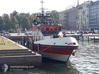
RESCUE JENNY WIHURI
Search and Rescue vessel
Current Trip
SAR
| Time Travelled | 1 day |
|---|---|
| Remaining Time | --- |
| Distance Travelled | 95.63 nm |
| Remaining Distance | --- |
| AVG Speed | 10.5 Knots |
| MAX Speed | 20.4 Knots |
| AVG Wind | 7.3 knots |
| MAX Wind | 10 knots |
| MIN Temp | 8.6°C / 47.48°F |
| MAX Temp | 13.3°C / 55.94°F |
| Draught | 2 m |
| Position Received | Now |
Current Position
| Longitude | 24.65878° |
|---|---|
| Latitude | 60.07698° |
| Status | Under way using engine |
| Speed | |
| Course | 52° |
| Area | Gulf of Finland |
| Station | T-AIS |
| Position Received | Now |
Info
Information
The current position of RESCUE JENNY WIHURI is in Gulf of Finland with coordinates 60.07698° / 24.65878° as reported on 2024-05-18 20:15 by AIS to our vessel tracker app. The vessel's current speed is 0 Knots
The vessel RESCUE JENNY WIHURI (MMSI: 230994270) is a Search and Rescue vessel It's sailing under the flag of [FI] Finland.
In this page you can find informations about the vessels current position, last detected port calls, and current voyage information. If the vessels is not in coverage by AIS you will find the latest position.
The current position of RESCUE JENNY WIHURI is detected by our AIS receivers and we are not responsible for the reliability of the data. The last position was recorded while the vessel was in Coverage by the Ais receivers of our vessel tracking app.
The current draught of RESCUE JENNY WIHURI as reported by AIS is 2 meters
Weather
| Temperature | 9.2°C / 48.56°F |
|---|---|
| Wind Speed | 5 knots |
| Direction | 51° NE |
| Pressure | 1016.1 hPa |
| Humidity | 78.1 % |
| Cloud Coverage | 9 % |
Featured Company
Events
| Time | Event | Details | Position / Dest | Info |
|---|---|---|---|---|
| 2024-05-18 16:51 | STOP Moving | 9.59 nm, South West of HELSINKI |
60.07699 / 24.65865
SAR
|
Speed: 0.3 kn Course: 64° |
| 2024-05-18 13:20 | START Moving | 10.91 nm, East of KOVERHAR |
59.83235 / 23.57700
SAR
|
Speed: 5.9 kn Course: 73.5° |
| 2024-05-18 11:33 | IN Coverage |
59.83162 / 23.57354
Gulf of Finland
|
Speed: Course: 317.8° |
|
| 2024-05-18 09:29 | OUT of Coverage |
59.97749 / 23.88124
Gulf of Finland
|
Speed: Course: 273.8° |
|
| 2024-05-18 09:29 | STOP Moving | 2.53 nm, South West of INKOO |
59.97749 / 23.88124
SAR
|
Speed: Course: 161° |
| 2024-05-18 07:53 | START Moving | 5.42 nm, South East of INKOO |
59.93543 / 24.01444
SAR
|
Speed: 5.7 kn Course: 17.7° |
| 2024-05-17 21:14 | STOP Moving | 5.59 nm, South East of INKOO |
59.93208 / 24.01431
SAR
|
Speed: Course: 136° |
| 2024-05-17 18:07 | PORT DEPARTURE |
|
60.14193 / 24.94948
SAR
|
Speed: 10.7 kn Course: 240° |
| 2024-05-17 17:52 | START Moving |
60.16436 / 24.95583
[FI] HELSINKI
|
Speed: 6.2 kn Course: 140° |
|
| 2024-05-17 13:31 | Status Changed | Under way using engine Moored |
60.16587 / 24.95380
[FI] HELSINKI
|
Speed: Course: 357° |