
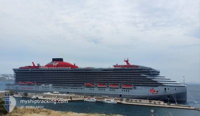
RESILIENT LADY
Passenger
Current Trip
| Trip Time | 1 day |
|---|---|
| Trip Distance | 592.94 nm |
| AVG Speed | 15.2 Knots |
| MAX Speed | 16.5 Knots |
| Draught | 8 m |
| AVG Wind | 10.8 knots |
| MAX Wind | 21 knots |
| MIN Temp | 17.5°C / 63.5°F |
| MAX Temp | 21.6°C / 70.88°F |
| Position Received | 12 h, 38 m ago |
Current Position
| Longitude | 18.00872° |
|---|---|
| Latitude | 42.62869° |
| Status | Under way using engine |
| Speed | 11 Knots |
| Course | 29.7° |
| Area | Adriatic Sea |
| Station | T-AIS |
| Position Received | 12 h, 38 m ago |
Info
Information
The current position of RESILIENT LADY is in Adriatic Sea with coordinates 42.62869° / 18.00872° as reported on 2024-05-28 05:46 by AIS to our vessel tracker app. The vessel's current speed is 11 Knots and is currently inside the port of DUBROVNIK.
The vessel RESILIENT LADY (IMO: 9805348, MMSI: 311001056) is a Passenger It's sailing under the flag of [BS] Bahamas.
In this page you can find informations about the vessels current position, last detected port calls, and current voyage information. If the vessels is not in coverage by AIS you will find the latest position.
The current position of RESILIENT LADY is detected by our AIS receivers and we are not responsible for the reliability of the data. The last position was recorded while the vessel was in Coverage by the Ais receivers of our vessel tracking app.
The current draught of RESILIENT LADY as reported by AIS is 8 meters
Weather
| Temperature | 18.4°C / 65.12°F |
|---|---|
| Wind Speed | 3 knots |
| Direction | 265° W |
| Pressure | 1013.7 hPa |
| Humidity | 77.4 % |
| Cloud Coverage | 92 % |
Featured Company
Last Port Calls
| Port | Arrival | Departure | Time In Port |
|---|---|---|---|
| 2024-05-28 06:13 | |||
| 2024-05-26 00:56 | 2024-05-26 15:15 | 14 h | |
| 2024-05-24 05:02 | 2024-05-25 11:04 | 1 d | |
| 2024-05-22 04:16 | 2024-05-22 17:21 | 13 h | |
| 2024-05-21 05:13 | 2024-05-21 15:10 | 9 h | |
| 2024-05-20 05:16 | 2024-05-20 17:46 | 12 h | |
| 2024-05-19 01:15 | 2024-05-19 15:14 | 13 h | |
| 2024-05-17 05:31 | 2024-05-17 15:23 | 9 h | |
| 2024-05-16 05:50 | 2024-05-16 16:49 | 10 h | |
| 2024-05-15 06:07 | 2024-05-15 20:32 | 14 h |
Last Trips
| Origin | Departure | Destination | Arrival | Distance | |
|---|---|---|---|---|---|
| 2024-05-26 18:15 | 2024-05-28 08:13 | 592.94 nm | |||
| 2024-05-25 14:04 | 2024-05-26 03:56 | 132.27 nm | |||
| 2024-05-22 20:21 | 2024-05-24 08:02 | 313.82 nm | |||
| 2024-05-21 18:10 | 2024-05-22 07:16 | 131.62 nm | |||
| 2024-05-20 20:46 | 2024-05-21 08:13 | 154.47 nm | |||
| 2024-05-19 18:14 | 2024-05-20 08:16 | 139.95 nm | |||
| 2024-05-17 18:23 | 2024-05-19 04:15 | 402.25 nm | |||
| 2024-05-16 18:49 | 2024-05-17 08:31 | 195.34 nm | |||
| 2024-05-15 22:32 | 2024-05-16 07:50 | 82.51 nm | |||
| 2024-05-13 19:22 | 2024-05-15 08:07 | 568.92 nm |
Events
| Time | Event | Details | Position / Dest | Info |
|---|---|---|---|---|
| 2024-05-28 06:49 | STOP Moving |
42.66599 / 18.07862
[HR] DUBROVNIK
|
Speed: 0.1 kn Course: 324° |
|
| 2024-05-28 06:13 | PORT ARRIVAL |
|
42.67316 / 18.05904
[HR] DUBROVNIK
|
Speed: 6.8 kn Course: 72° |
| 2024-05-28 05:50 | Status Changed | Default Under way using engine |
42.63837 / 18.01636
HRDBV
|
Speed: 11 kn Course: 29.7° |
| 2024-05-28 05:46 | OUT of Coverage |
42.62869 / 18.00872
Adriatic Sea
[HR] DUBROVNIK
|
Speed: 11 kn Course: 29.7° |
|
| 2024-05-28 05:36 | Status Changed | Under way using engine Default |
42.59897 / 17.99751
HRDBV
|
Speed: 11.1 kn Course: 359° |
| 2024-05-28 05:25 | Status Changed | Default Under way using engine |
42.56763 / 17.99821
HRDBV
|
Speed: 11 kn Course: 348.4° |
| 2024-05-28 01:44 | Change Sea Area | Croatian part of the Adriatic Sea Montenegrin part of the Adriatic Sea |
41.91213 / 18.26409
Adriatic Sea
HRDBV
|
Speed: 13.6 kn Course: 344.8° |
| 2024-05-27 23:37 | Change Sea Area | Montenegrin part of the Adriatic Sea Italian part of the Adriatic Sea |
41.36364 / 18.45988
Adriatic Sea
HRDBV
|
Speed: 16.2 kn Course: 344.3° |
| 2024-05-27 23:37 | Status Changed | Under way using engine Default |
41.36364 / 18.45988
HRDBV
|
Speed: 16 kn Course: 344° |
| 2024-05-27 23:37 | IN Coverage |
41.36364 / 18.45988
Adriatic Sea
HRDBV
|
Speed: 16.2 kn Course: 344.3° |