
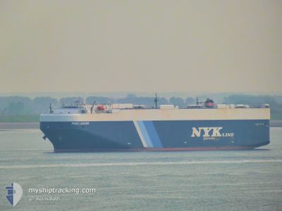
RHEA LEADER
Vehicles Carrier
Current Trip
| Time Travelled | 5 days |
|---|---|
| Remaining Time | 10 h, 9 mins |
| Distance Travelled | 1840.57 nm |
| Remaining Distance | 126.24 nm |
| AVG Speed | 13.2 Knots |
| MAX Speed | 18.4 Knots |
| AVG Wind | 7.9 knots |
| MAX Wind | 18 knots |
| MIN Temp | 24.5°C / 76.1°F |
| MAX Temp | 29.7°C / 85.46°F |
| Draught | 9.3 m |
| Position Received | 1 d ago |
Current Position
| Longitude | 126.03255° |
|---|---|
| Latitude | -8.15662° |
| Status | Under way using engine |
| Speed | 11.9 Knots |
| Course | 90° |
| Area | Banda Sea |
| Station | T-AIS |
| Position Received | 1 d ago |
Info
Information
The current position of RHEA LEADER is in Banda Sea with coordinates -8.15662° / 126.03255° as reported on 2024-06-08 10:34 by AIS to our vessel tracker app. The vessel's current speed is 11.9 Knots and is heading at the port of DARWIN. The estimated time of arrival as calculated by vessel tracking app is 2024-06-09 20:59 LT
The vessel RHEA LEADER (IMO: 9355214, MMSI: 432664000) is a Vehicles Carrier that was built in 2008 ( 16 years old ). It's sailing under the flag of [JP] Japan.
In this page you can find informations about the vessels current position, last detected port calls, and current voyage information. If the vessels is not in coverage by AIS you will find the latest position.
The current position of RHEA LEADER is detected by our AIS receivers and we are not responsible for the reliability of the data. The last position was recorded while the vessel was in Coverage by the Ais receivers of our vessel tracking app.
The current draught of RHEA LEADER as reported by AIS is 9.3 meters
Weather
| Temperature | 24.9°C / 76.82°F |
|---|---|
| Wind Speed | 8 knots |
| Direction | 138° SE |
| Pressure | 1014.5 hPa |
| Humidity | 59.9 % |
| Cloud Coverage | --- |
Featured Company
Last Port Calls
| Port | Arrival | Departure | Time In Port |
|---|---|---|---|
| 2024-06-03 09:06 | 2024-06-03 20:53 | 11 h | |
| 2024-05-30 00:17 | 2024-05-31 10:03 | 1 d | |
| 2024-05-19 21:40 | 2024-05-20 15:56 | 18 h | |
| 2024-05-16 22:46 | 2024-05-17 12:19 | 13 h | |
| 2024-05-14 08:51 | 2024-05-15 13:07 | 1 d | |
| 2024-04-25 21:42 | 2024-04-26 07:41 | 9 h | |
| 2024-04-23 08:01 | 2024-04-25 02:07 | 1 d | |
| 2024-04-10 18:50 | 2024-04-13 01:18 | 2 d | |
| 2024-04-07 17:41 | 2024-04-08 00:08 | 6 h | |
| 2024-04-05 22:16 | 2024-04-06 22:21 | 1 d |
Last Trips
| Origin | Departure | Destination | Arrival | Distance | |
|---|---|---|---|---|---|
| 2024-05-31 17:03 | 2024-06-03 17:06 | 822.64 nm | |||
| 2024-05-20 22:56 | 2024-05-30 07:17 | 2874.42 nm | |||
| 2024-05-17 20:19 | 2024-05-20 04:40 | 815.72 nm | |||
| 2024-05-15 20:07 | 2024-05-17 06:46 | 567.48 nm | |||
| 2024-04-26 10:41 | 2024-05-14 15:51 | 4601.15 nm | |||
| 2024-04-25 05:07 | 2024-04-26 00:42 | 282.92 nm | |||
| 2024-04-13 05:18 | 2024-04-23 11:01 | 489.56 nm | |||
| 2024-04-08 04:08 | 2024-04-10 22:50 | 47.97 nm | |||
| 2024-04-07 02:21 | 2024-04-07 21:41 | 287.72 nm | |||
| 2024-03-29 12:17 | 2024-04-06 02:16 | 3338.38 nm |
Events
| Time | Event | Details | Position / Dest | Info |
|---|---|---|---|---|
| 2024-06-08 10:54 | Status Changed | Default Under way using engine |
-8.15792 / 126.09682
AU DRW
|
Speed: 11.9 kn Course: 90° |
| 2024-06-08 10:34 | OUT of Coverage |
-8.15662 / 126.03255
Banda Sea
AU DRW
|
Speed: 11.9 kn Course: 90° |
|
| 2024-06-08 09:35 | Change Sea Area | Indonesian part of the Banda Sea Malaysian part of the Singapore Strait |
-8.14928 / 125.83865
Banda Sea
AU DRW
|
Speed: 11.5 kn Course: 93° |
| 2024-06-08 09:30 | Status Changed | Under way using engine Default |
-8.14828 / 125.82328
AU DRW
|
Speed: 11.2 kn Course: 94° |
| 2024-06-08 09:30 | IN Coverage |
-8.14928 / 125.83865
Banda Sea
AU DRW
|
Speed: 11.5 kn Course: 93° |
|
| 2024-06-04 00:12 | Status Changed | Default Under way using engine |
1.27437 / 104.24410
AU DRW
|
Speed: 11.2 kn Course: 81° |
| 2024-06-04 00:06 | OUT of Coverage |
1.27203 / 104.22667
Singapore Strait
AU DRW
|
Speed: 11.2 kn Course: 81° |
|
| 2024-06-03 23:41 | Change Sea Area | Malaysian part of the Singapore Strait Indonesian part of the Singapore Strait |
1.26030 / 104.14838
Singapore Strait
AU DRW
|
Speed: 11.5 kn Course: 82° |
| 2024-06-03 21:58 | Change Sea Area | Indonesian part of the Singapore Strait Singaporean part of the Singapore Strait |
1.18420 / 103.83463
Singapore Strait
AU DRW
|
Speed: 10 kn Course: 100° |
| 2024-06-03 20:53 | PORT DEPARTURE |
|
1.28087 / 103.74523
AU DRW
|
Speed: 6.8 kn Course: 204° |