
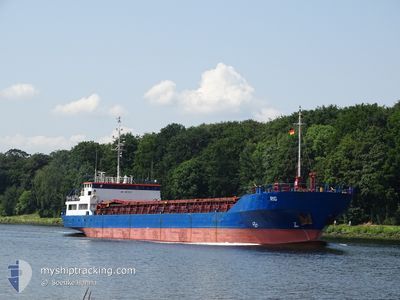
RIG
General Cargo
Current Trip
| Time Travelled | 14 h, 46 mins |
|---|---|
| Remaining Time | 17 h, 19 mins |
| Distance Travelled | 139.30 nm |
| Remaining Distance | 192.40 nm |
| AVG Speed | 9.4 Knots |
| MAX Speed | 11.4 Knots |
| AVG Wind | 15 knots |
| MAX Wind | 17.8 knots |
| MIN Temp | 12.1°C / 53.78°F |
| MAX Temp | 14.2°C / 57.56°F |
| Draught | 4.6 m |
| Position Received | 4 m ago |
Current Position
| Longitude | 2.04778° |
|---|---|
| Latitude | 51.38779° |
| Status | Under way using engine |
| Speed | 5.6 Knots |
| Course | 335.3° |
| Area | North Sea |
| Station | T-AIS |
| Position Received | 4 m ago |
Info
Information
The current position of RIG is in North Sea with coordinates 51.38779° / 2.04778° as reported on 2024-05-30 05:04 by AIS to our vessel tracker app. The vessel's current speed is 5.6 Knots and is heading at the port of HULL. The estimated time of arrival as calculated by vessel tracking app is 2024-05-30 22:28 LT
The vessel RIG (IMO: 8801137, MMSI: 305042000) is a General Cargo that was built in 1989 ( 35 years old ). It's sailing under the flag of [AG] Antigua Barbuda.
In this page you can find informations about the vessels current position, last detected port calls, and current voyage information. If the vessels is not in coverage by AIS you will find the latest position.
The current position of RIG is detected by our AIS receivers and we are not responsible for the reliability of the data. The last position was recorded while the vessel was in Coverage by the Ais receivers of our vessel tracking app.
The current draught of RIG as reported by AIS is 4.6 meters
Weather
| Temperature | 12.5°C / 54.5°F |
|---|---|
| Wind Speed | 17 knots |
| Direction | 297° WNW |
| Pressure | 1006.6 hPa |
| Humidity | 83.1 % |
| Cloud Coverage | 7 % |
Featured Company
Last Port Calls
| Port | Arrival | Departure | Time In Port |
|---|---|---|---|
| 2024-05-28 12:16 | 2024-05-29 14:23 | 1 d | |
| 2024-05-16 02:31 | 2024-05-17 13:44 | 1 d | |
| 2024-05-09 15:55 | 2024-05-12 17:02 | 3 d | |
| 2024-05-08 03:55 | 2024-05-08 15:26 | 11 h | |
| 2024-05-07 06:47 | 2024-05-07 06:49 | 1 m | |
| 2024-05-05 04:28 | 2024-05-06 17:35 | 1 d | |
| 2024-04-30 15:44 | 2024-05-03 15:08 | 2 d | |
| 2024-04-24 16:44 | 2024-04-26 09:16 | 1 d | |
| 2024-04-18 17:51 | 2024-04-18 17:53 | 2 m | |
| 2024-04-17 07:15 | 2024-04-17 22:44 | 15 h |
Last Trips
| Origin | Departure | Destination | Arrival | Distance | |
|---|---|---|---|---|---|
| 2024-05-17 15:44 | 2024-05-28 13:16 | 1921.36 nm | |||
| 2024-05-12 19:02 | 2024-05-16 04:31 | 699.25 nm | |||
| 2024-05-08 17:26 | 2024-05-09 17:55 | 227.23 nm | |||
| 2024-05-07 08:49 | 2024-05-08 05:55 | 193.03 nm | |||
| 2024-05-06 19:35 | 2024-05-07 08:47 | 88.34 nm | |||
| 2024-05-03 17:08 | 2024-05-05 06:28 | 84.99 nm | |||
| 2024-04-26 12:16 | 2024-04-30 17:44 | 904.07 nm | |||
| 2024-04-18 19:53 | 2024-04-24 19:44 | 931.71 nm | |||
| 2024-04-18 00:44 | 2024-04-18 19:51 | 144.45 nm | |||
| 2024-04-12 19:30 | 2024-04-17 09:15 | 532.62 nm |
Events
| Time | Event | Details | Position / Dest | Info |
|---|---|---|---|---|
| 2024-05-30 05:00 | Change Sea Area | United Kingdom part of the North Sea French part of the North Sea |
51.38206 / 2.05158
North Sea
GBHUL
|
Speed: 6.9 kn Course: 339.8° |
| 2024-05-30 04:09 | Status Changed | Under way using engine Default |
51.23968 / 2.07366
GBHUL
|
Speed: 11.4 kn Course: 64° |
| 2024-05-30 03:46 | Status Changed | Default Under way using engine |
51.20559 / 1.97372
GBHUL
|
Speed: 11.4 kn Course: 63.4° |
| 2024-05-30 03:10 | Change Sea Area | French part of the North Sea United Kingdom part of the North Sea |
51.15495 / 1.81554
North Sea
GBHUL
|
Speed: 11.1 kn Course: 62.2° |
| 2024-05-30 02:35 | Change Sea Area | United Kingdom part of the North Sea French part of the North Sea |
51.08428 / 1.67864
North Sea
GBHUL
|
Speed: 11 kn Course: 49.5° |
| 2024-05-30 02:05 | Change Sea Area | French part of the North Sea French part of the English Channel |
51.02656 / 1.57271
North Sea
GBHUL
|
Speed: 8.6 kn Course: 47.5° |
| 2024-05-30 00:55 | Status Changed | Under way using engine Default |
50.88830 / 1.40343
GBHUL
|
Speed: 9.3 kn Course: 14° |
| 2024-05-30 00:50 | Status Changed | Default Under way using engine |
50.87658 / 1.39877
GBHUL
|
Speed: 9.2 kn Course: 11.3° |
| 2024-05-29 23:38 | ETA Changed | 2024/05/31 05:00 2024/05/31 11:00 |
50.70843 / 1.31513
GBHUL
|
Speed: 9.1 kn Course: 53.2° |
| 2024-05-29 23:14 | Status Changed | Under way using engine Default |
50.66924 / 1.24263
GBHUL
|
Speed: 9.1 kn Course: 48° |