
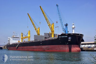
RIGI VENTURE
Cargo
Current Trip
| Time Travelled | 6 days |
|---|---|
| Remaining Time | --- |
| Distance Travelled | 1967.77 nm |
| Remaining Distance | --- |
| AVG Speed | 12.1 Knots |
| MAX Speed | 14.4 Knots |
| AVG Wind | 15.2 knots |
| MAX Wind | 25.1 knots |
| MIN Temp | 10.1°C / 50.18°F |
| MAX Temp | 22.3°C / 72.14°F |
| Draught | 11.6 m |
| Position Received | 5 d ago |
Current Position
| Longitude | 124.57477° |
|---|---|
| Latitude | 34.88463° |
| Status | Under way using engine |
| Speed | 12.4 Knots |
| Course | 160.6° |
| Area | Yellow Sea |
| Station | T-AIS |
| Position Received | 5 d ago |
Info
Information
The current position of RIGI VENTURE is in Yellow Sea with coordinates 34.88463° / 124.57477° as reported on 2024-05-11 23:02 by AIS to our vessel tracker app. The vessel's current speed is 12.4 Knots and is heading at the port of BALBOA. The estimated time of arrival as calculated by vessel tracking app is 2024-06-12 07:00 LT
The vessel RIGI VENTURE (IMO: 9693197, MMSI: 477790600) is a Cargo It's sailing under the flag of [HK] Hong Kong.
In this page you can find informations about the vessels current position, last detected port calls, and current voyage information. If the vessels is not in coverage by AIS you will find the latest position.
The current position of RIGI VENTURE is detected by our AIS receivers and we are not responsible for the reliability of the data. The last position was recorded while the vessel was in Coverage by the Ais receivers of our vessel tracking app.
The current draught of RIGI VENTURE as reported by AIS is 11.6 meters
Weather
| Temperature | 19.6°C / 67.28°F |
|---|---|
| Wind Speed | 12 knots |
| Direction | 181° S |
| Pressure | 1021.8 hPa |
| Humidity | 92.3 % |
| Cloud Coverage | 100 % |
Featured Company
Most Visited Ports (Last year)
| Port | Arrivals | |
|---|---|---|
| 2 | ||
| 1 | ||
| 1 | ||
| 1 | ||
| 1 | ||
| 1 |
Events
| Time | Event | Details | Position / Dest | Info |
|---|---|---|---|---|
| 2024-05-11 23:08 | Status Changed | Default Under way using engine |
34.86557 / 124.58440
BALBOA PANAMA
|
Speed: 12.4 kn Course: 160.6° |
| 2024-05-11 23:02 | OUT of Coverage |
34.88463 / 124.57477
Yellow Sea
|
Speed: 12.4 kn Course: 160.6° |
|
| 2024-05-11 18:05 | Draught Changed | 11.6 13.4 |
35.77417 / 124.12428
BALBOA PANAMA
|
Speed: 11.8 kn Course: 154.5° |
| 2024-05-11 18:05 | Destination Changed | BALBOA PANAMA SINGAPOE |
35.77417 / 124.12428
BALBOA PANAMA
|
Speed: 11.8 kn Course: 154.5° |
| 2024-05-11 18:05 | ETA Changed | 2024/06/12 07:00 2024/04/11 07:00 |
35.77417 / 124.12428
BALBOA PANAMA
|
Speed: 11.8 kn Course: 154.5° |
| 2024-05-11 17:40 | Change Sea Area | South Korean part of the Yellow Sea Chinese part of the Yellow Sea |
35.84825 / 124.08201
Yellow Sea
|
Speed: 11.8 kn Course: 155.9° |
| 2024-05-11 17:38 | Status Changed | Under way using engine Default |
35.85470 / 124.07837
SINGAPOE
|
Speed: 11.8 kn Course: 157° |
| 2024-05-11 17:25 | IN Coverage |
35.84825 / 124.08201
Yellow Sea
|
Speed: 11.8 kn Course: 155.9° |
|
| 2024-05-11 16:18 | Status Changed | Default Under way using engine |
36.09395 / 123.94003
SINGAPOE
|
Speed: 12.2 kn Course: 155.4° |
| 2024-05-11 16:14 | OUT of Coverage |
36.10730 / 123.93241
Yellow Sea
|
Speed: 12.2 kn Course: 155.4° |