
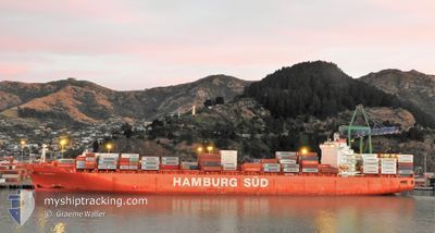
RIO MADEIRA
Container Ship
Current Trip
NZLYT>NZPOE
| Time Travelled | 5 h, 38 mins |
|---|---|
| Remaining Time | --- |
| Distance Travelled | 74.47 nm |
| Remaining Distance | --- |
| AVG Speed | 13.4 Knots |
| MAX Speed | 15.9 Knots |
| AVG Wind | 5.2 knots |
| MAX Wind | 10 knots |
| MIN Temp | 7.3°C / 45.14°F |
| MAX Temp | 9.4°C / 48.92°F |
| Draught | 11.4 m |
| Position Received | 4 d ago |
Current Position
| Longitude | 173.11756° |
|---|---|
| Latitude | -43.60291° |
| Status | Under way using engine |
| Speed | 13 Knots |
| Course | 105.7° |
| Area | South Pacific Ocean |
| Station | T-AIS |
| Position Received | 4 d ago |
Info
Information
The current position of RIO MADEIRA is in South Pacific Ocean with coordinates -43.60291° / 173.11756° as reported on 2024-05-18 23:25 by AIS to our vessel tracker app. The vessel's current speed is 13 Knots
The vessel RIO MADEIRA (IMO: 9348106, MMSI: 563051600) is a Container Ship that was built in 2009 ( 15 years old ). It's sailing under the flag of [SG] Singapore.
In this page you can find informations about the vessels current position, last detected port calls, and current voyage information. If the vessels is not in coverage by AIS you will find the latest position.
The current position of RIO MADEIRA is detected by our AIS receivers and we are not responsible for the reliability of the data. The last position was recorded while the vessel was in Coverage by the Ais receivers of our vessel tracking app.
The current draught of RIO MADEIRA as reported by AIS is 11.4 meters
Weather
| Temperature | 9.2°C / 48.56°F |
|---|---|
| Wind Speed | 7 knots |
| Direction | 46° NE |
| Pressure | 1011.2 hPa |
| Humidity | 77.5 % |
| Cloud Coverage | 100 % |
Featured Company
Last Port Calls
| Port | Arrival | Departure | Time In Port |
|---|---|---|---|
| 2024-05-21 01:31 | 2024-05-23 02:11 | 2 d | |
| 2024-05-17 01:19 | 2024-05-18 21:58 | 1 d | |
| 2024-05-14 10:15 | 2024-05-15 10:39 | 1 d | |
| 2024-05-11 17:50 | 2024-05-13 07:30 | 1 d | |
| 2024-05-04 22:12 | 2024-05-07 08:26 | 2 d | |
| 2024-04-23 01:02 | 2024-04-24 11:48 | 1 d | |
| 2024-04-20 19:40 | 2024-04-22 04:54 | 1 d | |
| 2024-04-02 01:28 | 2024-04-03 22:24 | 1 d | |
| 2024-03-31 09:56 | 2024-04-01 07:02 | 21 h | |
| 2024-03-27 21:00 | 2024-03-29 07:08 | 1 d |
Most Visited Ports (Last year)
| Port | Arrivals | |
|---|---|---|
| 9 | ||
| 9 | ||
| 8 | ||
| 7 | ||
| 7 | ||
| 7 |
Last Trips
| Origin | Departure | Destination | Arrival | Distance | |
|---|---|---|---|---|---|
| 2024-05-19 09:58 | 2024-05-21 13:31 | 201.52 nm | |||
| 2024-05-15 22:39 | 2024-05-17 13:19 | 362.77 nm | |||
| 2024-05-13 19:30 | 2024-05-14 22:15 | 293.43 nm | |||
| 2024-05-07 18:26 | 2024-05-12 05:50 | 1379.84 nm | |||
| 2024-04-24 19:48 | 2024-05-05 08:12 | 4235.33 nm | |||
| 2024-04-22 12:54 | 2024-04-23 09:02 | 48.02 nm | |||
| 2024-04-04 11:24 | 2024-04-21 03:40 | 5114.25 nm | |||
| 2024-04-01 20:02 | 2024-04-02 14:28 | 201.29 nm | |||
| 2024-03-29 20:08 | 2024-03-31 22:56 | 349.26 nm | |||
| 2024-03-25 07:47 | 2024-03-28 10:00 | 304.93 nm |
Events
| Time | Event | Details | Position / Dest | Info |
|---|---|---|---|---|
| 2024-05-23 02:11 | START Moving | 0.73 nm, North East of PORT CHALMERS |
-45.80164 / 170.63559
NZLYT>NZPOE
|
Speed: 5.8 kn Course: 59° |
| 2024-05-23 02:11 | PORT DEPARTURE |
|
-45.80164 / 170.63559
NZLYT>NZPOE
|
Speed: 1.3 kn Course: 40° |
| 2024-05-21 01:39 | STOP Moving |
-45.81126 / 170.62755
[NZ] PORT CHALMERS
|
Speed: 0.3 kn Course: 21° |
|
| 2024-05-21 01:31 | PORT ARRIVAL |
|
-45.81132 / 170.62921
[NZ] PORT CHALMERS
|
Speed: 0.9 kn Course: 317° |
| 2024-05-20 23:35 | START Moving | 8.9 nm, North East of PORT CHALMERS |
-45.67932 / 170.72082
NZLYT>NZPOE
|
Speed: 3.7 kn Course: 111° |
| 2024-05-19 12:15 | STOP Moving | 8.98 nm, North East of PORT CHALMERS |
-45.67632 / 170.71668
NZLYT>NZPOE
|
Speed: 0.2 kn Course: 195° |
| 2024-05-18 23:30 | Status Changed | Default Under way using engine |
-43.61087 / 173.14394
NZLYT>NZPOE
|
Speed: 13 kn Course: 105.7° |
| 2024-05-18 23:25 | Status Changed | Under way using engine Default |
-43.60291 / 173.11756
NZLYT>NZPOE
|
Speed: 13 kn Course: 106° |
| 2024-05-18 23:25 | OUT of Coverage |
-43.60291 / 173.11756
South Pacific Ocean
NZLYT>NZPOE
|
Speed: 13 kn Course: 105.7° |
|
| 2024-05-18 23:22 | Status Changed | Default Under way using engine |
-43.60078 / 173.10715
NZLYT>NZPOE
|
Speed: 12.9 kn Course: 106.2° |