
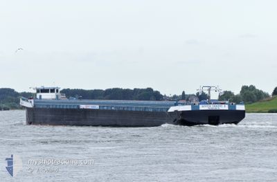
RIVER DRONE 2
Cargo
Current Trip
| Time Travelled | 19 h, 44 mins |
|---|---|
| Remaining Time | --- |
| Distance Travelled | 21.45 nm |
| Remaining Distance | --- |
| AVG Speed | 7 Knots |
| MAX Speed | 10.3 Knots |
| AVG Wind | 13.2 knots |
| MAX Wind | 15.8 knots |
| MIN Temp | 12°C / 53.6°F |
| MAX Temp | 17.5°C / 63.5°F |
| Draught | 3 m |
| Position Received | 16 h, 21 m ago |
Current Position
| Longitude | 4.41044° |
|---|---|
| Latitude | 50.95193° |
| Status | Under way using engine |
| Speed | 5.2 Knots |
| Course | 157° |
| Area | North Sea |
| Station | T-AIS |
| Position Received | 16 h, 21 m ago |
Info
Information
The current position of RIVER DRONE 2 is in North Sea with coordinates 50.95193° / 4.41044° as reported on 2024-06-16 14:04 by AIS to our vessel tracker app. The vessel's current speed is 5.2 Knots and is heading at the port of KNIPPLA.
The vessel RIVER DRONE 2 (MMSI: 205558390) is a Cargo It's sailing under the flag of [BE] Belgium.
In this page you can find informations about the vessels current position, last detected port calls, and current voyage information. If the vessels is not in coverage by AIS you will find the latest position.
The current position of RIVER DRONE 2 is detected by our AIS receivers and we are not responsible for the reliability of the data. The last position was recorded while the vessel was in Coverage by the Ais receivers of our vessel tracking app.
The current draught of RIVER DRONE 2 as reported by AIS is 3 meters
Weather
| Temperature | 12.8°C / 55.04°F |
|---|---|
| Wind Speed | 5 knots |
| Direction | 207° SSW |
| Pressure | 1009.8 hPa |
| Humidity | 95.9 % |
| Cloud Coverage | 91 % |
Featured Company
Last Port Calls
| Port | Arrival | Departure | Time In Port |
|---|---|---|---|
| 2024-06-15 17:29 | 2024-06-16 10:41 | 17 h | |
| 2024-06-14 20:45 | 2024-06-15 07:35 | 10 h | |
| 2024-06-13 09:01 | 2024-06-13 10:24 | 1 h | |
| 2024-06-11 21:51 | 2024-06-12 16:20 | 18 h | |
| 2024-05-30 07:51 | 2024-06-11 12:01 | 12 d | |
| 2024-05-28 18:55 | 2024-05-29 04:27 | 9 h | |
| 2024-05-26 13:00 | 2024-05-28 09:19 | 1 d | |
| 2024-05-25 17:00 | 2024-05-26 09:08 | 16 h | |
| 2024-05-25 06:03 | 2024-05-25 11:17 | 5 h | |
| 2024-05-24 06:38 | 2024-05-24 11:56 | 5 h |
Most Visited Ports (Last year)
| Port | Arrivals | |
|---|---|---|
| 34 | ||
| 9 | ||
| 8 | ||
| 8 | ||
| 6 | ||
| 6 |
Last Trips
| Origin | Departure | Destination | Arrival | Distance | |
|---|---|---|---|---|---|
| 2024-06-15 09:35 | 2024-06-15 19:29 | 74.58 nm | |||
| 2024-06-13 12:24 | 2024-06-14 22:45 | 101.01 nm | |||
| 2024-06-12 18:20 | 2024-06-13 11:01 | 65.86 nm | |||
| 2024-06-11 14:01 | 2024-06-11 23:51 | 63.93 nm | |||
| 2024-05-29 06:27 | 2024-05-30 09:51 | 78.92 nm | |||
| 2024-05-28 11:19 | 2024-05-28 20:55 | 74.88 nm | |||
| 2024-05-26 11:08 | 2024-05-26 15:00 | 38.24 nm | |||
| 2024-05-25 13:17 | 2024-05-25 19:00 | 43.22 nm | |||
| 2024-05-24 13:56 | 2024-05-25 08:03 | 42.84 nm | |||
| 2024-05-22 09:37 | 2024-05-24 08:38 | 86.05 nm |
Events
| Time | Event | Details | Position / Dest | Info |
|---|---|---|---|---|
| 2024-06-16 15:02 | STOP Moving | 4.15 nm, North East of BRUSSELS |
50.90333 / 4.40667
KALLO
|
Speed: Course: -1° |
| 2024-06-16 14:08 | Status Changed | Default Under way using engine |
50.94333 / 4.41500
KALLO
|
Speed: 5.2 kn Course: 157° |
| 2024-06-16 14:04 | Status Changed | Under way using engine Default |
50.95193 / 4.41044
KALLO
|
Speed: 5.7 kn Course: 150° |
| 2024-06-16 14:04 | START Moving | 6.72 nm, North East of BRUSSELS |
50.95193 / 4.41044
KALLO
|
Speed: 5.2 kn Course: 157° |
| 2024-06-16 14:04 | IN Coverage |
50.95193 / 4.41044
North Sea
|
Speed: 5.2 kn Course: 157° |
|
| 2024-06-16 14:04 | OUT of Coverage |
50.95193 / 4.41044
North Sea
|
Speed: 5.2 kn Course: 157° |
|
| 2024-06-16 13:29 | STOP Moving | 7.35 nm, South East of SINT AMANDS |
50.99833 / 4.37167
KALLO
|
Speed: Course: -1° |
| 2024-06-16 12:48 | Status Changed | Default Under way using engine |
51.03395 / 4.35791
KALLO
|
Speed: 4.8 kn Course: 177.6° |
| 2024-06-16 12:44 | OUT of Coverage |
51.04273 / 4.36092
North Sea
|
Speed: 4.8 kn Course: 177.6° |
|
| 2024-06-16 12:19 | START Moving | 3.31 nm, South East of RUPELMONDE |
51.08569 / 4.35031
KALLO
|
Speed: 3.7 kn Course: 149° |