
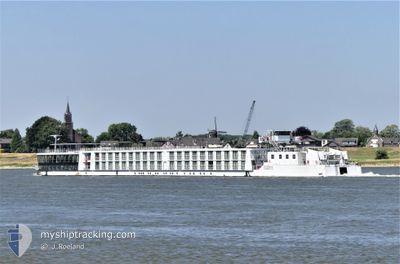
RIVER SAPPHIRE
Passenger
Current Trip
| Trip Time | 15 days |
|---|---|
| Trip Distance | 495.94 nm |
| AVG Speed | 7.1 Knots |
| MAX Speed | 12.1 Knots |
| Draught | 1.6 m |
| AVG Wind | 7.1 knots |
| MAX Wind | 11.8 knots |
| MIN Temp | 12.8°C / 55.04°F |
| MAX Temp | 31.4°C / 88.52°F |
| Position Received | 2 m ago |
Current Position
| Longitude | 17.10228° |
|---|---|
| Latitude | 48.13921° |
| Status | Under way using engine |
| Speed | 0.3 Knots |
| Course | --- |
| Area | North Sea |
| Station | T-AIS |
| Position Received | 2 m ago |
Info
Information
The current position of RIVER SAPPHIRE is in North Sea with coordinates 48.13921° / 17.10228° as reported on 2024-06-13 13:16 by AIS to our vessel tracker app. The vessel's current speed is 0.3 Knots and is currently inside the port of BRATISLAVA.
The vessel RIVER SAPPHIRE (MMSI: 269057623) is a Passenger It's sailing under the flag of [CH] Switzerland.
In this page you can find informations about the vessels current position, last detected port calls, and current voyage information. If the vessels is not in coverage by AIS you will find the latest position.
The current position of RIVER SAPPHIRE is detected by our AIS receivers and we are not responsible for the reliability of the data. The last position was recorded while the vessel was in Coverage by the Ais receivers of our vessel tracking app.
The current draught of RIVER SAPPHIRE as reported by AIS is 1.6 meters
Weather
| Temperature | 18.9°C / 66.02°F |
|---|---|
| Wind Speed | 9 knots |
| Direction | 334° NNW |
| Pressure | 1015.4 hPa |
| Humidity | 47.6 % |
| Cloud Coverage | 100 % |
Featured Company
Last Port Calls
| Port | Arrival | Departure | Time In Port |
|---|---|---|---|
| 2024-06-13 13:12 | |||
| 2024-05-28 01:49 | 2024-05-28 21:35 | 19 h | |
| 2024-05-27 21:38 | 2024-05-27 22:01 | 22 m | |
| 2024-05-23 06:24 | 2024-05-23 16:01 | 9 h | |
| 2024-05-15 16:13 | 2024-05-17 17:18 | 2 d | |
| 2024-05-11 13:29 | 2024-05-11 14:04 | 34 m | |
| 2024-05-06 09:25 | 2024-05-07 16:23 | 1 d | |
| 2024-05-05 13:11 | 2024-05-05 20:55 | 7 h | |
| 2024-05-02 05:22 | 2024-05-02 14:28 | 9 h | |
| 2024-05-01 20:21 | 2024-05-01 20:58 | 37 m |
Most Visited Ports (Last year)
| Port | Arrivals | |
|---|---|---|
| 11 | ||
| 9 | ||
| 6 | ||
| 6 | ||
| 2 | ||
| 2 |
Last Trips
| Origin | Departure | Destination | Arrival | Distance | |
|---|---|---|---|---|---|
| 2024-05-28 23:35 | 2024-06-13 15:12 | 495.94 nm | |||
| 2024-05-28 00:01 | 2024-05-28 03:49 | 29.67 nm | |||
| 2024-05-23 18:01 | 2024-05-27 23:38 | 271.86 nm | |||
| 2024-05-17 19:18 | 2024-05-23 08:24 | 212.57 nm | |||
| 2024-05-11 16:04 | 2024-05-15 18:13 | 266.90 nm | |||
| 2024-05-07 18:23 | 2024-05-11 15:29 | 146.26 nm | |||
| 2024-05-05 22:55 | 2024-05-06 11:25 | 58.17 nm | |||
| 2024-05-02 16:28 | 2024-05-05 15:11 | 111.46 nm | |||
| 2024-05-01 22:58 | 2024-05-02 07:22 | 46.16 nm | |||
| 2024-04-30 18:51 | 2024-05-01 22:21 | 134.09 nm |
Events
| Time | Event | Details | Position / Dest | Info |
|---|---|---|---|---|
| 2024-06-13 13:12 | STOP Moving |
48.13909 / 17.10234
[SK] BRATISLAVA
|
Speed: 0.3 kn Course: 511° |
|
| 2024-06-13 13:12 | PORT ARRIVAL |
|
48.13909 / 17.10234
[SK] BRATISLAVA
|
Speed: 0.8 kn Course: 511° |
| 2024-06-13 09:34 | START Moving | 13.16 nm, North West of GONYU |
47.88422 / 17.53885
VIENNA
|
Speed: 4.1 kn Course: 319.2° |
| 2024-06-13 09:14 | STOP Moving | 13.04 nm, North West of GONYU |
47.88269 / 17.54074
VIENNA
|
Speed: 0.1 kn Course: 511° |
| 2024-06-13 08:46 | IN Coverage |
47.84472 / 17.58114
North Sea
VIENNA
|
Speed: 8 kn Course: 319.8° |
|
| 2024-06-08 21:41 | OUT of Coverage |
44.84235 / 20.43497
North Sea
VIENNA
|
Speed: 8.1 kn Course: 302.7° |
|
| 2024-06-08 21:18 | START Moving | 8.42 nm, West of PANCEVO |
44.82091 / 20.44594
VIENNA
|
Speed: 3.1 kn Course: 321.2° |
| 2024-06-08 04:33 | STOP Moving | 8.37 nm, West of PANCEVO |
44.81938 / 20.44768
VIENNA
|
Speed: 0.3 kn Course: 511° |
| 2024-06-08 04:19 | Destination Changed | VIENNA TURNU MAGURELE |
44.83106 / 20.44996
VIENNA
|
Speed: 6.1 kn Course: 243.3° |
| 2024-06-08 04:19 | ETA Changed | 2024/06/14 02:00 2024/06/05 20:00 |
44.83106 / 20.44996
VIENNA
|
Speed: 6.1 kn Course: 243.3° |