
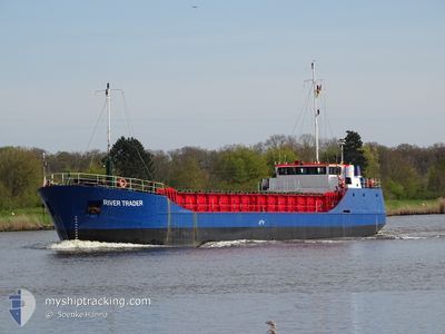
RIVER TRADER
General Cargo
Current Trip
Current Position
| Longitude | -4.12563° |
|---|---|
| Latitude | 50.36523° |
| Status | Moored |
| Speed | |
| Course | 173° |
| Area | English Channel |
| Station | T-AIS |
| Position Received | 1 m ago |
Info
Information
The current position of RIVER TRADER is in English Channel with coordinates 50.36523° / -4.12563° as reported on 2024-05-29 06:05 by AIS to our vessel tracker app. The vessel's current speed is 0 Knots and is currently inside the port of PLYMOUTH.
The vessel RIVER TRADER (IMO: 8813051, MMSI: 636015670) is a General Cargo that was built in 1989 ( 35 years old ). It's sailing under the flag of [LR] Liberia.
In this page you can find informations about the vessels current position, last detected port calls, and current voyage information. If the vessels is not in coverage by AIS you will find the latest position.
The current position of RIVER TRADER is detected by our AIS receivers and we are not responsible for the reliability of the data. The last position was recorded while the vessel was in Coverage by the Ais receivers of our vessel tracking app.
The current draught of RIVER TRADER as reported by AIS is 2.1 meters
Weather
| Temperature | 13.3°C / 55.94°F |
|---|---|
| Wind Speed | 8 knots |
| Direction | 295° WNW |
| Pressure | 1011.2 hPa |
| Humidity | 88.5 % |
| Cloud Coverage | 82 % |
Featured Company
Last Port Calls
| Port | Arrival | Departure | Time In Port |
|---|---|---|---|
| 2024-05-27 07:41 | |||
| 2024-05-22 17:49 | 2024-05-25 07:09 | 2 d | |
| 2024-05-17 08:10 | 2024-05-17 09:08 | 58 m | |
| 2024-05-14 16:33 | 2024-05-15 12:00 | 19 h | |
| 2024-05-01 16:03 | 2024-05-02 12:33 | 20 h | |
| 2024-04-28 19:46 | 2024-04-29 19:20 | 23 h | |
| 2024-04-25 07:49 | 2024-04-26 17:20 | 1 d | |
| 2024-04-21 05:06 | 2024-04-22 17:49 | 1 d | |
| 2024-04-15 02:26 | 2024-04-16 04:27 | 1 d | |
| 2024-04-14 09:39 | 2024-04-14 21:57 | 12 h |
Most Visited Ports (Last year)
| Port | Arrivals | |
|---|---|---|
| 9 | ||
| 6 | ||
| 5 | ||
| 5 | ||
| 5 | ||
| 4 |
Last Trips
| Origin | Departure | Destination | Arrival | Distance | |
|---|---|---|---|---|---|
| 2024-05-25 08:09 | 2024-05-27 08:41 | 249.33 nm | |||
| 2024-05-17 10:08 | 2024-05-22 18:49 | 332.68 nm | |||
| 2024-05-15 14:00 | 2024-05-17 09:10 | 310.07 nm | |||
| 2024-05-02 14:33 | 2024-05-14 18:33 | 881.55 nm | |||
| 2024-04-29 20:20 | 2024-05-01 18:03 | 322.08 nm | |||
| 2024-04-26 19:20 | 2024-04-28 20:46 | 291.06 nm | |||
| 2024-04-22 18:49 | 2024-04-25 09:49 | 266.63 nm | |||
| 2024-04-16 06:27 | 2024-04-21 06:06 | 369.34 nm | |||
| 2024-04-14 23:57 | 2024-04-15 04:26 | 29.84 nm | |||
| 2024-04-14 05:40 | 2024-04-14 11:39 | 25.92 nm |
Events
| Time | Event | Details | Position / Dest | Info |
|---|---|---|---|---|
| 2024-05-28 17:45 | Status Changed | Moored Default |
50.36525 / -4.12567
[GB] PLYMOUTH
|
Speed: Course: -1° |
| 2024-05-28 17:43 | Status Changed | Default Moored |
50.36500 / -4.12500
[GB] PLYMOUTH
|
Speed: Course: 175° |
| 2024-05-28 10:45 | Status Changed | Moored Default |
50.36516 / -4.12565
[GB] PLYMOUTH
|
Speed: Course: -1° |
| 2024-05-28 10:43 | Status Changed | Default Moored |
50.36500 / -4.12500
[GB] PLYMOUTH
|
Speed: Course: 175° |
| 2024-05-27 07:41 | IN Coverage |
50.36518 / -4.12568
English Channel
[GB] PLYMOUTH
|
Speed: Course: 174° |
|
| 2024-05-27 07:41 | PORT ARRIVAL |
|
50.36518 / -4.12567
[GB] PLYMOUTH
|
Speed: 0.2 kn Course: 216° |
| 2024-05-27 05:48 | OUT of Coverage |
50.34734 / -4.14668
English Channel
|
Speed: 0.2 kn Course: 216° |
|
| 2024-05-26 14:11 | STOP Moving | 1 nm, South of PLYMOUTH |
50.34745 / -4.14572
GBPLY
|
Speed: 0.1 kn Course: 229° |
| 2024-05-26 14:05 | Status Changed | At anchor Under way using engine |
50.34623 / -4.14574
GBPLY
|
Speed: 1.4 kn Course: 334° |
| 2024-05-26 09:22 | Detected in Sea | United Kingdom part of the English Channel |
50.01687 / -4.84680
English Channel
GBPLY
|
Speed: 7.7 kn Course: 57.6° |