
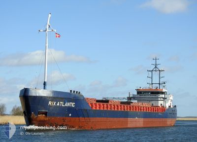
RIX ATLANTIC
General Cargo
Current Trip
| Time Travelled | 3 days |
|---|---|
| Remaining Time | 19 h, 11 mins |
| Distance Travelled | 754.85 nm |
| Remaining Distance | 517.33 nm |
| AVG Speed | 9 Knots |
| MAX Speed | 12.8 Knots |
| AVG Wind | 5.9 knots |
| MAX Wind | 23 knots |
| MIN Temp | 13.2°C / 55.76°F |
| MAX Temp | 17.2°C / 62.96°F |
| Draught | 3.7 m |
| Position Received | 1 d ago |
Current Position
| Longitude | -6.96652° |
|---|---|
| Latitude | 48.45531° |
| Status | Under way using engine |
| Speed | 9.1 Knots |
| Course | 204.2° |
| Area | Celtic Sea |
| Station | T-AIS |
| Position Received | 1 d ago |
Info
Information
The current position of RIX ATLANTIC is in Celtic Sea with coordinates 48.45531° / -6.96652° as reported on 2024-06-24 14:06 by AIS to our vessel tracker app. The vessel's current speed is 9.1 Knots and is heading at the port of FIGUEIRA DA FOZ. The estimated time of arrival as calculated by vessel tracking app is 2024-06-27 02:54 LT
The vessel RIX ATLANTIC (IMO: 9194270, MMSI: 209151000) is a General Cargo that was built in 1999 ( 25 years old ). It's sailing under the flag of [CY] Cyprus.
In this page you can find informations about the vessels current position, last detected port calls, and current voyage information. If the vessels is not in coverage by AIS you will find the latest position.
The current position of RIX ATLANTIC is detected by our AIS receivers and we are not responsible for the reliability of the data. The last position was recorded while the vessel was in Coverage by the Ais receivers of our vessel tracking app.
The current draught of RIX ATLANTIC as reported by AIS is 3.7 meters
Weather
| Temperature | 16.5°C / 61.7°F |
|---|---|
| Wind Speed | 20 knots |
| Direction | 17° NNE |
| Pressure | 1009.6 hPa |
| Humidity | 94.8 % |
| Cloud Coverage | 100 % |
Featured Company
Last Port Calls
| Port | Arrival | Departure | Time In Port |
|---|---|---|---|
| 2024-06-20 08:51 | 2024-06-22 21:51 | 2 d | |
| 2024-06-12 05:55 | 2024-06-13 17:58 | 1 d | |
| 2024-06-09 22:37 | 2024-06-10 20:21 | 21 h | |
| 2024-06-07 19:07 | 2024-06-09 16:58 | 1 d | |
| 2024-05-28 21:07 | 2024-05-29 00:35 | 3 h | |
| 2024-05-27 07:30 | 2024-05-28 12:31 | 1 d | |
| 2024-05-23 07:23 | 2024-05-24 14:29 | 1 d | |
| 2024-05-22 05:03 | 2024-05-22 16:21 | 11 h | |
| 2024-05-18 16:57 | 2024-05-21 15:29 | 2 d | |
| 2024-05-16 00:20 | 2024-05-17 13:09 | 1 d |
Most Visited Ports (Last year)
| Port | Arrivals | |
|---|---|---|
| 5 | ||
| 4 | ||
| 4 | ||
| 3 | ||
| 3 | ||
| 3 |
Last Trips
| Origin | Departure | Destination | Arrival | Distance | |
|---|---|---|---|---|---|
| 2024-06-13 18:58 | 2024-06-20 09:51 | 883.88 nm | |||
| 2024-06-10 21:21 | 2024-06-12 06:55 | 213.74 nm | |||
| 2024-06-09 17:58 | 2024-06-09 23:37 | 49.03 nm | |||
| 2024-05-29 02:35 | 2024-06-07 20:07 | 1403.89 nm | |||
| 2024-05-28 14:31 | 2024-05-28 23:07 | 52.49 nm | |||
| 2024-05-24 16:29 | 2024-05-27 09:30 | 118.84 nm | |||
| 2024-05-22 18:21 | 2024-05-23 09:23 | 145.32 nm | |||
| 2024-05-21 17:29 | 2024-05-22 07:03 | 120.93 nm | |||
| 2024-05-17 15:09 | 2024-05-18 18:57 | 229.94 nm | |||
| 2024-05-13 21:43 | 2024-05-16 02:20 | 174.04 nm |
Events
| Time | Event | Details | Position / Dest | Info |
|---|---|---|---|---|
| 2024-06-24 14:09 | Status Changed | Default Under way using engine |
48.44787 / -6.97140
PTFDF
|
Speed: 9.1 kn Course: 204.2° |
| 2024-06-24 14:06 | Status Changed | Under way using engine Default |
48.45531 / -6.96652
PTFDF
|
Speed: 9 kn Course: 199° |
| 2024-06-24 14:06 | OUT of Coverage |
48.45531 / -6.96652
Celtic Sea
PTFDF
|
Speed: 9.1 kn Course: 204.2° |
|
| 2024-06-24 13:54 | Status Changed | Default Under way using engine |
48.48320 / -6.94805
PTFDF
|
Speed: 9.2 kn Course: 198.2° |
| 2024-06-24 13:51 | Status Changed | Under way using engine Default |
48.48889 / -6.94501
PTFDF
|
Speed: 9.4 kn Course: 201° |
| 2024-06-24 13:51 | IN Coverage |
48.48889 / -6.94501
Celtic Sea
PTFDF
|
Speed: 9.2 kn Course: 198.2° |
|
| 2024-06-24 12:30 | Status Changed | Default Under way using engine |
48.69339 / -6.82093
PTFDF
|
Speed: 10.3 kn Course: 200.1° |
| 2024-06-24 12:30 | OUT of Coverage |
48.69525 / -6.81991
Celtic Sea
PTFDF
|
Speed: 10.3 kn Course: 200.1° |
|
| 2024-06-24 12:29 | Status Changed | Under way using engine Default |
48.69711 / -6.81893
PTFDF
|
Speed: 10.2 kn Course: 201° |
| 2024-06-24 12:08 | Change Sea Area | French part of the Celtic Sea United Kingdom part of the Celtic Sea |
48.75454 / -6.78745
Celtic Sea
PTFDF
|
Speed: 10.2 kn Course: 199.8° |