
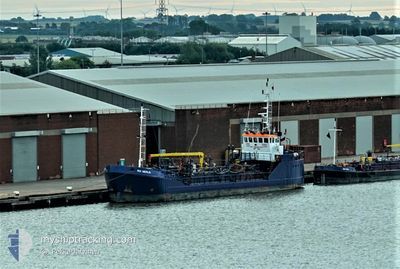
RIX MERLIN
Oil Products Tanker
Current Trip
| Time Travelled | 8 h, 32 mins |
|---|---|
| Remaining Time | 4 h, 48 mins |
| Distance Travelled | 64.78 nm |
| Remaining Distance | 35.84 nm |
| AVG Speed | 7.5 Knots |
| MAX Speed | 9 Knots |
| AVG Wind | 9.9 knots |
| MAX Wind | 14.8 knots |
| MIN Temp | 11.6°C / 52.88°F |
| MAX Temp | 13.4°C / 56.12°F |
| Draught | 3 m |
| Position Received | Now |
Current Position
| Longitude | 0.14339° |
|---|---|
| Latitude | 53.93105° |
| Status | Under way using engine |
| Speed | 7.8 Knots |
| Course | 147.8° |
| Area | North Sea |
| Station | T-AIS |
| Position Received | Now |
Info
Information
The current position of RIX MERLIN is in North Sea with coordinates 53.93105° / 0.14339° as reported on 2024-05-29 03:42 by AIS to our vessel tracker app. The vessel's current speed is 7.8 Knots and is heading at the port of HULL. The estimated time of arrival as calculated by vessel tracking app is 2024-05-29 08:31 LT
The vessel RIX MERLIN (IMO: 9366952, MMSI: 235030851) is a Oil Products Tanker that was built in 2005 ( 19 years old ). It's sailing under the flag of [GB] United Kingdom.
In this page you can find informations about the vessels current position, last detected port calls, and current voyage information. If the vessels is not in coverage by AIS you will find the latest position.
The current position of RIX MERLIN is detected by our AIS receivers and we are not responsible for the reliability of the data. The last position was recorded while the vessel was in Coverage by the Ais receivers of our vessel tracking app.
The current draught of RIX MERLIN as reported by AIS is 3 meters
Weather
| Temperature | 11.7°C / 53.06°F |
|---|---|
| Wind Speed | 14 knots |
| Direction | 249° WSW |
| Pressure | 1003.2 hPa |
| Humidity | 94.3 % |
| Cloud Coverage | 84 % |
Featured Company
Last Port Calls
| Port | Arrival | Departure | Time In Port |
|---|---|---|---|
| 2024-05-28 14:07 | 2024-05-28 19:11 | 5 h | |
| 2024-05-25 20:04 | 2024-05-27 10:59 | 1 d | |
| 2024-05-25 16:59 | 2024-05-25 19:02 | 2 h | |
| 2024-05-25 11:15 | 2024-05-25 16:54 | 5 h | |
| 2024-05-24 20:24 | 2024-05-25 08:57 | 12 h | |
| 2024-05-23 20:14 | 2024-05-24 19:02 | 22 h | |
| 2024-05-23 02:03 | 2024-05-23 02:40 | 37 m | |
| 2024-05-22 16:27 | 2024-05-23 01:59 | 9 h | |
| 2024-05-22 15:43 | 2024-05-22 16:19 | 36 m | |
| 2024-05-20 07:34 | 2024-05-21 15:02 | 1 d |
Last Trips
| Origin | Departure | Destination | Arrival | Distance | |
|---|---|---|---|---|---|
| 2024-05-27 11:59 | 2024-05-28 15:07 | 111.14 nm | |||
| 2024-05-25 20:02 | 2024-05-25 21:04 | 6.37 nm | |||
| 2024-05-25 17:54 | 2024-05-25 17:59 | 0.26 nm | |||
| 2024-05-25 09:57 | 2024-05-25 12:15 | 0.65 nm | |||
| 2024-05-24 20:02 | 2024-05-24 21:24 | 12.50 nm | |||
| 2024-05-23 03:40 | 2024-05-23 21:14 | 116.04 nm | |||
| 2024-05-23 02:59 | 2024-05-23 03:03 | 0.53 nm | |||
| 2024-05-22 17:19 | 2024-05-22 17:27 | 0.57 nm | |||
| 2024-05-21 16:02 | 2024-05-22 16:43 | 110.35 nm | |||
| 2024-05-20 07:30 | 2024-05-20 08:34 | 7.82 nm |
Events
| Time | Event | Details | Position / Dest | Info |
|---|---|---|---|---|
| 2024-05-29 01:27 | IN Coverage |
54.16235 / -.07090
North Sea
HULL
|
Speed: 6.3 kn Course: 140.7° |
|
| 2024-05-28 22:53 | Status Changed | Default Under way using engine |
54.40439 / -.39482
HULL
|
Speed: 8.3 kn Course: 137.7° |
| 2024-05-28 22:07 | OUT of Coverage |
54.48394 / -.50990
North Sea
HULL
|
Speed: 8.3 kn Course: 137.7° |
|
| 2024-05-28 21:21 | Destination Changed | HULL TEES |
54.54487 / -.65977
HULL
|
Speed: 8.8 kn Course: 121.2° |
| 2024-05-28 21:21 | ETA Changed | 2024/05/29 14:00 2024/05/28 14:30 |
54.54487 / -.65977
HULL
|
Speed: 8.8 kn Course: 121.2° |
| 2024-05-28 19:11 | PORT DEPARTURE |
|
54.64833 / -1.14097
TEES
|
Speed: 8.4 kn Course: 28° |
| 2024-05-28 18:49 | START Moving |
54.60291 / -1.15519
[GB] TEES
|
Speed: 6.4 kn Course: 317° |
|
| 2024-05-28 14:36 | STOP Moving |
54.60080 / -1.15110
[GB] TEES
|
Speed: 0.2 kn Course: 120° |
|
| 2024-05-28 14:07 | PORT ARRIVAL |
|
54.64702 / -1.14410
[GB] TEES
|
Speed: 7.9 kn Course: 205.5° |
| 2024-05-28 13:15 | START Moving | 5.98 nm, East of HARTLEPOOL |
54.69636 / -1.02638
TEES
|
Speed: 3.2 kn Course: 252° |