
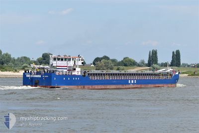
RMS CUXHAVEN
General Cargo
Current Trip
| Time Travelled | 1 day |
|---|---|
| Remaining Time | 16 h, 3 mins |
| Distance Travelled | 260.33 nm |
| Remaining Distance | 121.64 nm |
| AVG Speed | 7.8 Knots |
| MAX Speed | 11.6 Knots |
| AVG Wind | 5.4 knots |
| MAX Wind | 13.9 knots |
| MIN Temp | 9.4°C / 48.92°F |
| MAX Temp | 15.6°C / 60.08°F |
| Draught | 3.2 m |
| Position Received | 18 m ago |
Current Position
| Longitude | 5.06417° |
|---|---|
| Latitude | 51.82222° |
| Status | Under way using engine |
| Speed | 6.5 Knots |
| Course | 54.8° |
| Area | North Sea |
| Station | T-AIS |
| Position Received | 18 m ago |
Info
Information
The current position of RMS CUXHAVEN is in North Sea with coordinates 51.82222° / 5.06417° as reported on 2024-05-19 07:04 by AIS to our vessel tracker app. The vessel's current speed is 6.5 Knots and is heading at the port of STURZELBERG. The estimated time of arrival as calculated by vessel tracking app is 2024-05-19 23:25 LT
The vessel RMS CUXHAVEN (IMO: 9218533, MMSI: 636092996) is a General Cargo that was built in 2001 ( 23 years old ). It's sailing under the flag of [LR] Liberia.
In this page you can find informations about the vessels current position, last detected port calls, and current voyage information. If the vessels is not in coverage by AIS you will find the latest position.
The current position of RMS CUXHAVEN is detected by our AIS receivers and we are not responsible for the reliability of the data. The last position was recorded while the vessel was in Coverage by the Ais receivers of our vessel tracking app.
The current draught of RMS CUXHAVEN as reported by AIS is 3.2 meters
Weather
| Temperature | 15.7°C / 60.26°F |
|---|---|
| Wind Speed | 4 knots |
| Direction | 20° NNE |
| Pressure | 1011.1 hPa |
| Humidity | 83.4 % |
| Cloud Coverage | 16 % |
Featured Company
Last Port Calls
| Port | Arrival | Departure | Time In Port |
|---|---|---|---|
| 2024-05-16 13:18 | 2024-05-18 01:28 | 1 d | |
| 2024-05-13 16:11 | 2024-05-14 15:22 | 23 h | |
| 2024-05-13 01:59 | 2024-05-13 14:01 | 12 h | |
| 2024-05-12 19:03 | 2024-05-12 20:11 | 1 h | |
| 2024-05-12 10:05 | 2024-05-12 10:47 | 42 m | |
| 2024-05-11 22:10 | 2024-05-12 00:31 | 2 h | |
| 2024-05-09 07:33 | 2024-05-10 18:23 | 1 d | |
| 2024-05-06 21:12 | 2024-05-07 12:28 | 15 h | |
| 2024-05-03 16:28 | 2024-05-06 19:04 | 3 d | |
| 2024-05-03 09:38 | 2024-05-03 10:30 | 51 m |
Last Trips
| Origin | Departure | Destination | Arrival | Distance | |
|---|---|---|---|---|---|
| 2024-05-14 17:22 | 2024-05-16 14:18 | 374.74 nm | |||
| 2024-05-13 16:01 | 2024-05-13 18:11 | 26.42 nm | |||
| 2024-05-12 22:11 | 2024-05-13 03:59 | 25.80 nm | |||
| 2024-05-12 12:47 | 2024-05-12 21:03 | 40.24 nm | |||
| 2024-05-12 02:31 | 2024-05-12 12:05 | 57.45 nm | |||
| 2024-05-10 19:23 | 2024-05-12 00:10 | 245.81 nm | |||
| 2024-05-07 14:28 | 2024-05-09 08:33 | 363.91 nm | |||
| 2024-05-06 21:04 | 2024-05-06 23:12 | 26.17 nm | |||
| 2024-05-03 12:30 | 2024-05-03 18:28 | 26.05 nm | |||
| 2024-05-01 12:03 | 2024-05-03 11:38 | 348.31 nm |
Events
| Time | Event | Details | Position / Dest | Info |
|---|---|---|---|---|
| 2024-05-19 07:19 | Status Changed | Default Under way using engine |
51.82167 / 5.10333
DESUE
|
Speed: 6.5 kn Course: 54.8° |
| 2024-05-18 23:33 | Detected in Sea | Dutch part of the North Sea |
52.04807 / 3.70628
North Sea
DESUE
|
Speed: 8.7 kn Course: 121.9° |
| 2024-05-18 23:33 | Status Changed | Under way using engine Default |
52.04807 / 3.70628
DESUE
|
Speed: 8.6 kn Course: 118° |
| 2024-05-18 23:19 | IN Coverage |
52.04807 / 3.70628
North Sea
DESUE
|
Speed: 8.7 kn Course: 121.9° |
|
| 2024-05-18 19:33 | Status Changed | Default Under way using engine |
52.37822 / 2.87472
DESUE
|
Speed: 9.3 kn Course: 123.8° |
| 2024-05-18 19:28 | Status Changed | Under way using engine Default |
52.38468 / 2.85821
DESUE
|
Speed: 9.3 kn Course: 124° |
| 2024-05-18 19:28 | OUT of Coverage |
52.38468 / 2.85821
North Sea
DESUE
|
Speed: 9.3 kn Course: 123.8° |
|
| 2024-05-18 19:13 | IN Coverage |
52.38468 / 2.85821
North Sea
DESUE
|
Speed: 9.3 kn Course: 123.8° |
|
| 2024-05-18 18:28 | Status Changed | Default Under way using engine |
52.46660 / 2.63865
DESUE
|
Speed: 9.5 kn Course: 125.1° |
| 2024-05-18 18:21 | OUT of Coverage |
52.47619 / 2.61556
North Sea
DESUE
|
Speed: 9.5 kn Course: 125.1° |